


“Utah 🇺🇸 ~Fourth Stop of Five in Torrey for Capitol Reef National Park and More”
Fourth Stop of Five in the
Torrey, Utah Area for
Capitol Reef National Park

Driving from Green River, Utah, to Torrey, Utah was only two hours, so the inconvenience of the miles, prior, between Green River and Moab was a thing, but to get to this next stop, it was a blessing!
Having been to all the National Parks in Utah, (because Bryce Canyon NP will be a fun repeat for us), I have to say, Capitol Reef is my favorite; though they are ALL worth visiting.
I loved how this place felt like a trip back in time, with every place we got to visit, within the Park.
In some ways, Capitol Reef National Park, is the overlooked stepsister of Utah’s five National Parks; overshadowed by Zion, Bryce, Arches and Canyonlands. That’s unfortunate, because Capitol Reef is a jewel, and should not be missed!
Capitol Reef takes its name from an immense uplifting of rock (that’s where the “reef” part comes in) which occurred 65 million years ago. Over the millennia since then, the layers of rock have eroded into multihued canyons, towering cliffs, and oddly shaped spires and monoliths. The “Capitol” part of the name, comes from a prominent rock formation that looks like a capitol dome.
Torrey, Utah and staying at Sand Creek RV
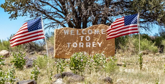
Torrey is a tree-lined town, located on State Route 24, in Wayne County, Utah, United States, 8 miles from Capitol Reef National Park. As of the 2010 census, the town had a population of 182 and elevation: 6,837 feet

Torrey is designated an IDA International Dark Sky Park in 2015. It is the first such U.S. national park “gateway community” to earn the International Dark Sky Community designation.
Torrey’s status is therefore key to preserving abundant natural nighttime darkness in Capitol Reef.


Capitol Reef National Park ✅

Capitol Reef National Park lies in Utah’s south-central desert, an oasis of colorful sandstone cliffs, impressive domes, and soaring monoliths. Once called “Wayne Wonderland,” the Park got its name, in part, from the great white rock formations which resemble the U.S. Capitol building, and from the sheer cliffs that presented a barrier to early travelers.
Early inhabitants referred to the area as the “land of the sleeping rainbow,” because of its beautiful contrasts: multi-colored sandstone surrounded by verdant riverbanks and arid desert vegetation, all nestled beneath deep blue skies.
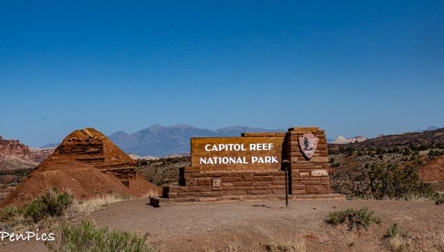
The area was designated as a national monument in 1937 and reclassified as a national park in 1971. The park is open year-round. Unlike other National Parks, we have yet to go through a manned gate to “Enter” the Park. The Capitol Reef National Park signs can be seen along Utah Route 24, as soon as you leave the town of Torrey. There is, however a Visitor’s Center, and a place to pay your Park fee, on the honor system, as you go on the scenic drive.

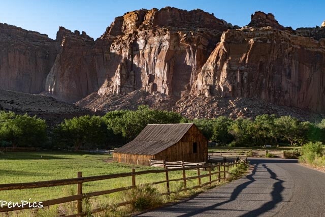
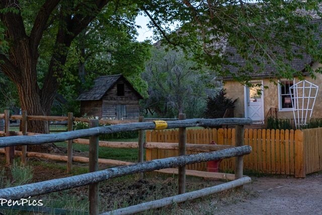
Historic Fruita District
We went through this gorgeous area several times, on our way to explore parts of the Park. This area, which is now part of the Park was settled in the 1880’s by the Mormon pioneers!
There is a small schoolhouse, an old homestead, and thousands of fruit trees still standing, on the banks of the life-giving Fremont River.
What to Know
Have fun learning about the settlers of this area and their way of life in this historic district of the Park. Be sure to stop in and peek into the old schoolhouse, devour a delicious homemade pie from the Gifford House, and stroll through the orchards that still produce fruit {if you time it right, you can take some home with you)!
Getting There
From Torrey, travel 11 miles east on Highway 24. Turn right toward the Visitor Center and continue along that road for another mile to reach the Gifford House and Museum.


Merlin Smith’s Black Smith implement barn


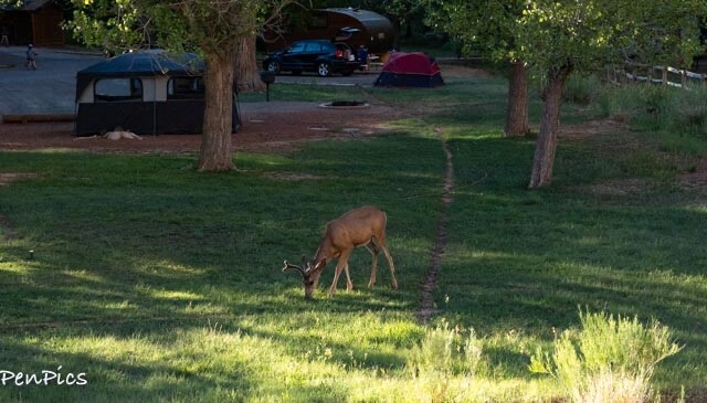
Deer can be seen often, sharing space in the campground.
The unique Waterpocket Fold has created diverse habitats that allow a wide range of plants and animals to flourish. More than 300 species reside here, including Deer, Antelope, Ringtail Raccoons, Chipmunks and Squirrels, Golden Eagles, Raven, Bats, Marmots, Turkeys, Whiptail and Collared Lizards. Mountain Lions, Coyote, and Black Bear are rarely seen, but also populate the area.


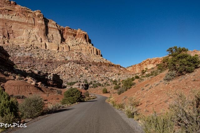
The Scenic Drive
Continue on past the Fruita District, to have a chance to marvel at the spectacular Scenic Drive of Capitol Reef!
The interesting geology is apparent in the area, as we traveled deeper into the Waterpocket Fold


“Hank Tower”


The Scenic Drive is not a thru road, so it is around a 25-mile round-trip.
Here we were, returning from the drive to the small historic district of “Fruita,” which resides inside the Park, where more than 2,500 fruit trees; some of which were originally planted by Mormon pioneers, continue to thrive.
Today, the town is federally owned, and visitors can stroll through the orchards and eat fruit fresh off the trees.
What to Know
The Scenic Drive is the only part of Capitol Reef that you will be charged to see. Drive slowly and enjoy the views! CAUTION: You do not want to be driving or hiking in this area at all, if there is a chance of flash flooding. You can check in at the Visitor’s Center for more information.
Getting There
From Torrey, take Highway 24 east for 11 miles to the Visitor Center. Turn right toward the Visitor Center and continue along the road past the picnic area and campground to the entrance booth at the beginning of the Scenic Drive. Pay your entrance fee (honor system) and then get ready for a beautiful drive.
The Fruita Schoolhouse


About Nettie Behunin Noyes
Nettie, was one of the oldest Behunin daughters (standing on the top right in the photo). As a daughter, she was expected to do household chores, although she preferred outdoor work to indoor work and was known to be strong and the best of all her siblings at repairs. She was also known to be patient with younger children.
In 1890, when she was just 12 years old, she became Fruita’s first school teacher. She would teach classes outdoors to the younger children and was loved by her students.
In 1896, the Fruita schoolhouse was built, and Nettie was still teaching. At some point, she attended teacher school in Monroe, UT, about 90 miles from Fruita, and earned her official teaching license.
Nettie married Fred Noyes in 1897, and had their first child a year later. When she was 22, Fruita got an official Utah State curriculum and Nettie was still the teacher. Later on in life, Nettie became the postmistress of Torrey.


Class size in the one-room schoolhouse ranged from 8-22 students, from 1st to 8th grades.

By 1941, there were not enough students to keep the school open, and it closed. The National Park Service nominated the school to the National Register of Historic Places, and it was restored to its 1930s appearance in 1989.
Getting There
From Torrey, travel east on Highway 24 for 11 miles, at which point you will see the Visitor Center. Stay on the highway, passing the turnoff to the Visitor Center. Shortly after passing the Visitor Center, you will see a small parking area for the Fruita Schoolhouse on the left
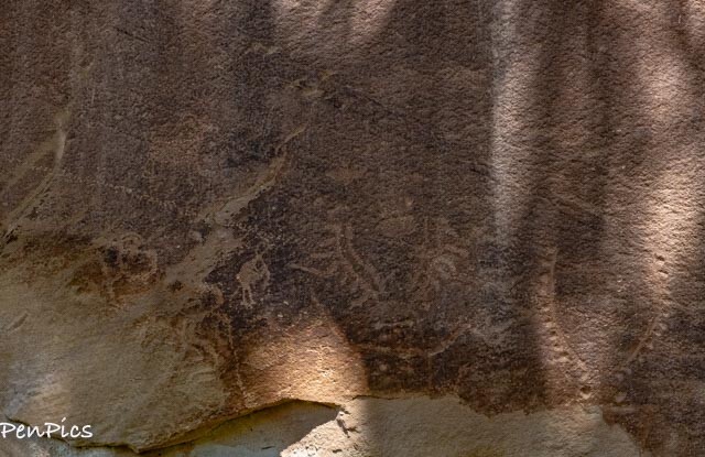
The Fremont Petroglyph Panel on Route 24
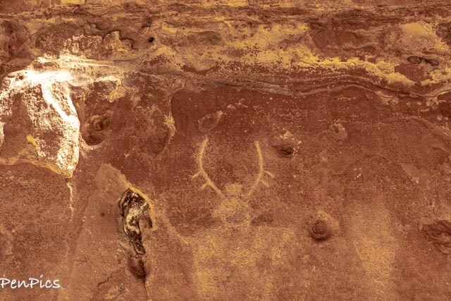
Take a look at these (very easy to get to) petroglyphs, beautifully etched into stone.
Look for warriors, bighorn sheep, and other markings that tell the story of the people who inhabited this area long ago!


What to Know
From the parking area, you will see two boardwalks. The shorter one right next to the parking lot has binoculars provided and takes you to the petroglyphs that are the easiest to find. The longer one to the right of the parking lot doesn’t provide any signs or a definitive place to see the petroglyphs, and you’ll have to hunt for them.
Getting There
From Torrey, travel east on Highway 24 for 11 miles, at which point you will see the Visitor Center. Stay on the highway, passing the turnoff to the Visitor Center. Shortly after passing the Visitor Center, you will see a small parking area for the Fruita Schoolhouse. Pass the Schoolhouse, and the Petroglyph Panel will be the next parking area on the left.
Panorama Point
A short uphill walk from the parking lot onto a plateau and we had breathtaking, 360 degree views of the Park. Best viewed in the late afternoon/sunset


“Chimney Rock”

Getting There
From Torrey, take Highway 24 east for approximately 9 miles. Panorama Point is on the right side of the road, just past the Chimney Rock Trailhead.
Goosenecks Point Overlook
The short trail leads from the parking area to an overlook above the winding bends of Sulphur Creek Canyon hundreds of feet below. The creek apparently cut its way downward into the soft rock as the area was lifted up when the Rocky Mountains were formed.


The overlook sits on the canyon rim just below the summit of the hill. Hikers are warned to keep off the rocks close to the rim because they can be loose.


What to know
The trail to the Overlook is 0.2 miles round trip.
Getting There
From Torrey, take Highway 24 east for 9 miles and turn right onto the Panorama Point/Goosenecks Overlook Road. Take a left at the Panorama Point parking area and travel on a dirt road for 1 mile. The parking area for the Goosenecks is at the end of this road, and the trail starts at the far end of the parking lot.
Sunset Point Trail
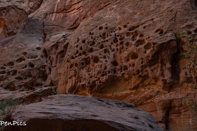
Gaze at the Waterpocket Fold, the unique upheaval of land that prompted the protection of Capitol Reef! The formations along this fold go for miles and miles (about 100 miles actually), and this viewpoint gives you the opportunity to appreciate the vastness of the park.


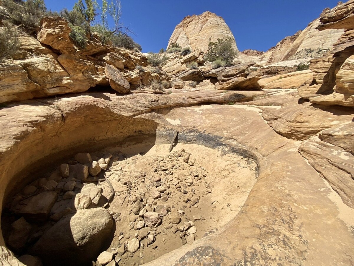
Looks like the Ancients carved out water bowls

What to Know
Although the Sunset Point Trail shares a parking lot with the Goosenecks Overlook, the two activities do not share the same trailhead. To access Sunset Point, take the marked trail from the left side of the parking area as you enter from the dirt road. Do not try to access Sunset Point from the Goosenecks Overlook Trail. This trail has very little shade, and water is not available. It is 0.8 miles round trip, and pets are not permitted.
Getting Here
Follow the directions above for the Goosenecks Overlook to get to the parking area. The trail is well marked and starts on the left side of the parking lot.
Cassidy Arch
A hike to Cassidy Arch is a unique experience that you don’t want to miss. (we missed it) This arch is named after Butch Cassidy; a true American outlaw. Rumor has it, that he used this area of Utah as a hideout!
What to Know.
This trail is 3.4 miles round trip and is moderately strenuous, mostly due to the switchbacks at the beginning. After completing the switchbacks, the trail levels out, considerably. Bring plenty of water with you. The hot desert sun and dry air make it easy to become dehydrated. Walking up and down the slickrock is also required. As you get closer to the arch, you will need to follow cairns to find your way. Cairns are small stacks of rocks that mark the route, so for the safety of other hikers, please do not tamper with them or build your own. Pets are not permitted on this trail.
Getting There
Follow the directions above to get to the Scenic Drive. After 2.2 miles along the Scenic Drive, turn left onto the Grand Wash Road. When you get to the end of this road, you will find the parking area and trailhead. Walk along the wash for 0.3 miles until you see a large sign for the Cassidy Arch Trail, on your left.

We took the Grand Wash Road, which spurs off of the Scenic Drive. It is a one-mile dirt road that loosely leads to Cassidy Arch. (there were very misleading road signs). To be clear, the road does not lead to Cassidy Arch, but it does lead to a small parking lot, where the trail head is for The Narrows. Cassidy Arch’s trail head is further.


From the parking lot; accurate info for Narrows hike, as this sign marks that trail head. The parking lot is not the trailhead for Cassidy Arch; it is indicating the trailhead is .3 miles further from parking lot. By the time we got to the trail head, we were on our sixth hour of motion and decided against the straight-up rock mountain hike. These spur roads are kinda rough, so we will not return again.

NOTE: Before reaching the parking lot, there is this sign. Again, the trailhead is loosely accurate, but it will get you there. BUT FOR SURE..there is NO viewpoint for the arch. We walked up the trail and while pretty, there is no view of the arch. Very strange.

Not my photo; Cassidy Arch
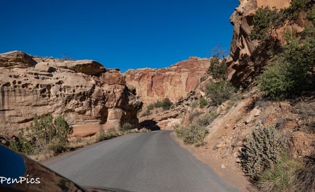
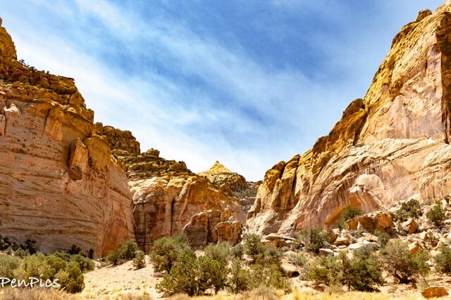
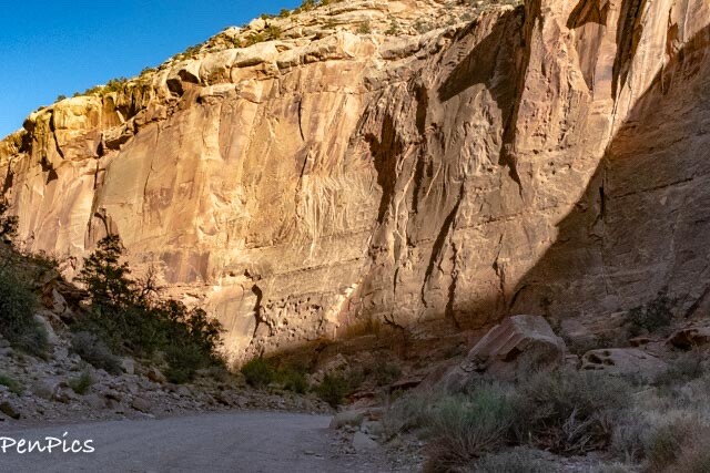
Capitol Gorge
OUR FAVORITE ADVENTURE
Get ready to be shocked at how close your car will be to the canyon walls and how high the cliffs are above your heads! This short drive takes you through the canyon and provides spectacular views!
What to Know
This is a narrow and curvy dirt road, suitable for most vehicles, but not for anything over 27 feet in length. Just go slow and keep at least two wheels on the bedrock, when there is sand. At the end of the road, there are a few picnic tables under a pavilion and a pit toilet. No water is available.
Getting there
Capitol Gorge Road is at the end of the Scenic Drive where the road begins to the left at a parking area with restrooms. Continue down the dirt road for 2.4 miles to reach the end of the road.
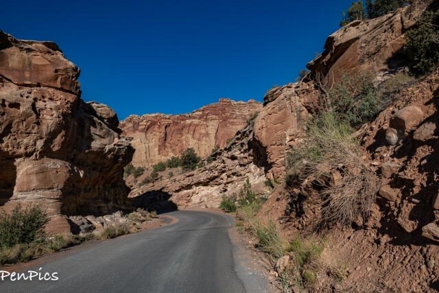
At the end of the Scenic Drive this is one of two spur roads, which offer spectacular backcountry access.
Leave the pavement and begin driving this dirt road, which is dead ahead from the pavement. This road becomes a dry creek bed. Never travel this road if potential rain storms are brewing. The flash flood fills this, otherwise, dry creek bed, leaving no place to escape.


AND….IT JUST KEPT GETTING BETTER!
LOVED THIS!
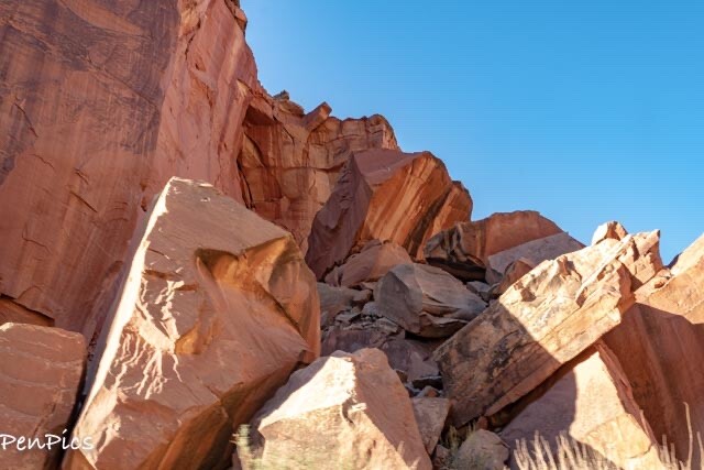
Pioneer Register Trail
It was this place, that made Capitol Reef National Park my favorite, on the Grand Circle!
We got to step back in time, and hike an easy trail that was used by the pioneers on wagons, to get through the Waterpocket Fold!
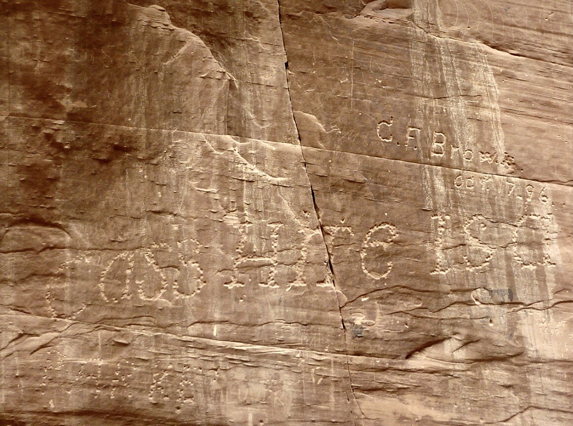
Along the sandy creek bed we scoured the towering walls, looking for signatures of those that passed through this way in the 1800’s and early 1900’s.
Prior to arriving at the Pioneer Register, there are a few petroglyphs to see, which have been around much longer than the Pioneer Registry!
What to Know
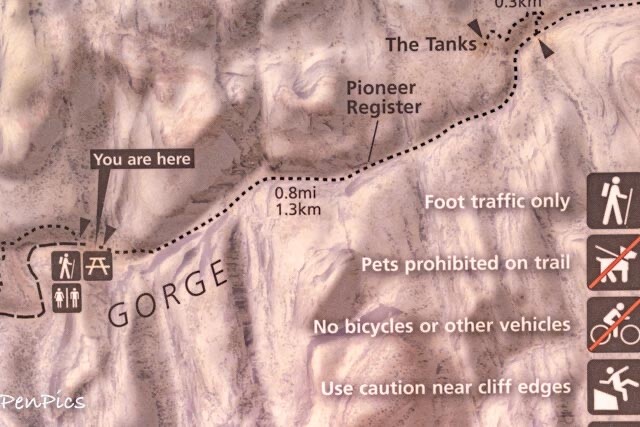
No signs or indications are provided of where the actual signatures are inscribed, nor exactly where the Petroglyphs are along the trail, making this one big game of “I-Spy!”
We found the petroglyphs toward the beginning of the trail on the left side, and the names and dates of early settlers, showed up about 0.3 miles in. At the main wall with many of the signatures, you will see a sign that discourages people from etching their names into the walls.
”WRITING ANYTHING ON THE ROCKS IS A FEDERAL OFFENSE, so do not add your own writing to the walls.” (If only people would not vandalize such treasures).
This trail is 0.8 miles round trip, if you turn around after the Pioneer Register, or 2 miles round trip if you continue to the natural water tanks.
Pets are not permitted
Getting There
Use the instructions above for getting to the Capitol Gorge Road. Drive to the parking area at the end of the dirt road, and pick up the trail from the inside of the pavilion. The Golden Throne Trail (which we did not do) also leaves from this parking area, so just make sure you are walking in the dry wash to get to the Pioneer Register Trail.


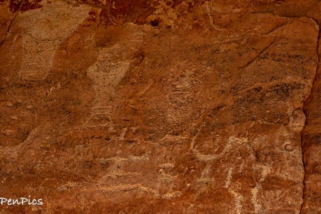
The prehistoric Fremont Culture existed between approximately 600 – 1300 AD, in what is now Utah, Idaho, Colorado and Nevada. For many years anthropologists grouped this culture together with the Ancestral Puebloans; better known as the Anasazi. That designation has since changed, as archeological discoveries have proven that this group had its own distinct culture, one named “Fremont” after the river where their sites were discovered and first defined.
Rather than living in cliff dwellings, the Fremont Indians lived in pit houses that were dug into the ground and had a roof made of brush. While the Anasazi wore sandals made of plant fibers, the Fremont wore moccasins, fashioned of animal hide. Their pottery was made in a different style as well. And most intriguing of all, the Fremont sites often contain small, human-shaped unfired clay figurines. The little figures have intricate details like ear bobs, necklaces, clothing, hair and facial decorations. Their purpose is unknown, though it is speculated that they had ritual or religious significance. As you can see on this cliff face, these figures also appear in the petroglyphs created by the Fremont people.


After finding the Petroglyphs, we continue on, in search of the Pioneer Register. Something to bear in mind is, the erosion over the years, since early settlement, the creek bed is much lower, so this makes the writing on the rock walls higher to find. As it was, the pioneers anticipated flash flooding, so intentionally wrote their inscription above anticipated flooding.


look at the north side of the canyon wall (left). There, you will the many names, dates; carved, painted, and in one case, shot, into the sandstone. Prospectors, explorers, surveyors, cowboys, area settlers, and early visitors would often stand on their wagons to carve their names into the canyon wall. They were leaving their mark above flash flood danger, likely hoping their names would survive for centuries.
These inscriptions provide an important log of those who passed through the region, and they offer insight into the men and women who left their names behind. The earliest inscriptions belong to two mineral prospectors, J.A. Call and Wal. Bateman. These men were probably in search of economic wealth from mining and travelled through Capitol Gorge September 20, 1871. Aside from their names, the date, and “PROSSPECTER,” very little is known about these two men. If they hadn’t left their mark, no one would know they were likely the earliest Euro-American presence in the Capitol Reef region. They were not part of a large, government-sponsored expedition, like the 1872 trip through Capitol Reef, lead by Almon Thompson, under the larger J.W. Powell Expedition. It is now illegal to carve, paint, scratch, or otherwise deface any canyon wall, historic, or archeological site.
The names of many early Fruita and Wayne County residents can be found on the register: E.P. Pectol, Aaron Holt, Walter and E.J. Hanks as well as members of the Oyler, Smith, Carrell, and Cook families.
Other notable local people include Hanksville shop owner C.A. Gibbons who supposedly furnished Zane Gray with the story of Wildfire; his 1915 novel.
A group of French archeologists looking at ruins in the area also left their names behind: G. Guiraud, A. Pillaud, P. Brossard, and T. Breard on January 30, 1893.


As you return to the parking lot, look for inscriptions towards the top of the cliff, on the south side of the canyon walls. These names belong to surveyors. One of their descendants, Pam Stewart, provides the story behind them. Her great-uncle, John R. Stewart, and his half-brother Quinby, worked for the state of Utah as land surveyors in 1912. They had contracted a crew of University of Utah geology students to help them over the summer.


Hickman Bridge
The Hickman Bridge is a stunning 133-foot natural bridge (arch), nestled in a beautiful canyon with stunning views of the Capitol Dome and various interesting rock formations on top of the canyon walls. The vista in front of you, as you are hiking, is unparalleled, and the Bridge at the end is massive!

Due to high winds and rain, we opted out of of this hike, or any more hiking, because of the slick rock climbing portion. However, with our lifestyle, we will most likely return to Utah and can do this hike then. I truly enjoyed Capitol Reef so much, and coming back here is a real possibility. Anyway, here is the info on this hike, just in case you are interested!
What to Know
This trail is 1.8 miles round trip and pets are not permitted.
Travel along the top of the slickrock for amazing views of the surrounding formations. When you get to the bridge, continue hiking the short loop that travels around it. This trail gains about 400-feet of elevation, giving it a moderate rating. Most hikers will have no problem completing this trail.
Getting There
From Torrey, travel east on Highway 24 for 11 miles, at which point you will see the Visitor Center. Stay on the highway, passing the turnoff to the Visitor Center. Shortly after passing the Visitor Center, you will see a small parking area for the Fruita Schoolhouse. Pass the turnouts for the Schoolhouse and the Petroglyph Panel. The Hickman Bridge Trailhead is the next turnout on the left.

(not my photo)
The Historic Behunin Cabin
This cabin is a great example of what early settlers in Southern Utah lived in. The cabin, built by Elijah Cutler Behunin, in 1883-1884 was renovated in the 1960’s by the National Park Service, to preserve it for future generations.
The cabin was only lived in for a year, before the Behunin family moved to Fruita, but illustrates the simplicity of a settlers home, and the resourcefulness of settlers to make do with what was available. The cabin is made with sandstone and cement plaster walls, and a wood and clay roof. It is humbling by today’s standards to imagine a single person living in a 13 x 16.5 foot home (215 sq. ft.), let alone a large Mormon family.
In 1882 Elijah Cutler Behunin and his family built this cabin, and stayed a brief time until the rising river washed out their crops. Behunin was one of the first settler in the area. A family of ten lived here. Braided rugs covered the dirt floor. Ends of dress materials became curtains. There was a fireplace to cook in, and a water supply near the door. The family probably ate outside. Father, mother, and two smallest children slept in the cabin. The post bed almost filled one side of the room. By widening a dugout in the cliff, the older boys had a place to sleep. The girls made a bed in an old wagon box.


(This cabin is where the 12-year-old teacher first lived)
Getting There
Head east from the visitor center about 6 miles to milepost 85.1. The cabin is on the south side of the road. (About 16.5 miles east of Torrey).
Interesting reading about the Pioneer Women of Capitol Reef. Life was not easy, nor fair:
https://www.nps.gov/articles/000/pioneer-women-of-capitol-reef.htm#onthisPage-2


Here is the link to move to the final blog on the road trip: Part Five of Five:
About Us

About Us
Hello and Welcome to our Travel Blog Website, We enjoy writing about our experiences and taking photos of our adventuring along the way. Our names are: Daryl and Pen, but Daryl calls me “Bunny.” We met, quite randomly, whilst both traveling in Thailand with friends. We happened to be in the same travel group, and […]