


“USA 🇺🇸 ~Colorado SOUTH Rim Montose Black Canyon at the Gunnison National Park and Montrose Area”
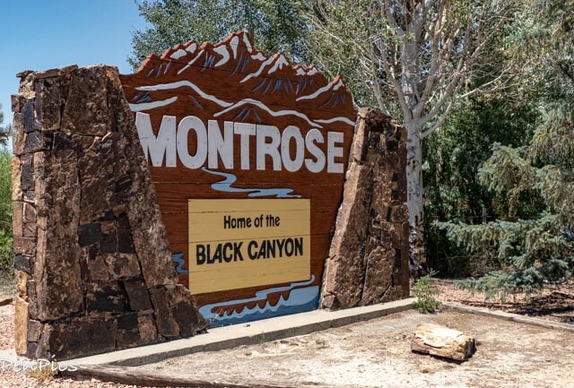
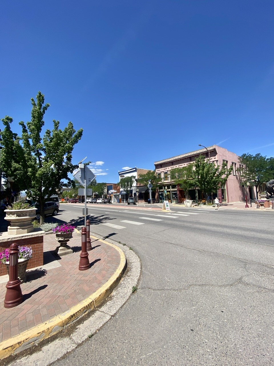
Montrose, Colorado ⬇️
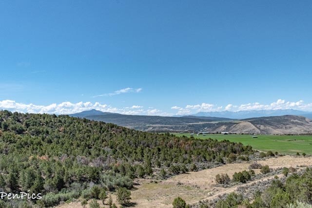
Nestled between rugged canyons, the Grand Mesa, and the majestic San Juan Mountains, Montrose is a mecca for outdoor fun and adventures.
Montrose is surrounded by a lot of adventurous things to do and beauty to see.
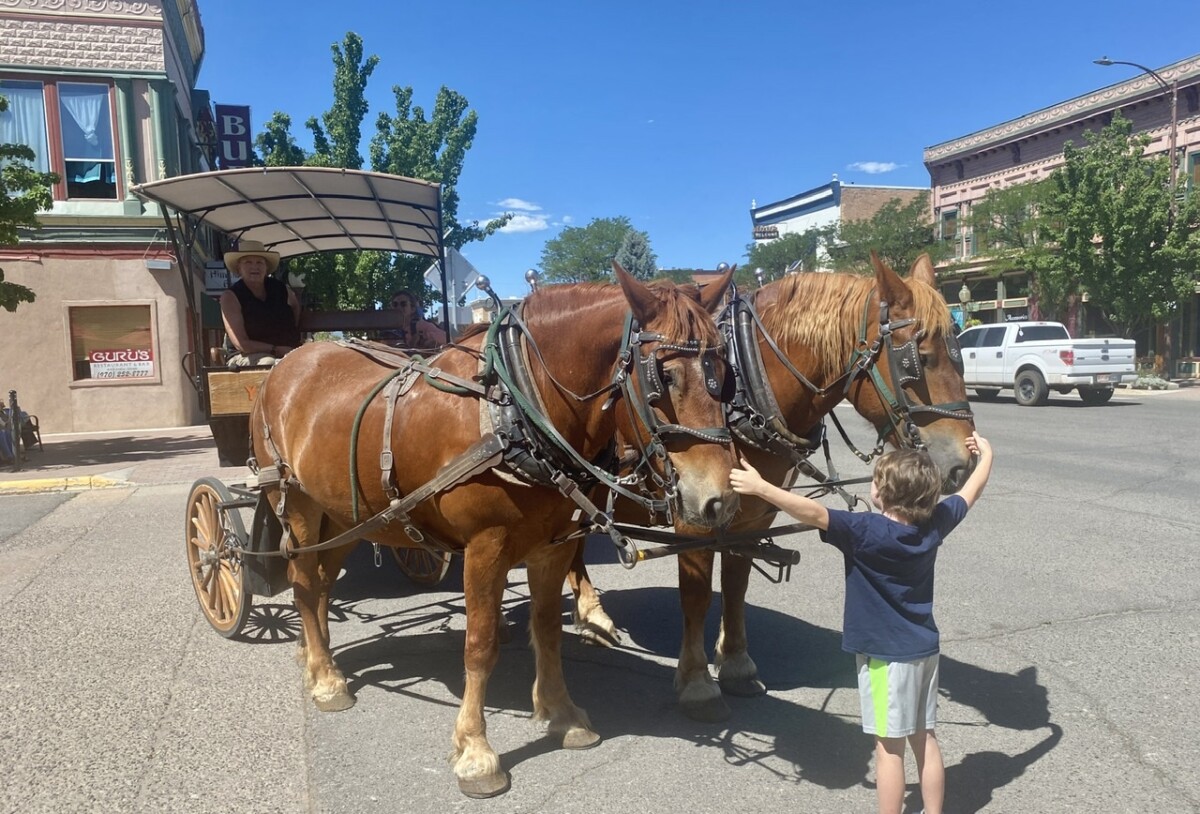
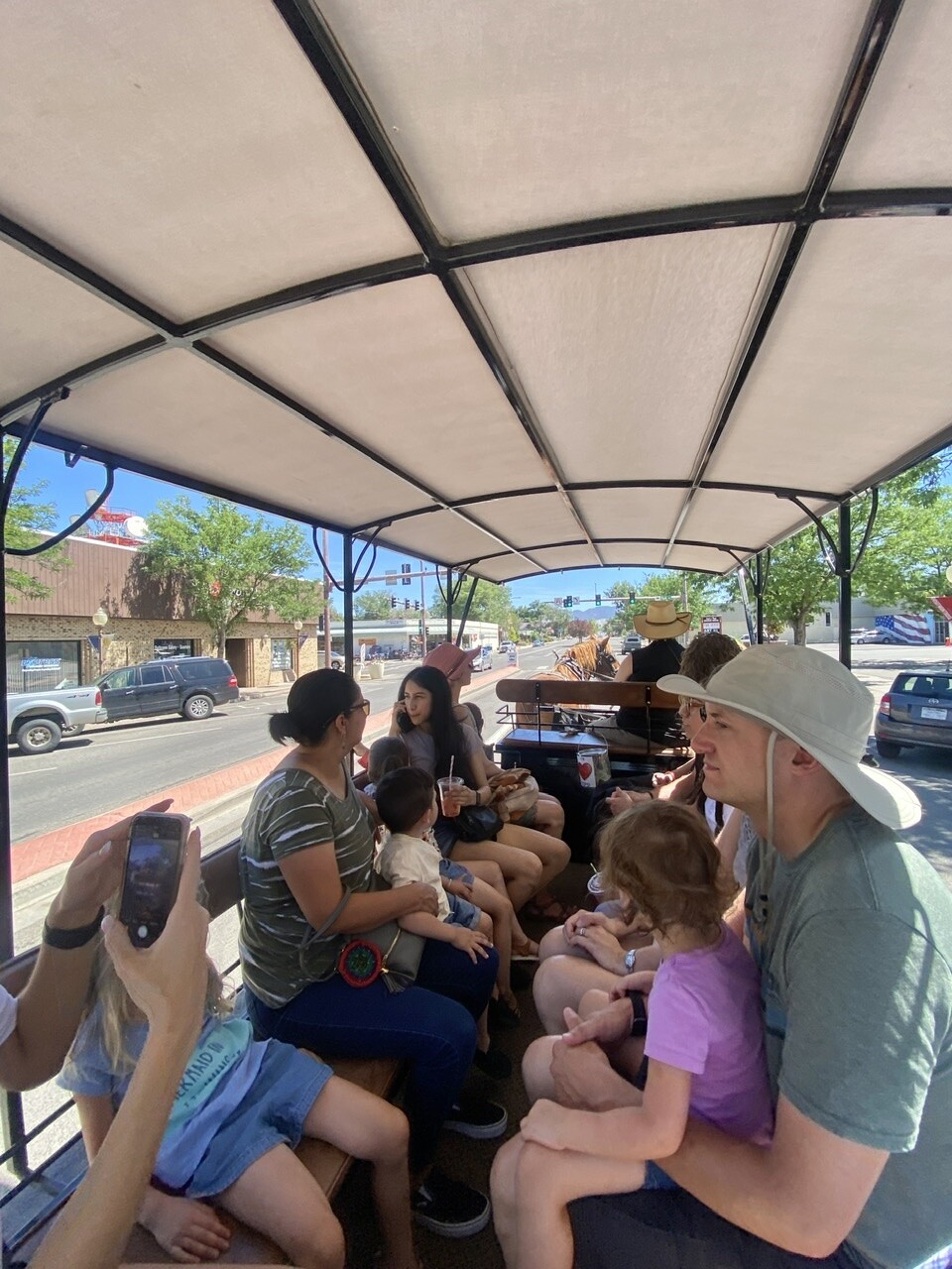
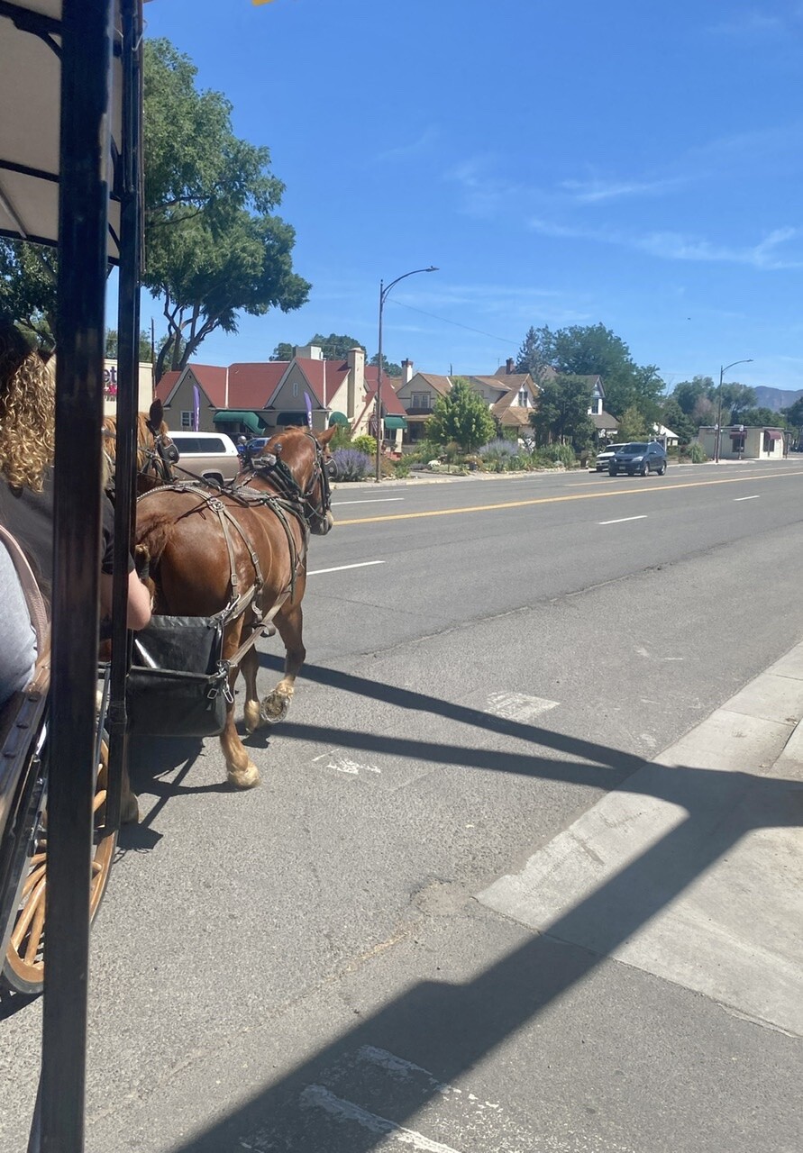
On this day ⬇️ we went to the Saturday Farmer’s Market and enjoyed a complimentary Wagon Ride! (tips appreciated)

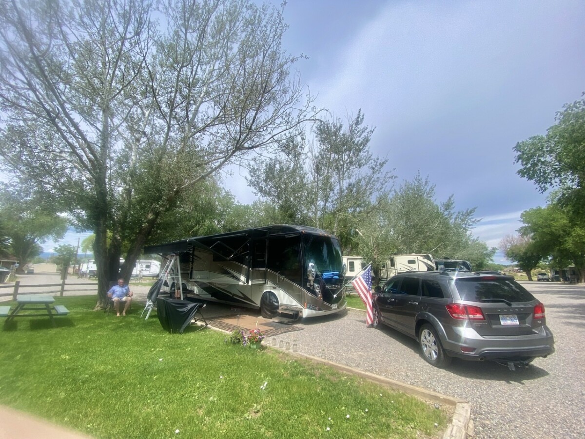
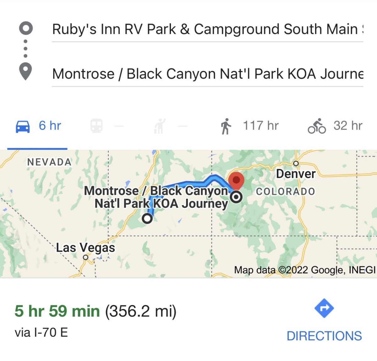
We picked this small Colorado town to hang out in for the summer, with the fuel costs and DEF shortages making this a long stop. It’s a little frustrating, but we are enjoying the down-time just the same, and we try to roll with things the best we can.
What is DEF? Our Motorhome, which weighs 45,000 pounds has an engine (Cummins 450hp) just like some of the semi trucks hauling big trailers you see on the roads: Diesel Exhaust Fluid (DEF) is a solution of urea and water that’s injected into the exhaust stream of diesel vehicles to turn NOx gases (harmful emissions) into nitrogen and water.
Because we still need to pick up our “Jonah” the VW Bug, when her restoration is complete in the fall, we are not getting too far from Arizona, but no way did we want Arizona temps for summer!
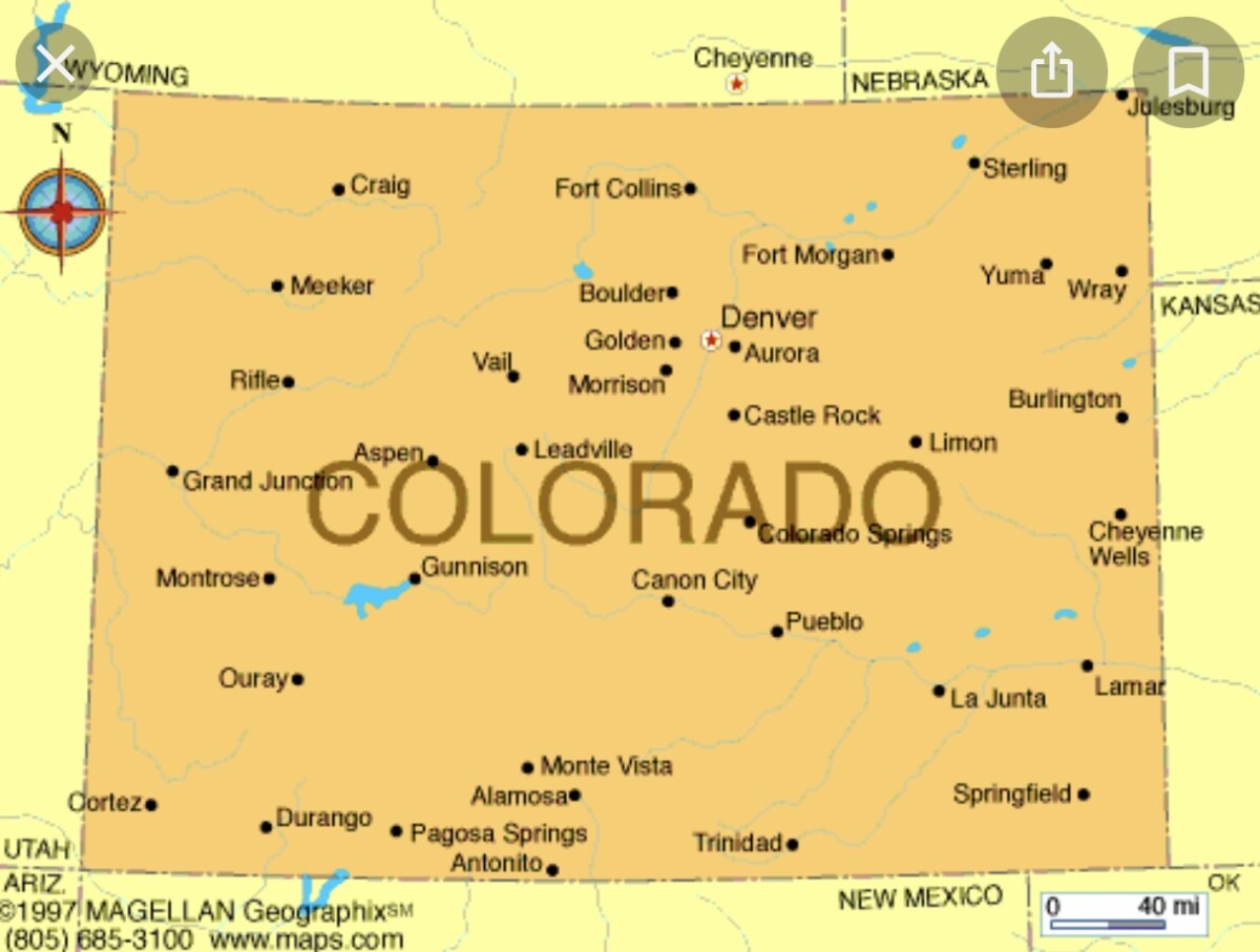
I used to live in Colorado and have a soft spot for this beautiful state.
While visiting Colorado we hope to visit a couple National Parks, Lakes, Dams, get to Four Corners, and ride a scenic train.
********
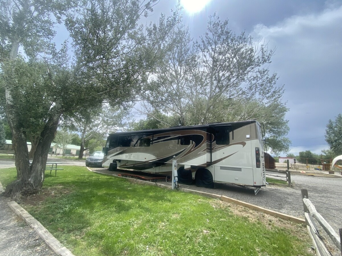
Black Canyon National Park KOA ⬇️
********
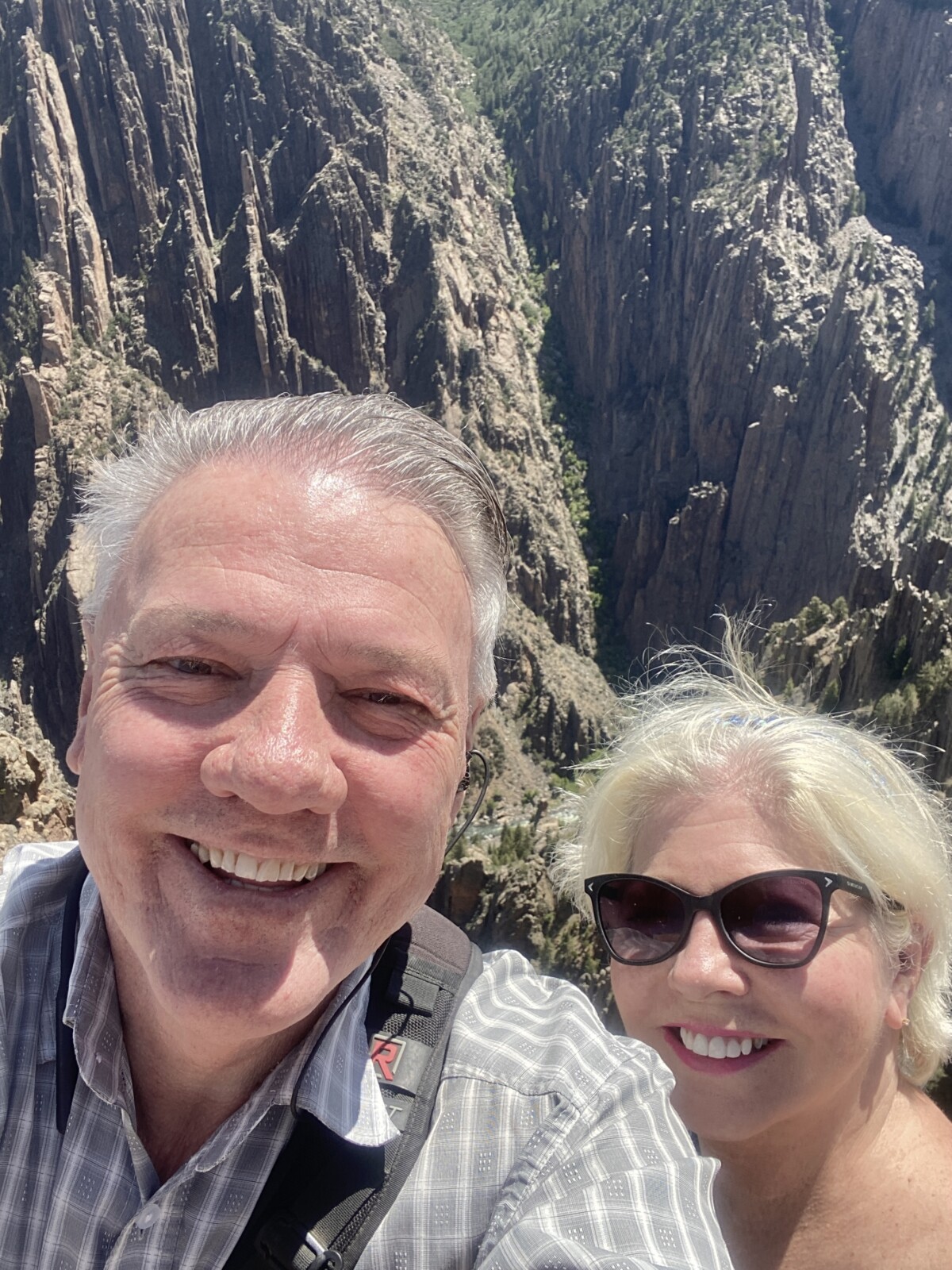
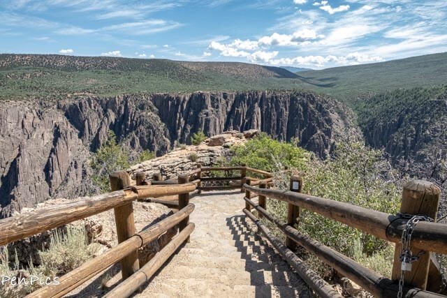
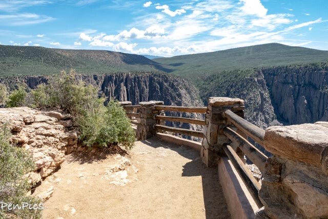
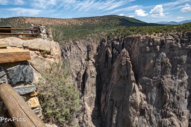
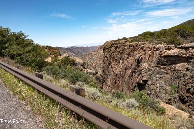
SOUTH Rim Black Canyon of the Gunnison National Park ⬇️
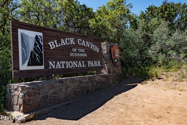
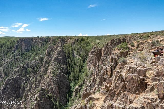
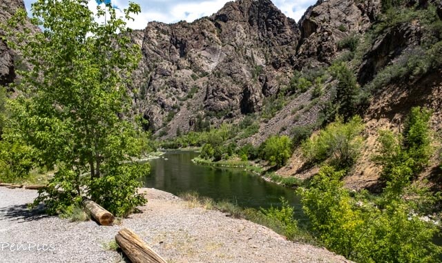
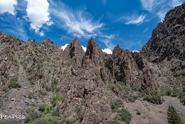
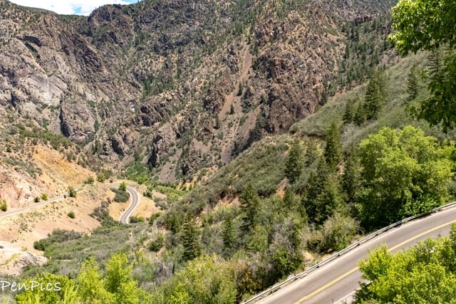
With a break in this rainy weather, we made a dash to the SOUTH Rim Black Canyon of the Gunnison National Park. No two National Parks are the same, and all are worth a visit, IMHO.
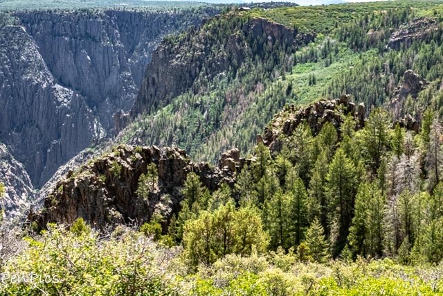
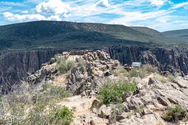
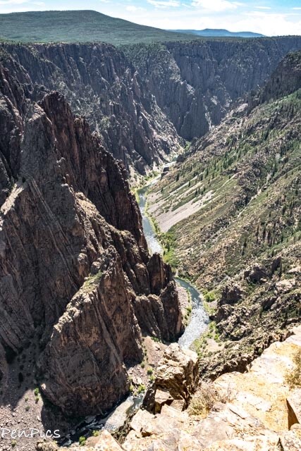
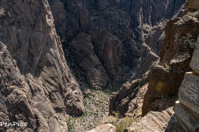
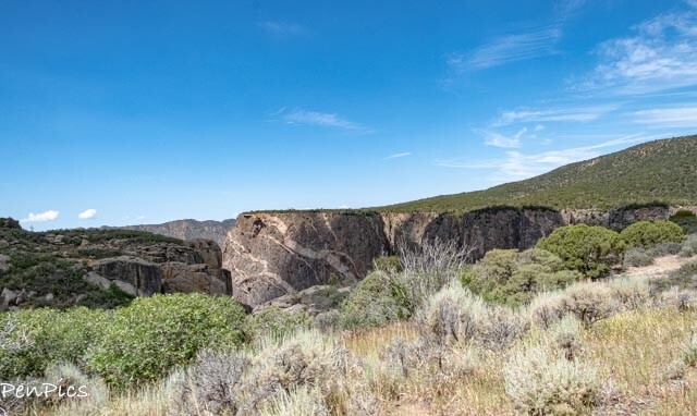
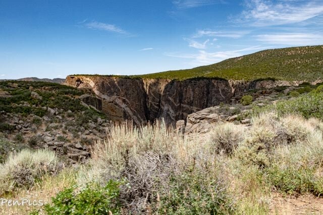
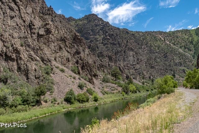
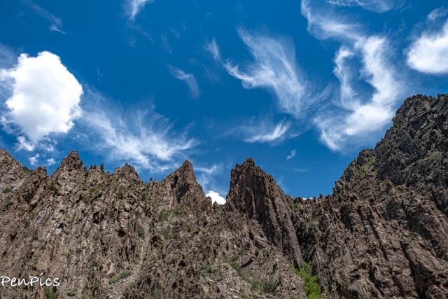
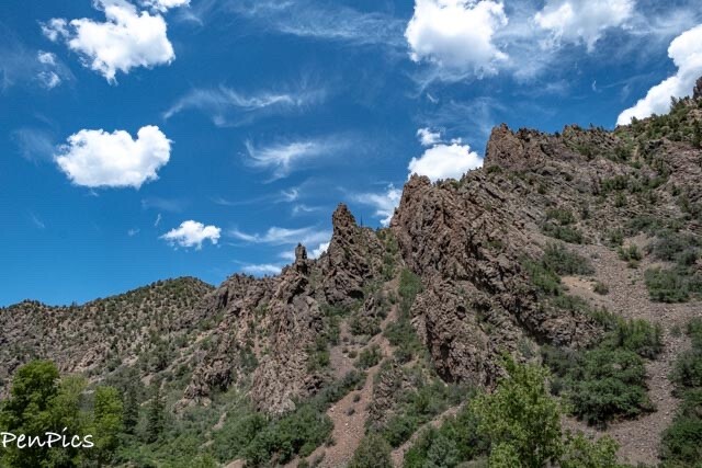
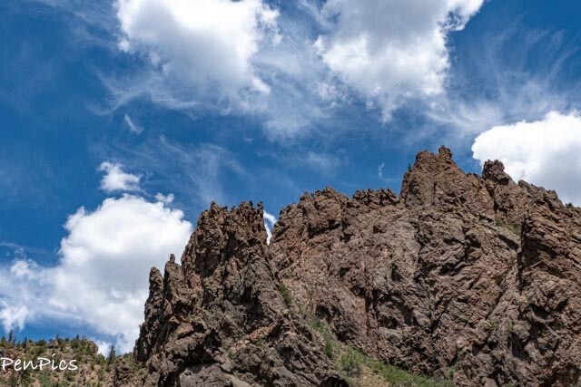
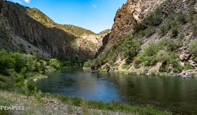
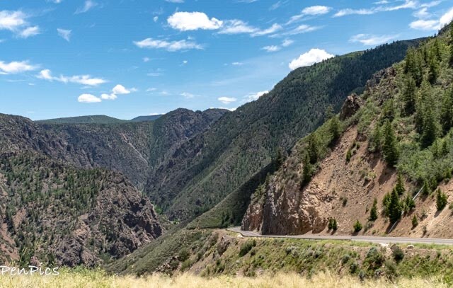
This particular Canyon is VERY steep and rugged. It’s quite dynamic to see, so up-close.
To protect “the roar of the river,” President Herbert Hoover declared the Black Canyon a national monument in 1933. In 1999, Congress declared it a National Park.
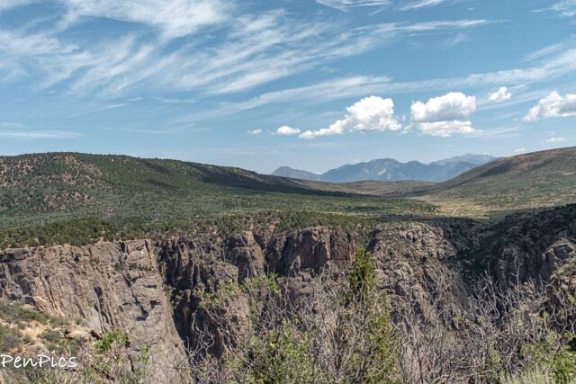
This is a stunning, yet often overlooked National Park, making this canyon a must-see for any visitor to Montrose, Colorado.
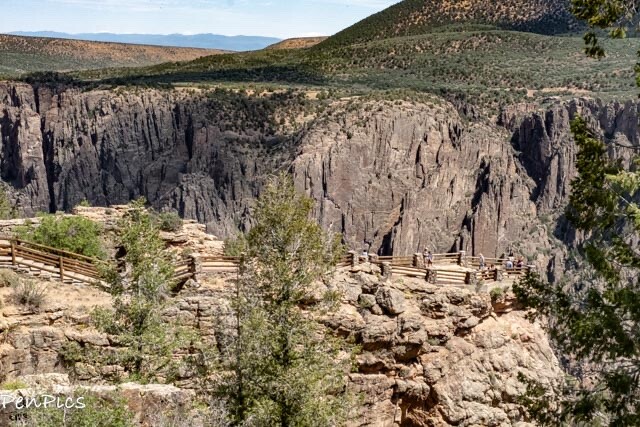
Unlike the crowds, often found at other, more, well-known National Parks in America, Black Canyon of the Gunnison provides equally stunning views with less frequent crowds. There’s a huge range of activities visitors can take advantage of at the park, including: rock climbing, fishing, kayaking, hiking, plus snowshoeing and cross-country skiing in the winter.
Montrose is closest to the South Rim entrance with the North Rim entrances closest to Crawford. There is no bridge connecting to the other side, so a roughly two-hour drive is required to reach the other side of the canyon. (We eventually made this drive, too). This South Rim entrance is the only one that remains open year-round.
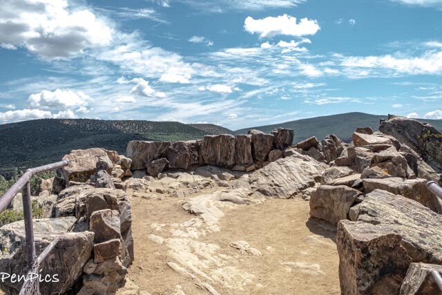
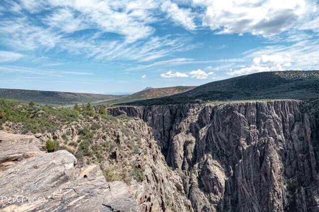
All visitors should definitely drive the South Rim Road; a seven-mile road reaching between Tomichi Point and High Point, offering twelve different overlooks.
Oak Flat Loop Trail is a trail that explores below the rim of the canyon. Though it’s only two miles long, the high elevation change makes this trail strenuous, so, like always, visitors should be prepared before embarking on a hike.
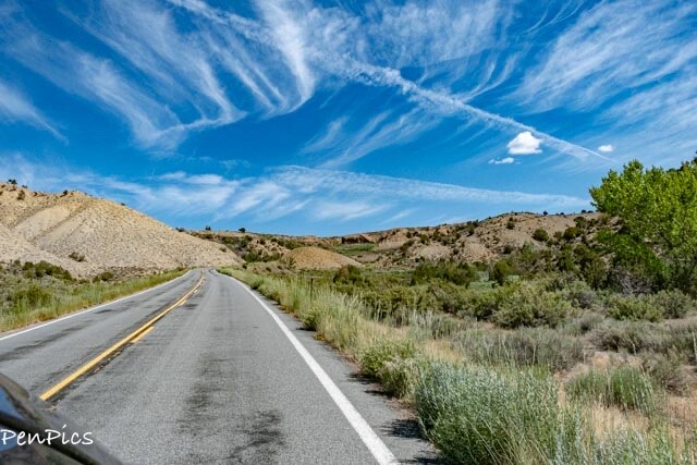
⬆️ From Montrose, it is an easy 21-minute drive to the South Rim entrance of this Black Canyon National Park.
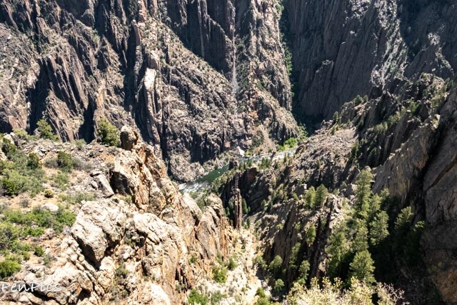
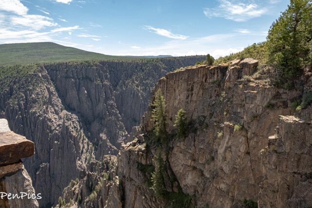
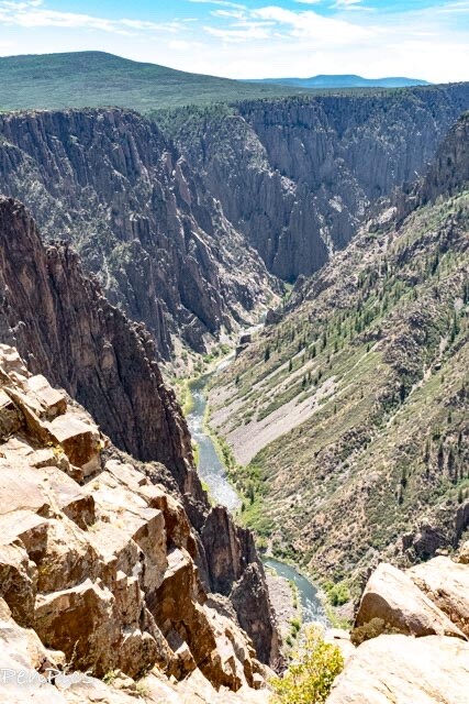
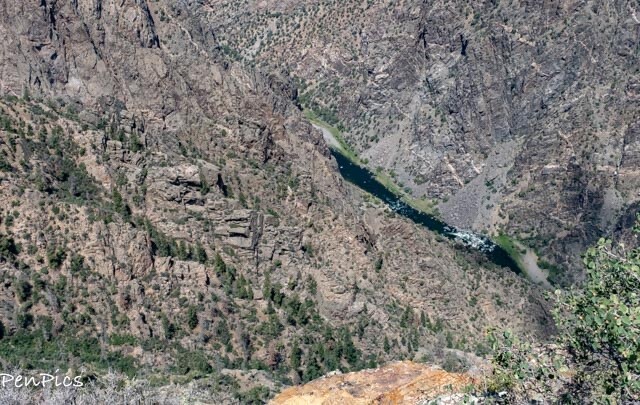
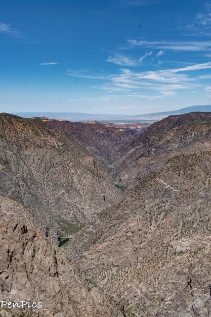
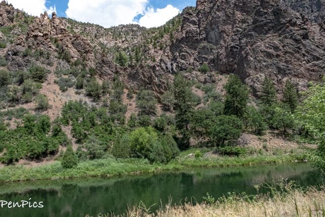
From the heart of Black Canyon of the Gunnison, it’s easy to appreciate the raw power of the Gunnison River. (with drought conditions, it doesn’t roar) Monolithic walls of ebony schist, slashed by veins of granite, and carved to depths of more than 2,000 feet tell the tale of 2 million years of the mighty Gunnison, relentlessly churning through mountains of stone.
The abyss was considered impassable by anything but the river until 1901, when a team of surveyors hiked through and mapped out plans for a 5.8-mile diversion tunnel that still shuttles more than 300,000 acre-feet of water from the Gunnison to a smaller tributary in the Uncompahgre Valley every year.

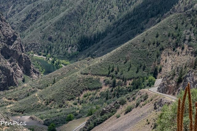
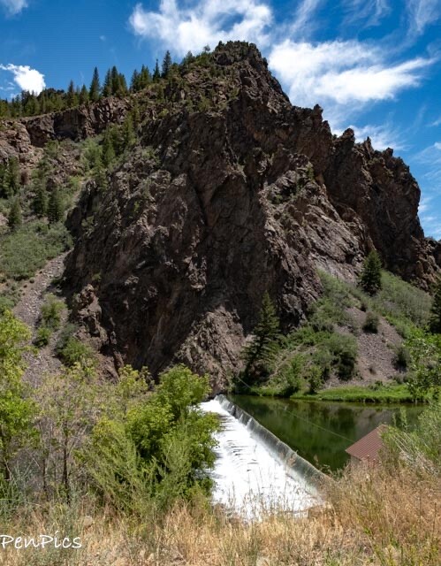
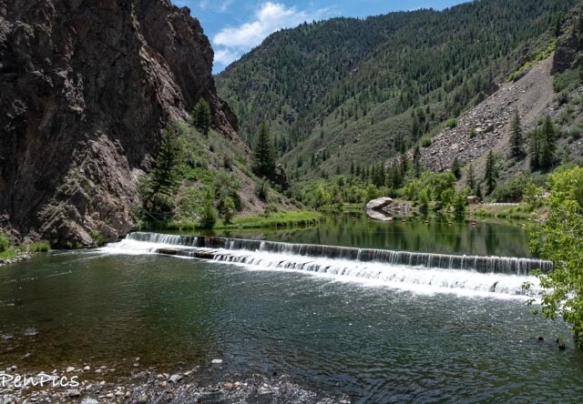
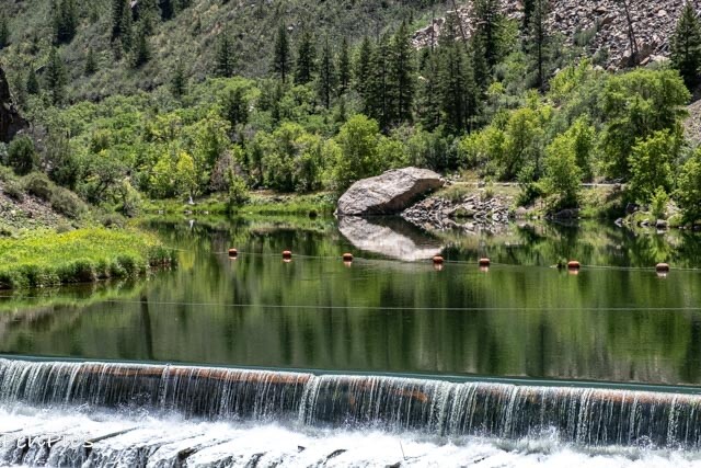
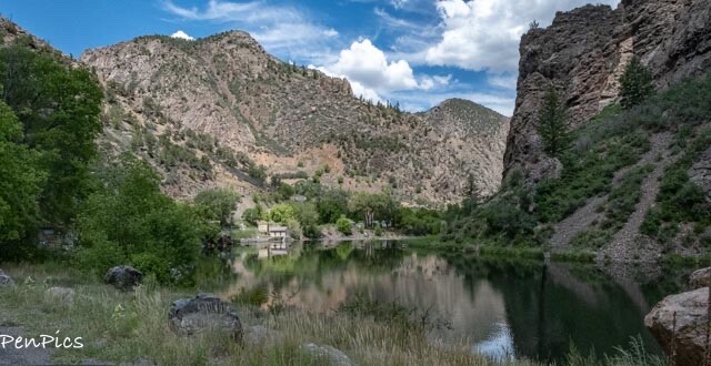
Having completed the scenic drive through Black Canyon, we headed down a steep grade to the Gunnison Tunnel and Diversion Dam. The road ends, so it’s the same way out. Very beautiful!

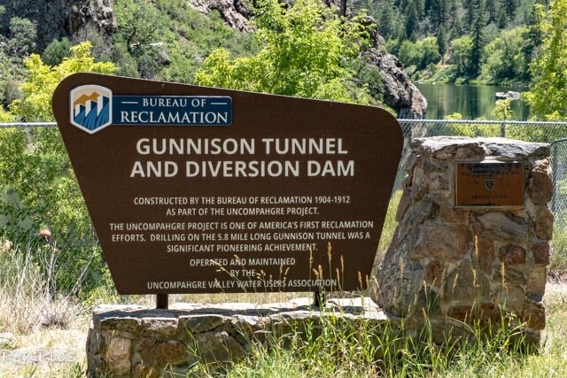
The 120-year-old, 5.8-mile tunnel was the largest irrigation tunnel in the country, when it opened in 1909. It was also the first major transmountain diversion in the U.S., becoming a model for moving Western water beneath mountains, connecting wet basins with dry deserts.
Today, the Gunnison Tunnel can move more than 500,000 acre-feet of water a year; more than the entire Eastern Slope draws from the Upper Colorado River Basin. Unfortunately, for us, the road in, ended with a gate and a no trespassing sign. Authorized personnel obviously have access to the tunnel to monitor and maintain this 120+ year-old engineering phenomenon ⬇️
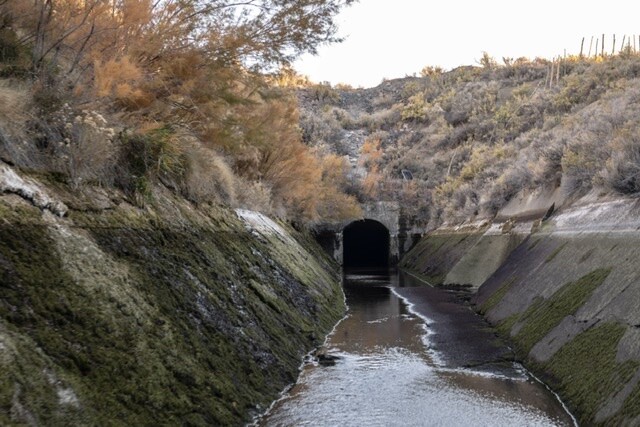
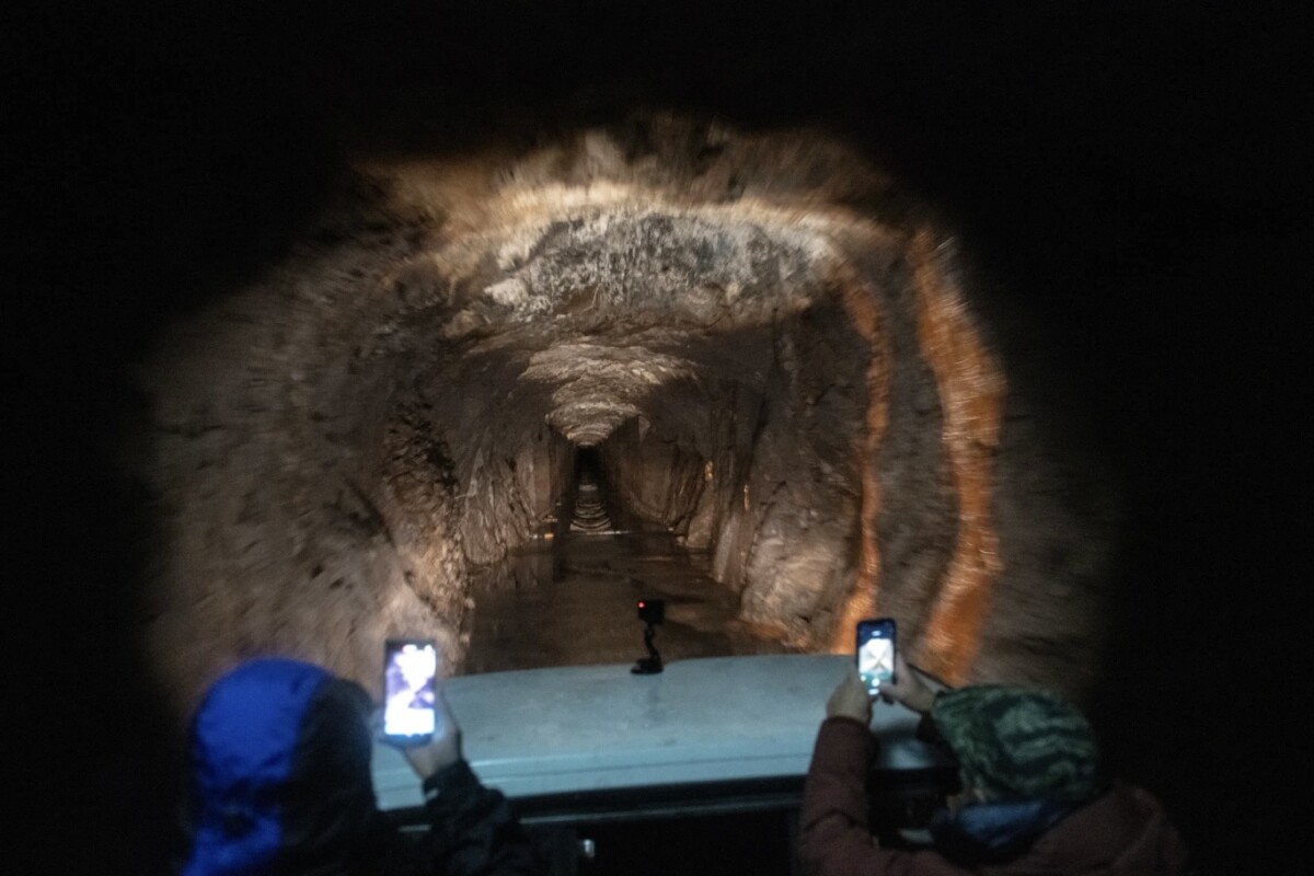
⬆️ The above two photos are not mine….We would have loved to go inside, but we’re not allowed
There are some camping spots down here, but very small for tent and small trailers; perhaps boondocking. Permit required. That grade in and out would not be great for big rigs like The Whale.
*********
DARYL WROTE:
We went to Black Canyon National Park a few weeks ago. I just got a new computer so I can process my photos now.
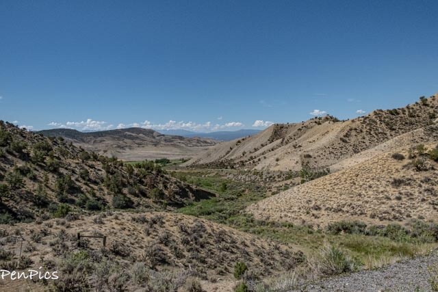
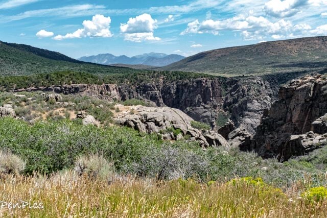
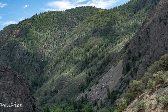
Four minutes down the road, we turned onto a thirty minute drive to the park. This road follows Gunnison River and the craggy deep canyon carved by the rapid torrents of water and sediment over the eons.
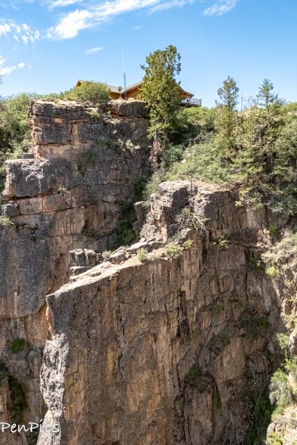
The roadside turnouts reveal Dramatic views of lone trees perched on ragged panicles so removed and inaccessible by anything but a mountain goat or bird. View of the foamy river below can also be had.
The canyon walls rise above the torrents of white water almost two thousand feet on each side. The views are so majestic, it rivals the Grand Canyon for beauty but not for size. The granite walls are striated with white veins similar to marble of Italy.
The spring time, when water is deeper, ridding the rapids in inflatable boats or kayaks would give adrenaline junkies a ride to brag about.
The steep sides of the canyon draw crowds of rock climbers with all their climbing and safety equipment. Bring binoculars and zoom lens for your cameras, we to capture the daredevils in action.
The South side has a longer road with more views than the North side. Red Canyon obstacle on the North side shortens the road access so the South side is the better viewpoint.
As we headed back to the entrance gate, on left is a turn that takes a steep drive down to to a dam and and river level. The road terminates at the largest tunnel at the time of construction to bring water for crops and hay fields. As you travel down, lower gears help save your brakes. On the way back, turn off your air conditioner so you don’t over-heat your engine like we did.
******
If you want to see my blog post from our next visit to this Park, on the NORTH Rim, click this link:
*********
 Utah to Colorado
 COLORADO
 UTAH
UTAH
 USA 🇺🇸
About Us

About Us
Hello and Welcome to our Travel Blog Website, We enjoy writing about our experiences and taking photos of our adventuring along the way. Our names are: Daryl and Pen, but Daryl calls me “Bunny.” We met, quite randomly, whilst both traveling in Thailand with friends. We happened to be in the same travel group, and […]