


“USA 🇺🇸 ~Colorado Animas Forks Mining Ghost Town, “The Million Dollar Highway” and So Much MORE!”

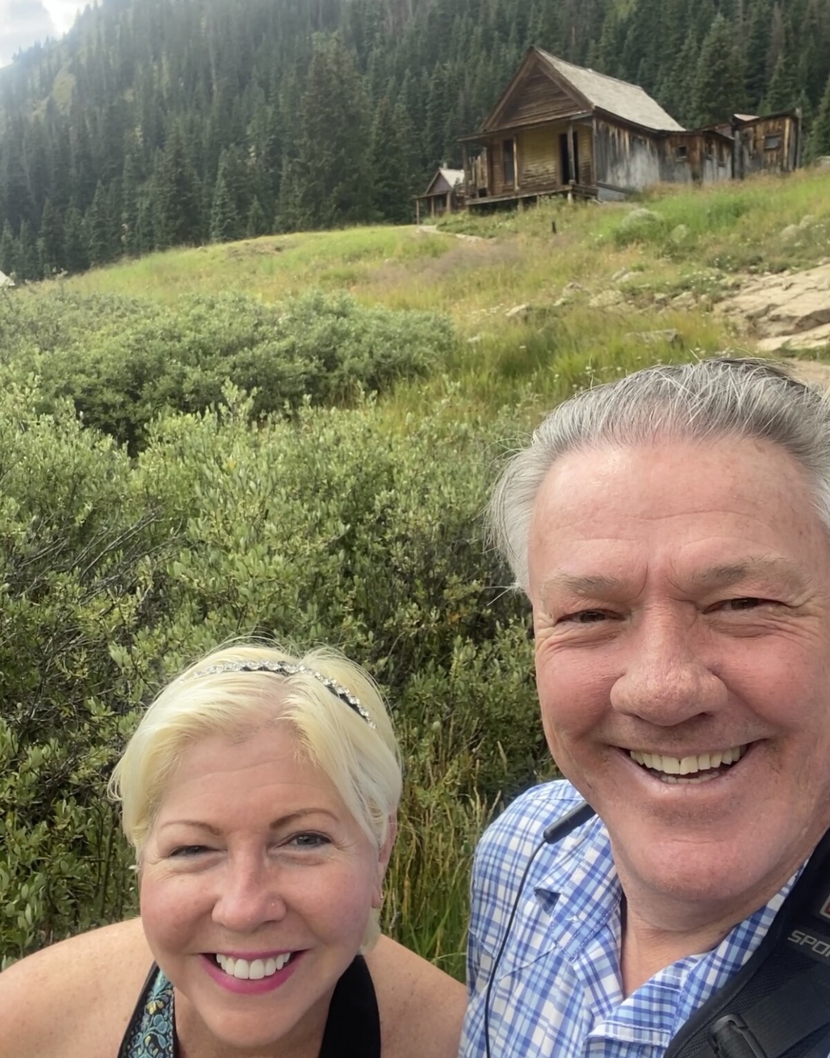
By a bit of a miracle, we made it into the Mountains, up to 11,200 feet to visit a very cool Ghost Town!
Speaking of cool, quite literally, I was in my element with 57 degree temps, up high for awhile, leaving the 87 degree temps, below!
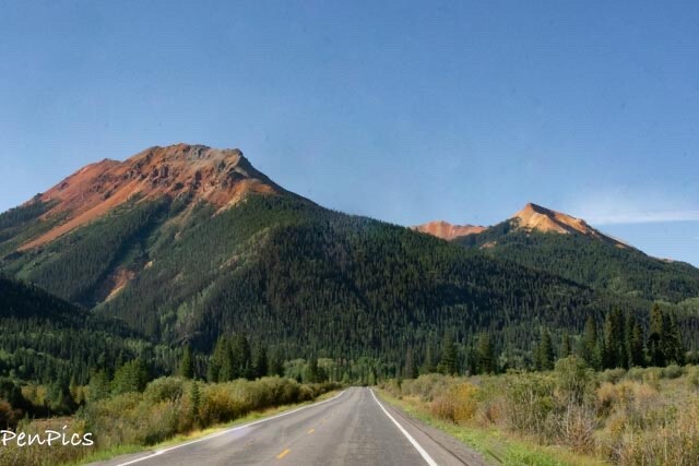
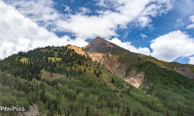
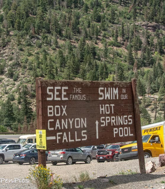
On the way to this ghost town, just beyond Ouray, we hit up “The Million Dollar Highway” with Million Dollar Views while wearing Million Dollar Smiles!
What an Amazing Adventure!
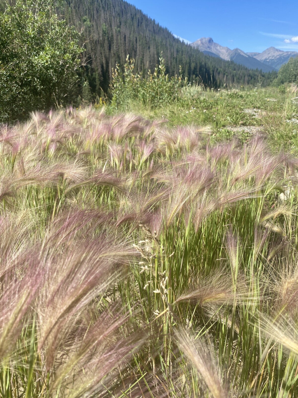
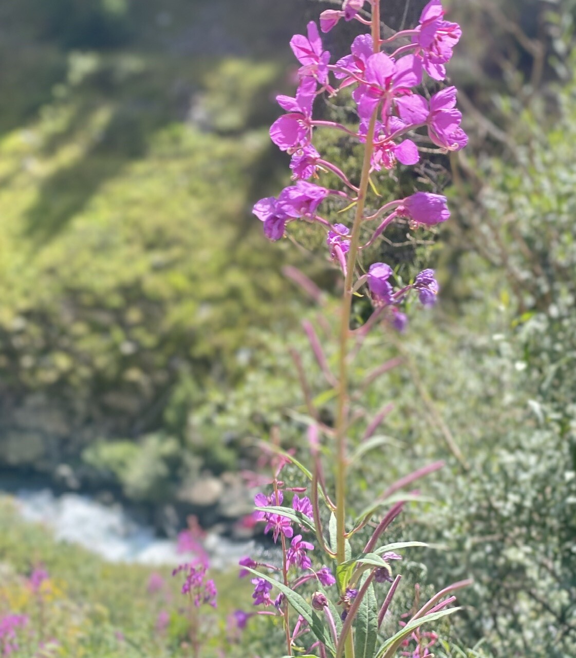
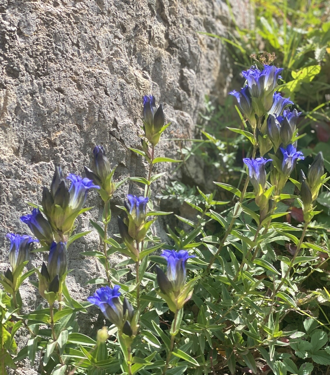
Side Note: With my “new to me” D7200 Nikon in hand, I was very excited to get some great pictures of Mountain scenery! My Nikon is perfect and worked like a champ! ….Only set back was my much anticipated 18-200 mm Nikon lens which finally arrived, also, just in time for this outing….well, it just didn’t look right. For brand spanking new; and $695, it’s hard to imagine it could be damaged, but it was. We do know it got lost in transit, and for a brand new purchase, the box it came in looked really worn, like it got wet, somehow; yet was dry when I received it. A bit of a mystery for sure, but clearly it is getting returned for a full refund! Only thing now, is, Nikon no longer has this particular lens in stock to purchase. Bummer, but the big guy came to the rescue with his eBay expertise.
Just like with my Nikon Camera he got for me, he has already ordered me the same 18-200mm used Nikon lens for $181! It’s guaranteed, and after my “brand new piece of crap experience,” I’m game. I mean, could it be any worse? 😂
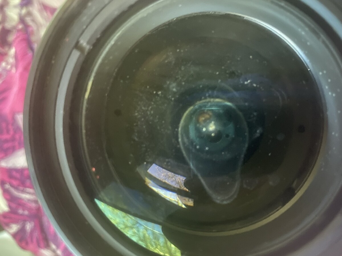 ⬆️ Just look at all that dust and what looks like a watermark, left by water drying (inside). Water and lenses do not mix!
*********
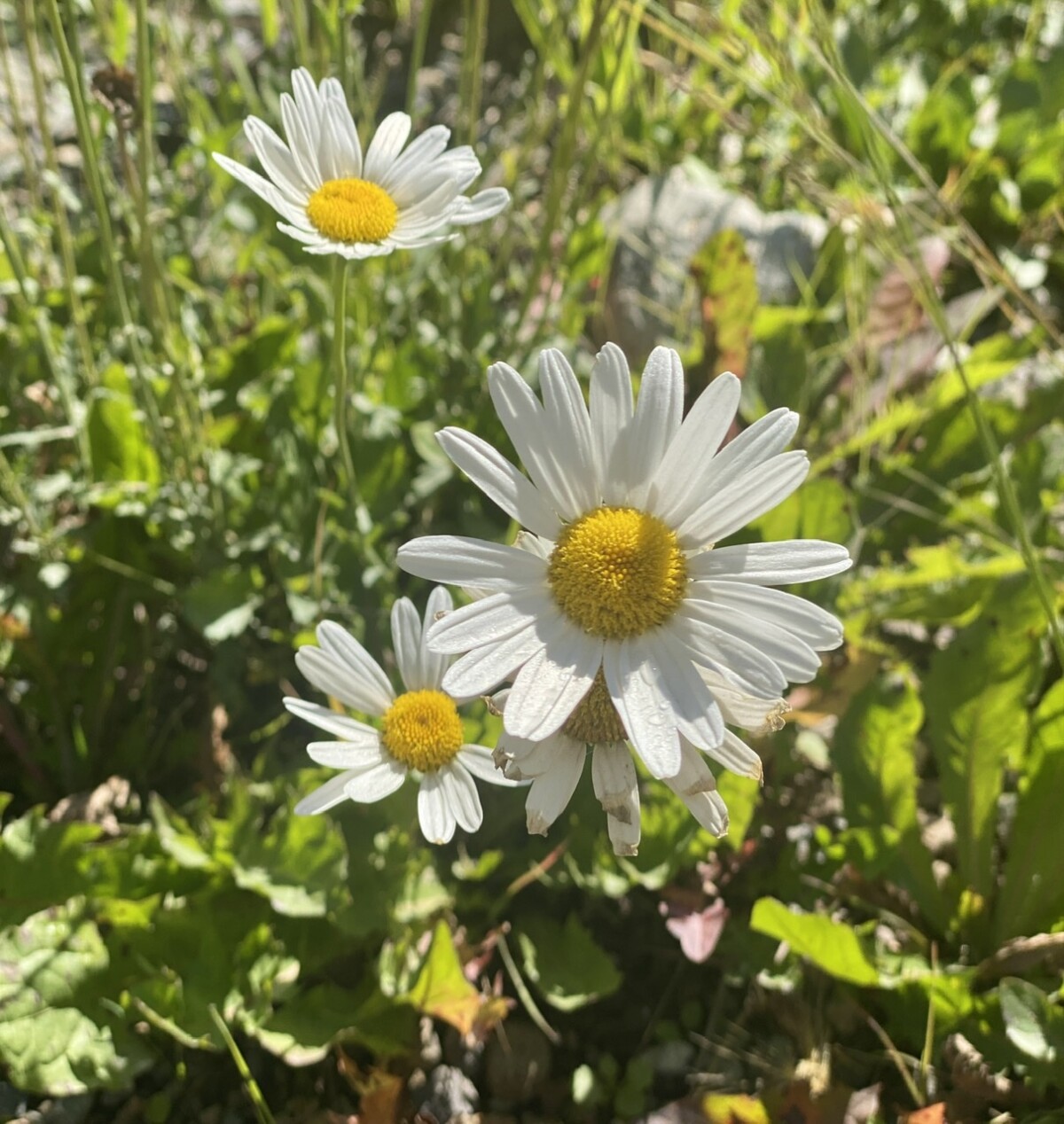
 ⬆️ Every photo with a clear sky, showed the water mark from inside the lens. This made a lot of work, processing photos to try to clean it that up. Ugh, but hey, my landscape shots are sharp! 😂
*********
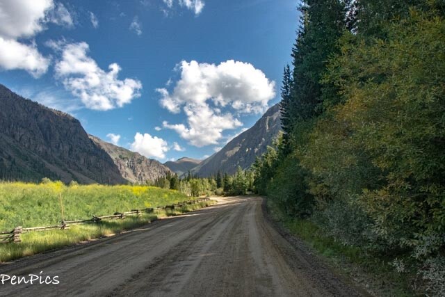
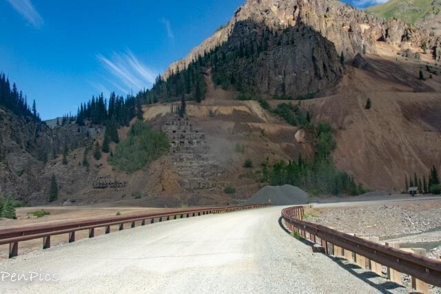
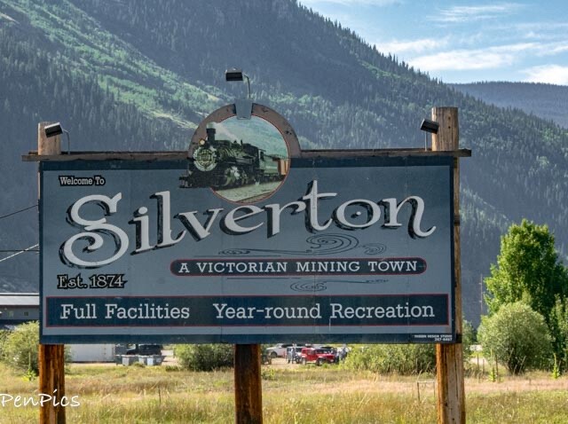
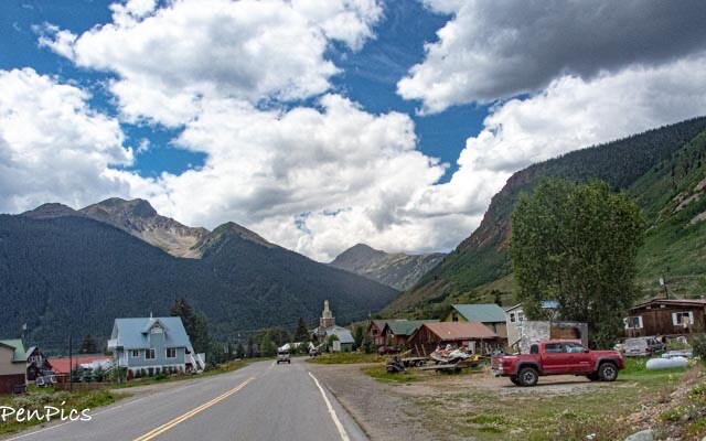
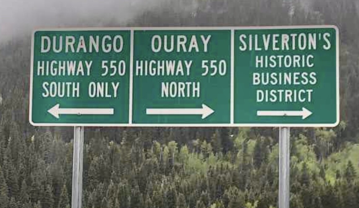
Anywho… When driving to the Ghost Town, we passed through the old town of Silverton.
Not far beyond this town the pavement ends and the challenging road begins.
The road is posted, recommending 4×4, but we really wanted to go! Our deal is, if super interested in a destination, we know we can always turn around if roads gets too sketchy.
Today, we had beautiful dry weather on our side.
Bonus!
The entire road was not bad, just the last four miles. Truth be told, we were the only non-4×4 up there. We have good tires and “Rusty” is an AWD, but because we still have low clearance, we went super, super slow, over some pretty rough parts of the road. Daryl did a great job.
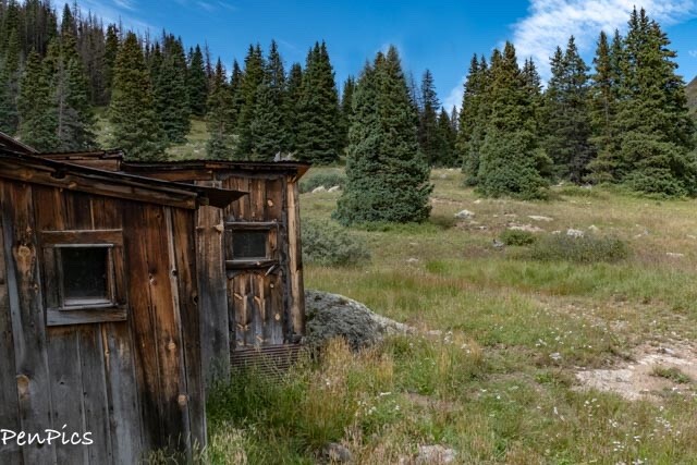
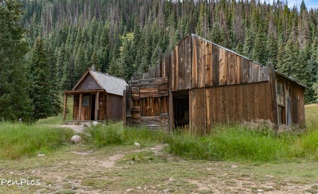
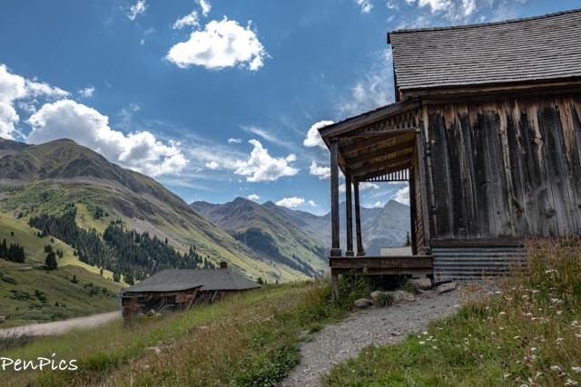
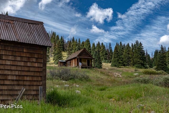
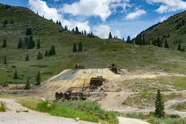
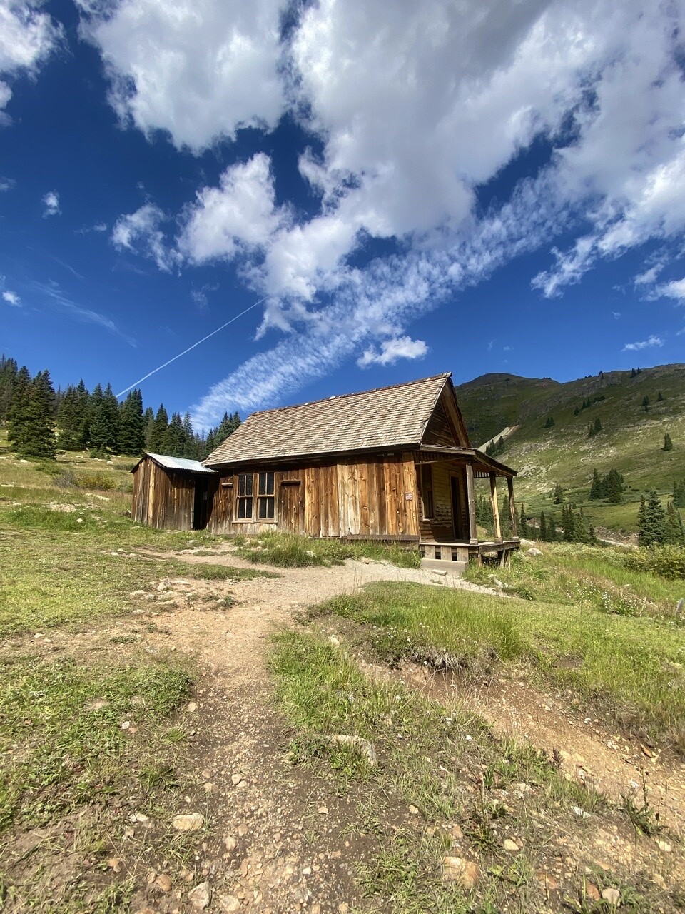
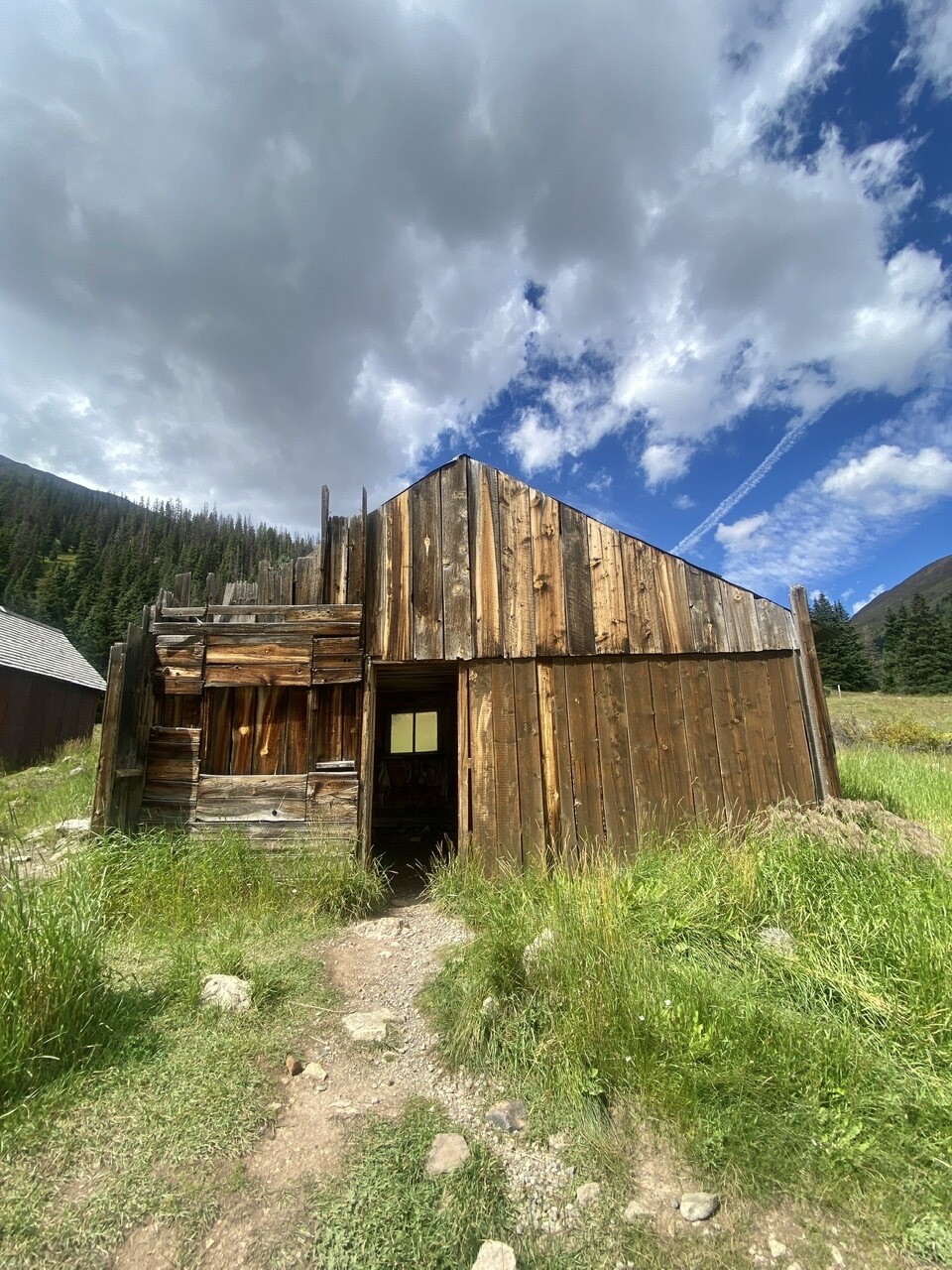
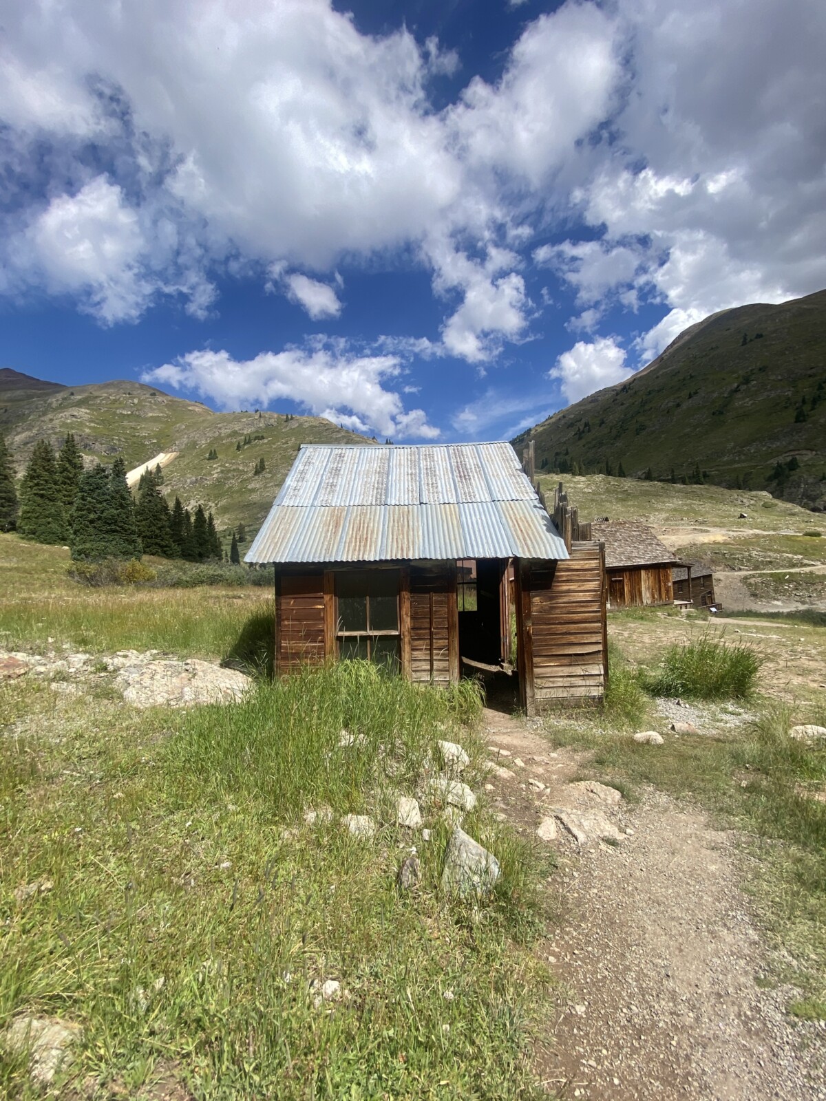
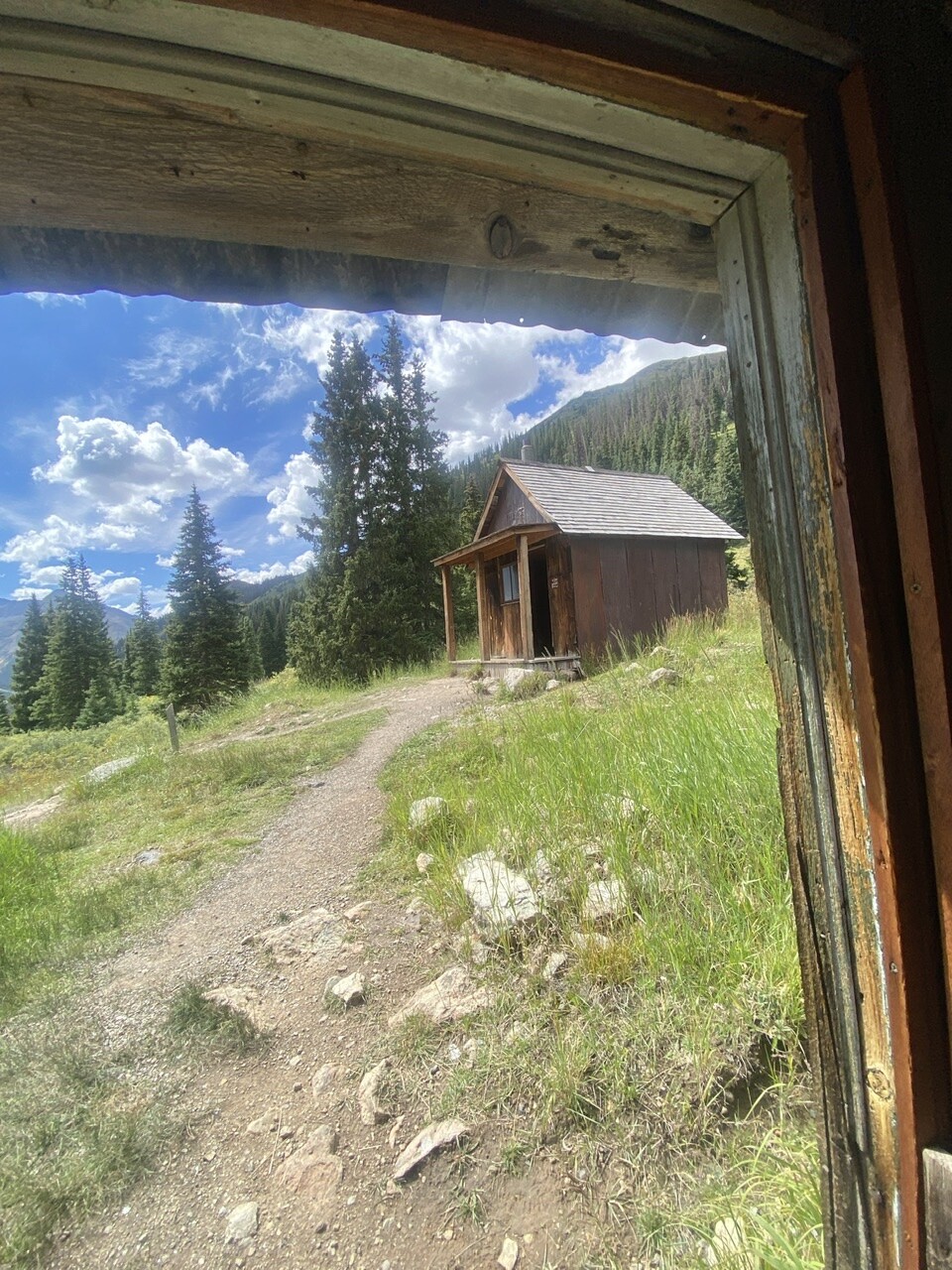
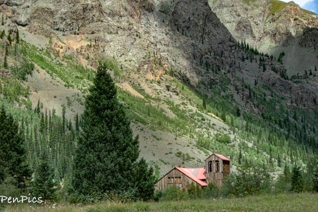
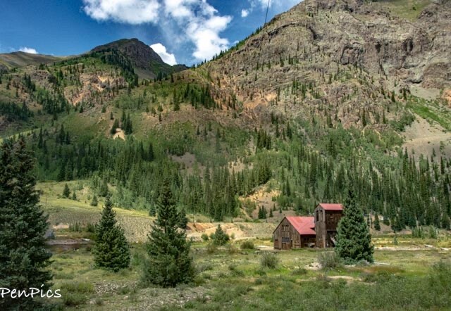
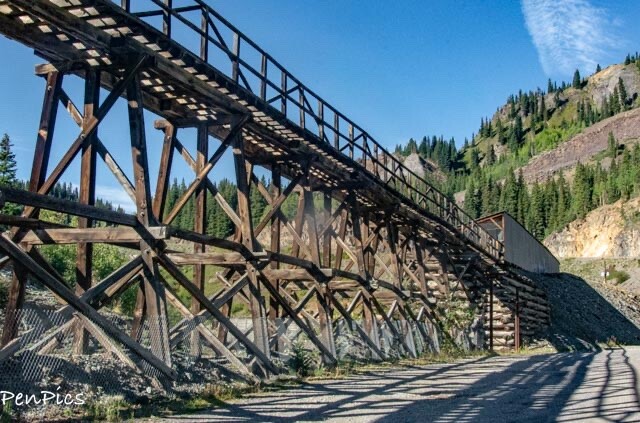
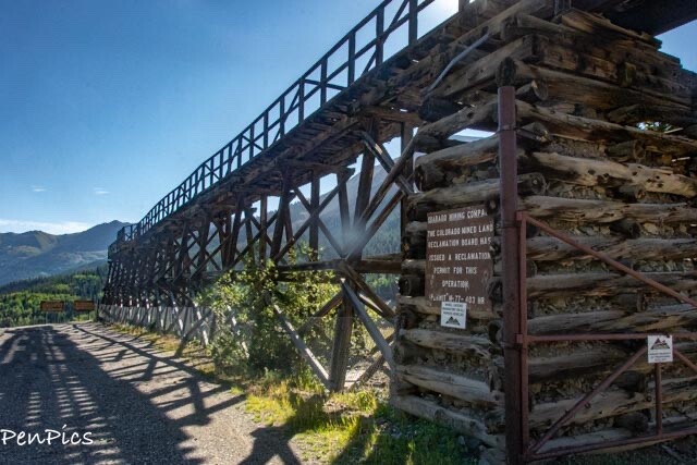
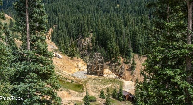
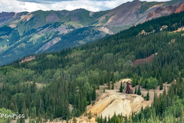
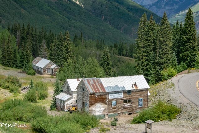
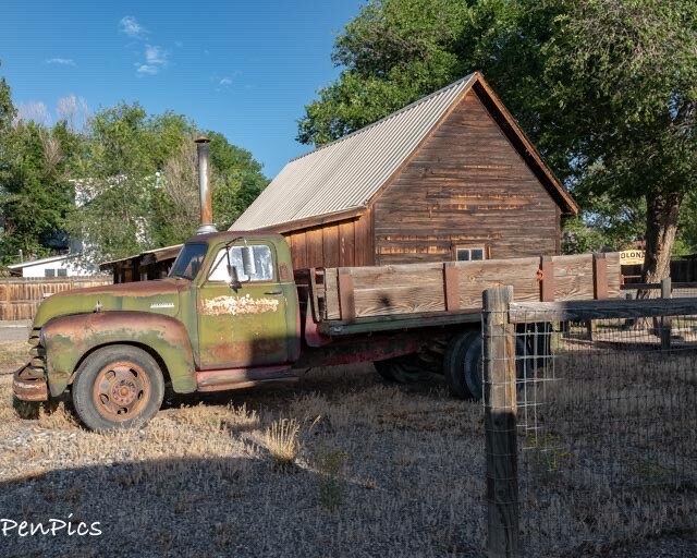
Animas Forks Mining/Ghost Town ⬇️
is located at 11,200 feet above sea level high in the San Juan Mountains, along the Alpine Loop. It usually takes a 4-wheel-drive vehicle to conquer the unimproved roads to the ghost town, and the mountain ghost town comes with a wealth of history.
Citizen Stewardship
Preservation of the buildings in Animas Forks has been an on-going struggle for the past 40 years.
The Duncan House, for example, would likely have been lost to effects of extreme weather and vandalism, without the volunteer efforts of many concerned citizens.
The Bureau of Land Management has worked in partnership with many organizations such as the San Juan County Historical Society to maintain the site.
As a visitor to this site, we can now count our selves among those responsible for preserving the history of Animas Forks.
During your visit, please ask others to respect this unique place, taking only pictures, and leave only footprints.
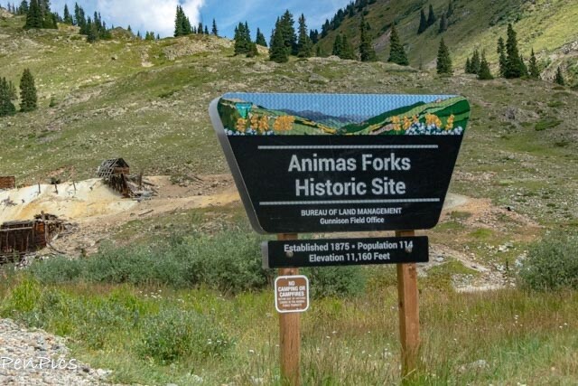
Sitting at an elevation of 11,200 feet, the first log cabin was built here in 1873, by prospectors.
As more miners arrived to work in the area, a mining camp was born, which was originally called “Three Forks of the Animas River.”
When the town gained a post office, in February 1875, the name was shortened to Animas Forks. Because of the high altitude, most of the town residents migrated to Silverton in the winter.
By 1876, the mining camp had become a bustling mining community, boasting 30 cabins, a hotel, a general store, an unlicensed saloon, and the post office which held the record for the highest elevation newspaper in American 🇺🇸
That year, the Dakota and San Juan Mining Company built a large mill in town. Though the mill was never very productive or profitable, it gave the impression of success and encouraged outside investment in the area.
As the camp became a regional center for commerce, a formal townsite was laid out in 1877. The same year, the first legal saloon opened, and Otto Mears constructed a toll road linking Ouray, Animas Forks, and Lake City. Before long, daily stagecoaches were running between Animas Forks and Lake City.
Animas Forks had a population of 114, and the town was incorporated the next year; becoming the second municipality in San Juan County.
Animas Forks reportedly grew as large as 450 over the next few years, and many new businesses were established. Three more stores were opened, as well as two butcher shops, two boarding houses, the Mercer House hotel, the Flagstaff House restaurant and bakery, a drug store, two assay shops, and a blacksmith shop. The town built a jail in 1882, and the same year, it gained a newspaper called the “Animas Forks Pioneer,” and established a school district. Classes were held for a few years in rented buildings.
During these prosperous years, the town boasted itself as the “largest city in the world,” but added in small type, “at this altitude.” However, despite its promising beginnings, Animas Forks began to decline in the mid-1880s, as speculative mining activity in the area slowed to a halt. It did not help matters for this town when in 1884, a blizzard inundated the town with 25 feet of snow, forcing the residents to dig tunnels to get from building to building.
The residents were snowbound for a devastating 23 days, and unable to obtain supplies.
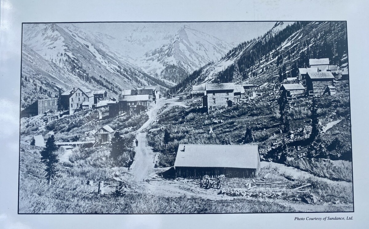 ⬆️ A photo from sometime after 1875
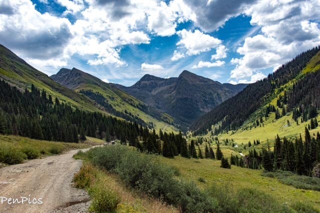
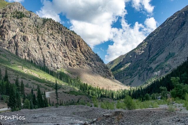
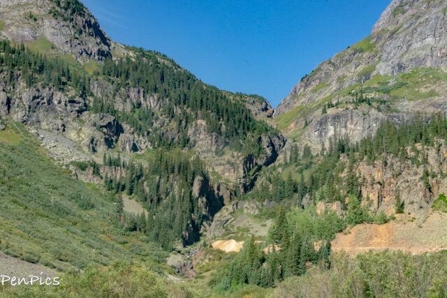
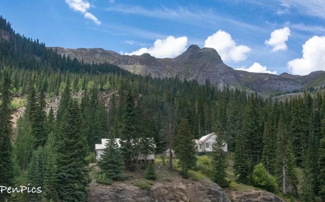
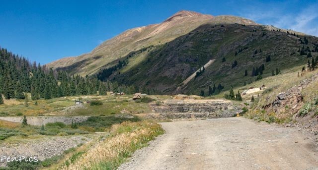 ⬆️ From a distance, I could see we were almost there. I was pretty excited at this point, because with every bend in the road, we weren’t sure we wouldn’t have to turn it around!
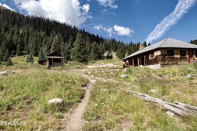
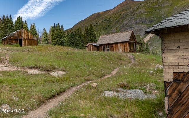


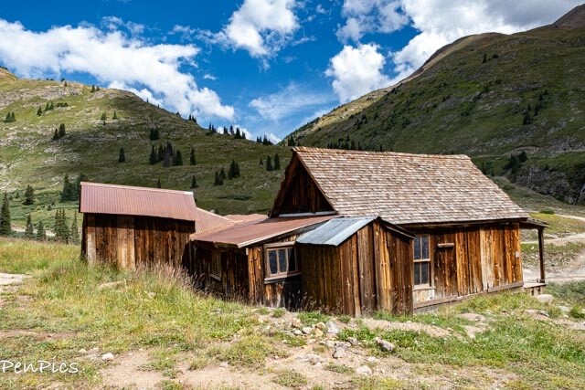
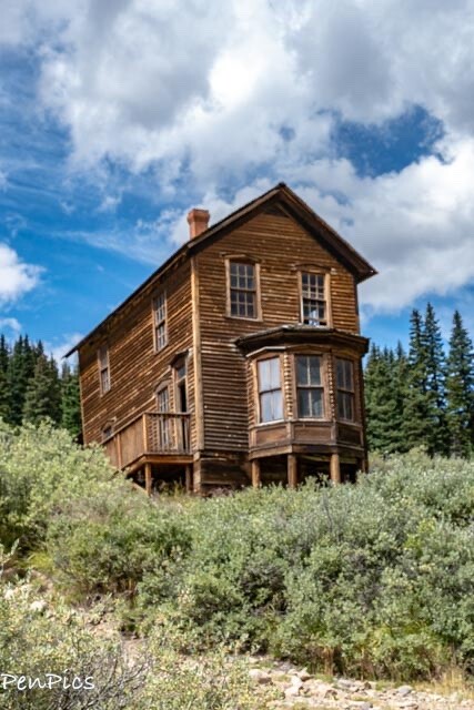
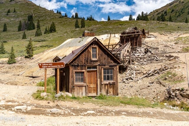
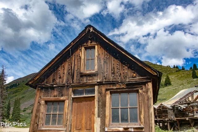
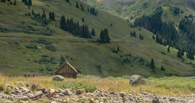
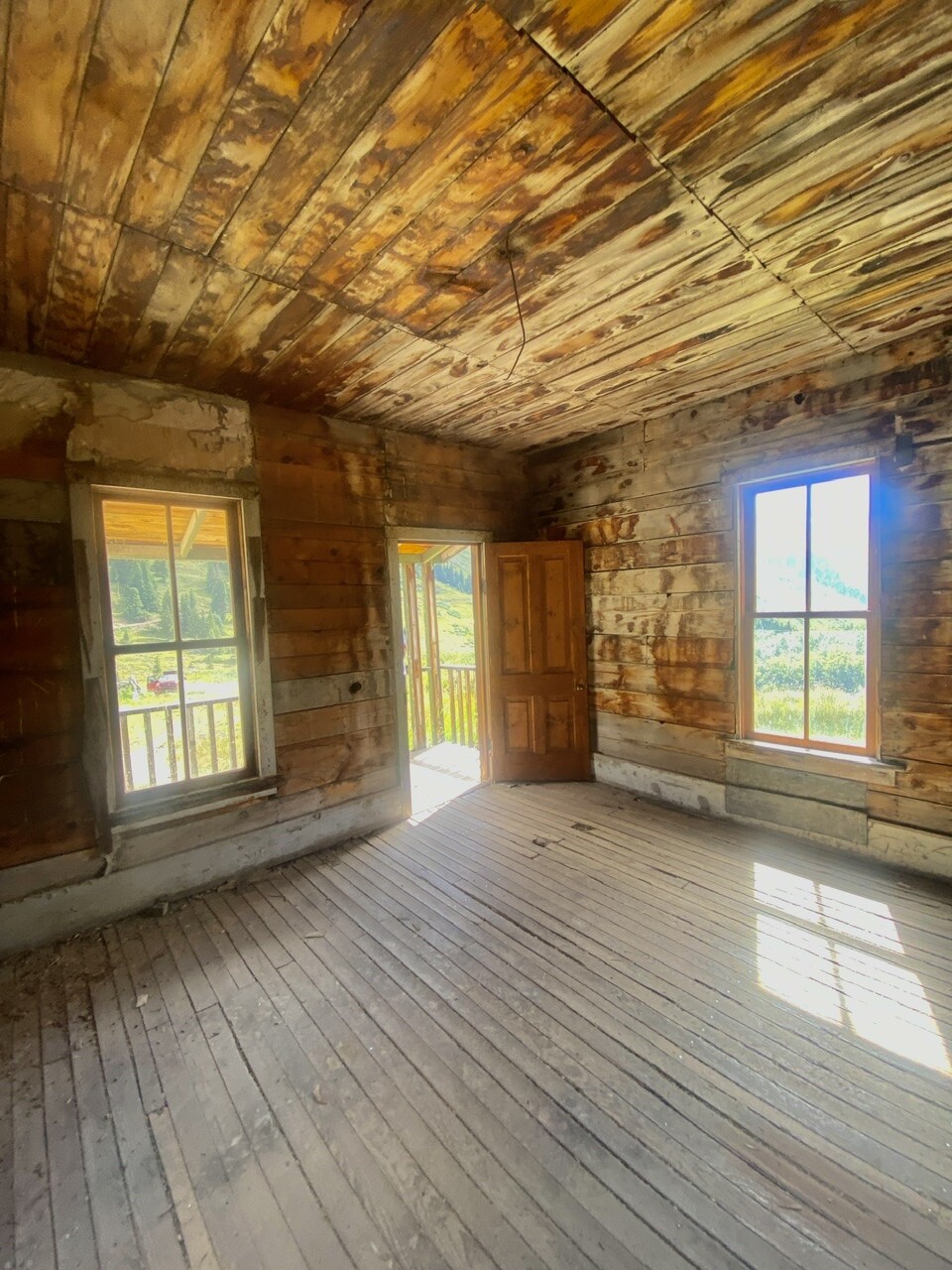
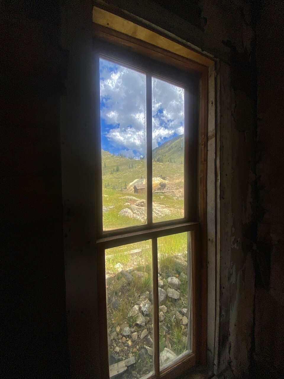
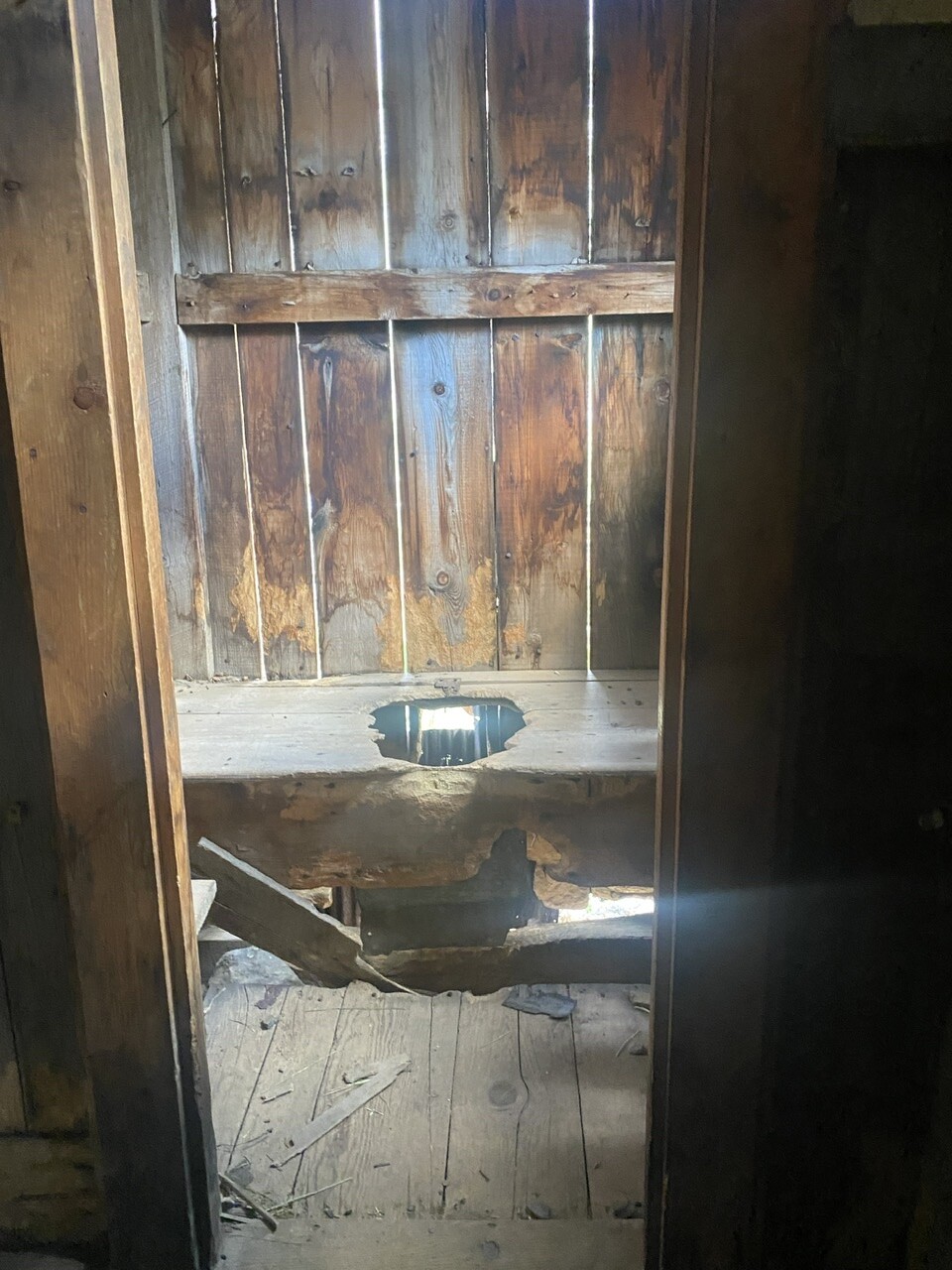
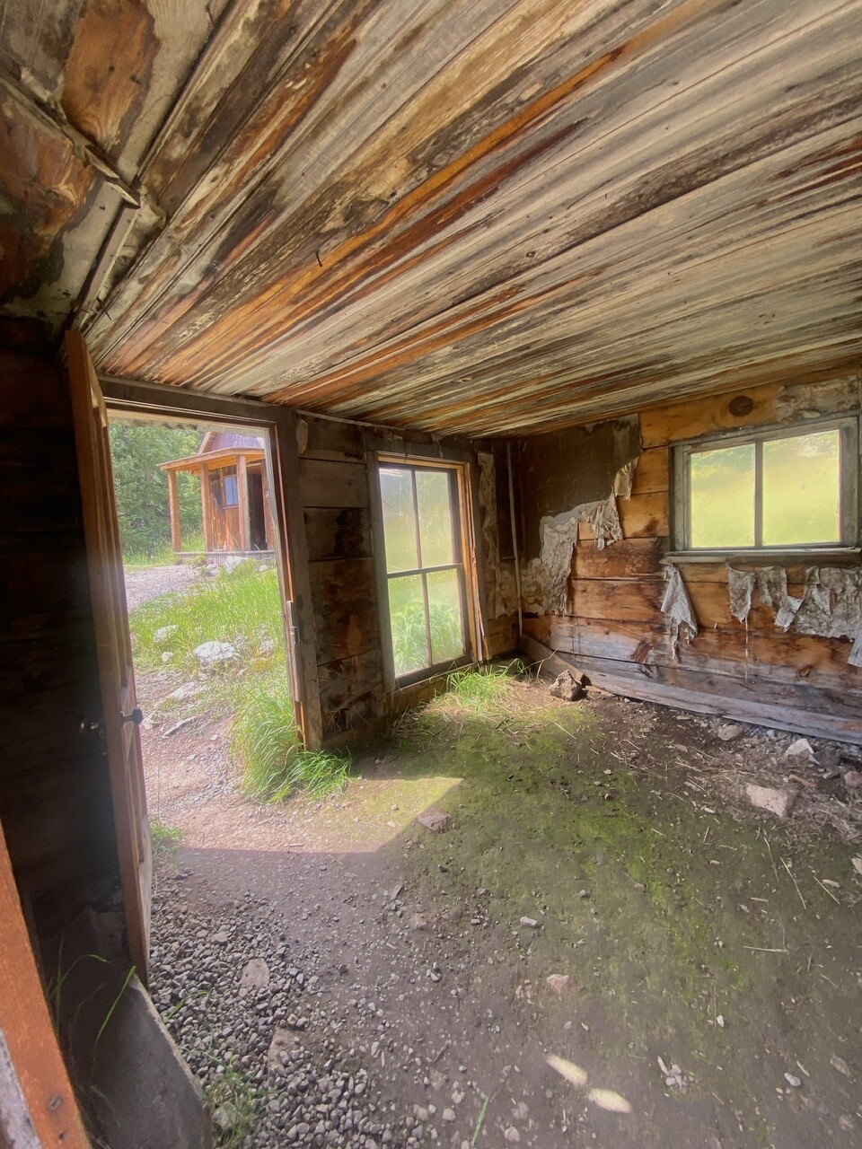
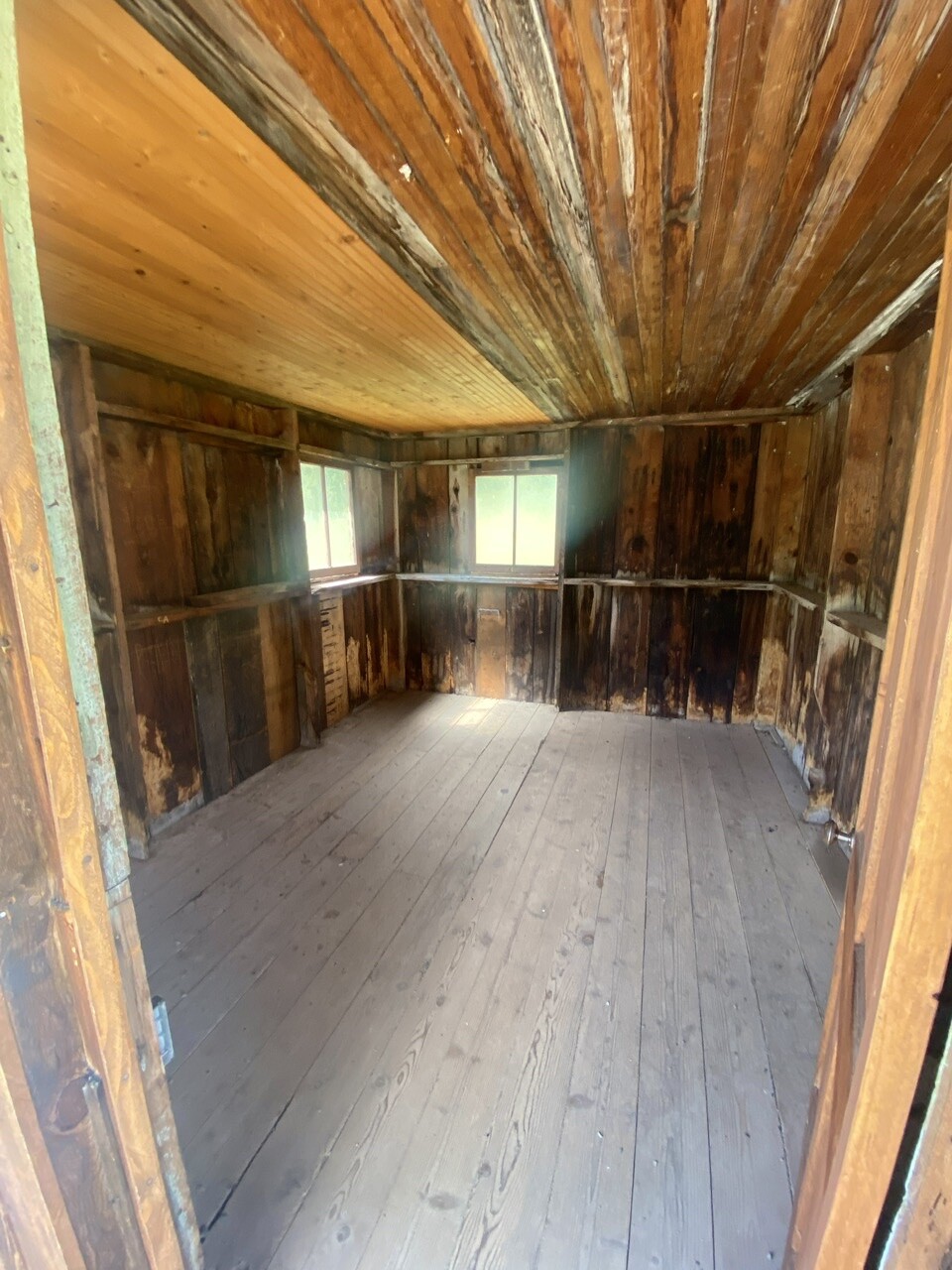
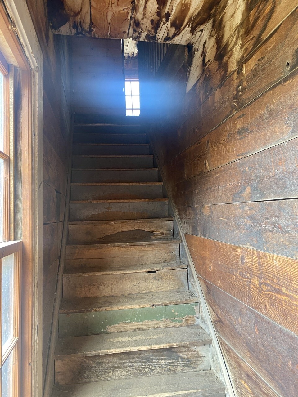
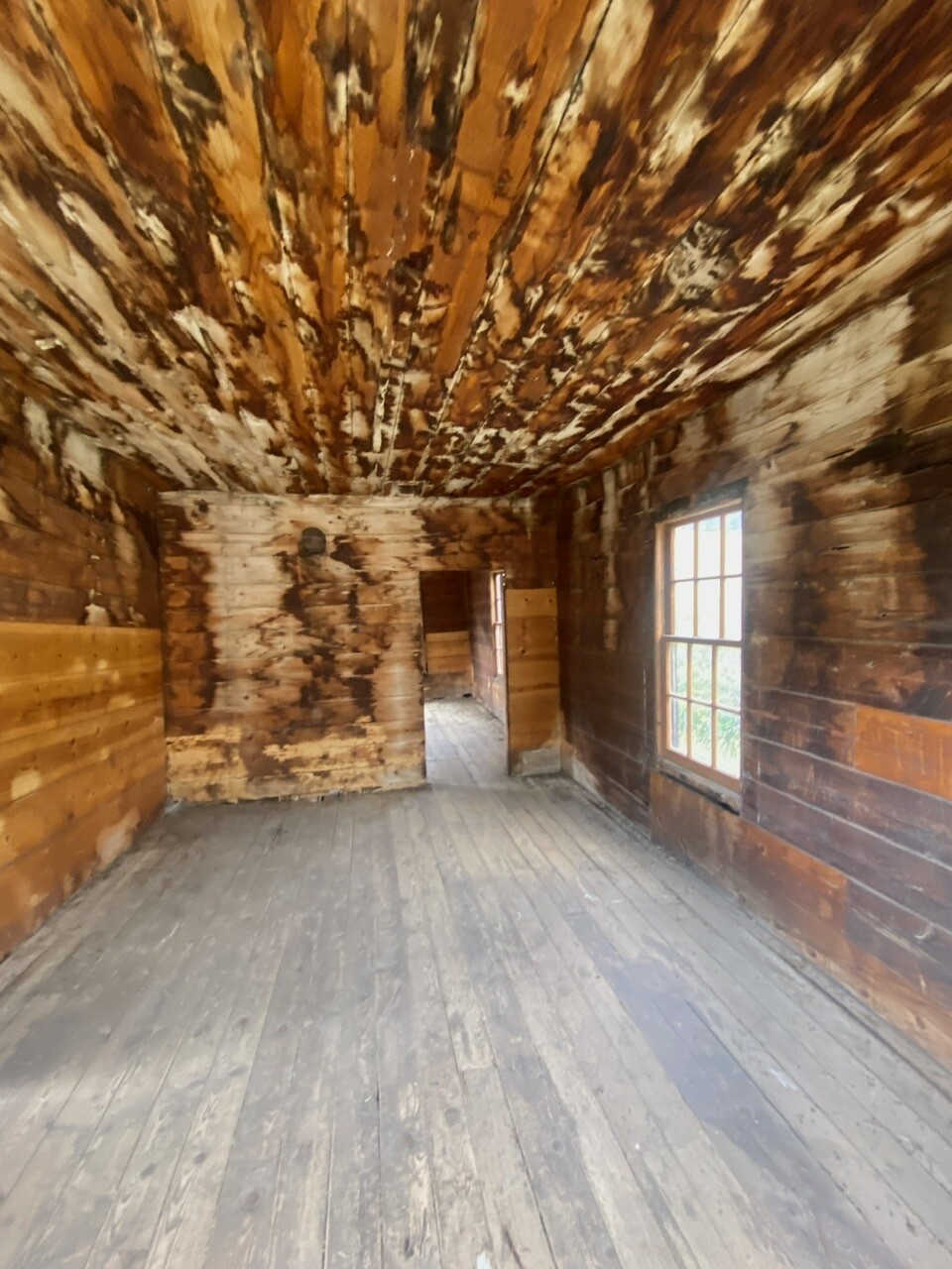
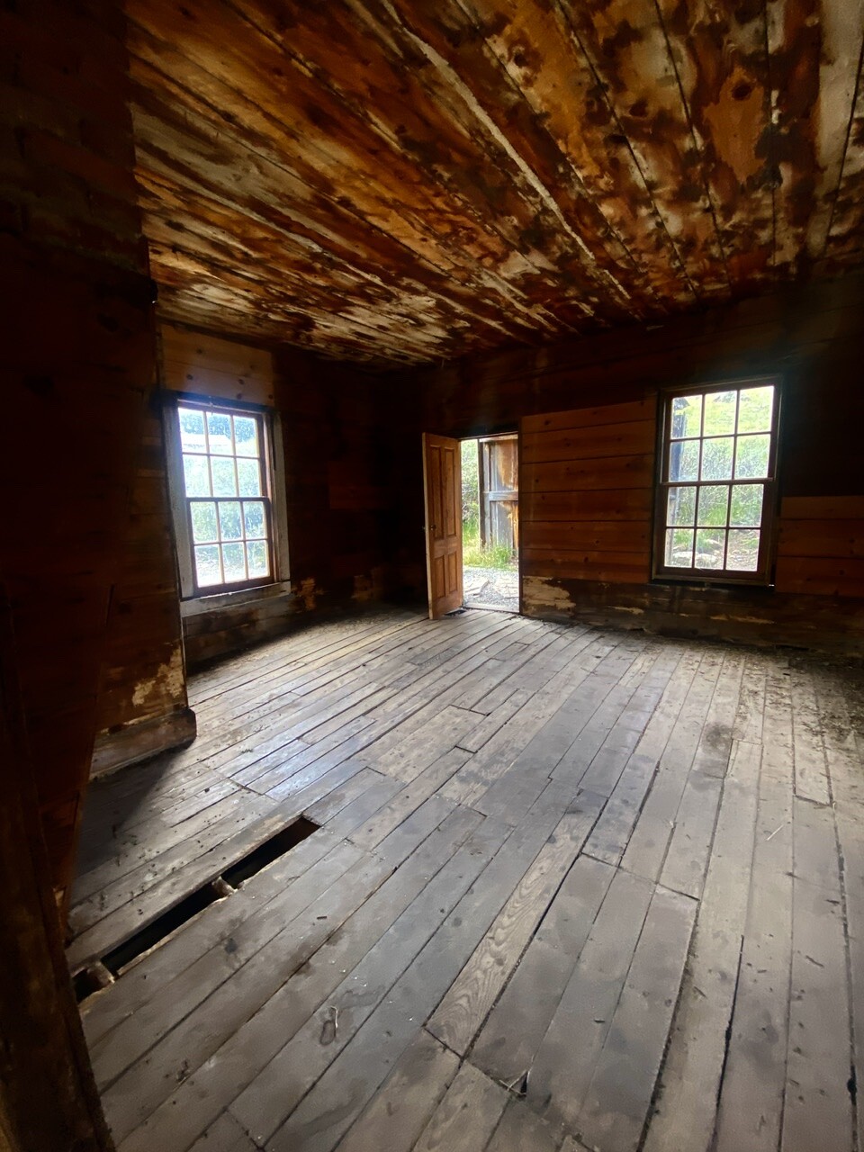
A look inside some of the structures, and their views, from days of yore ⬇️

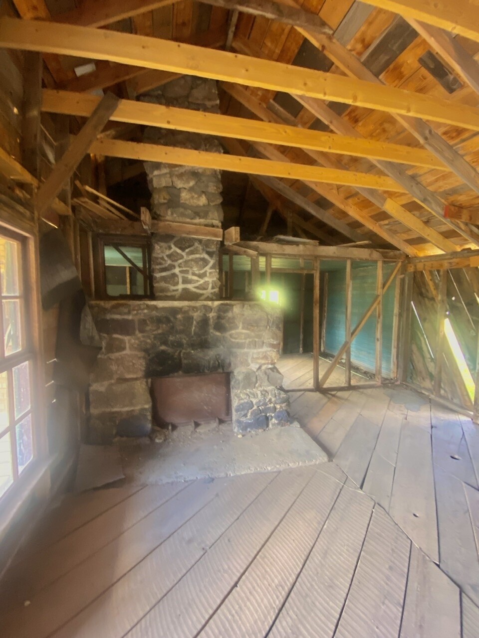
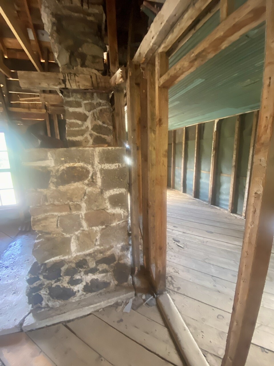

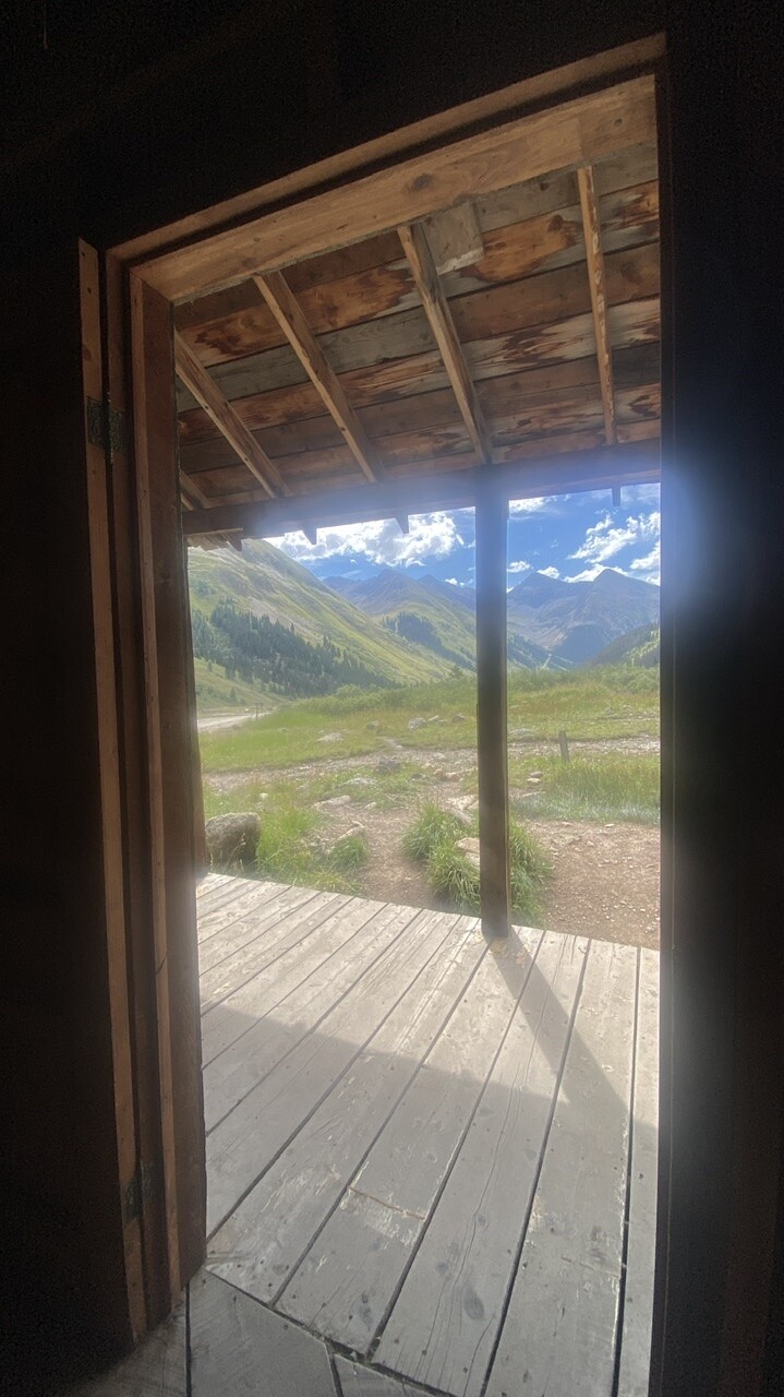
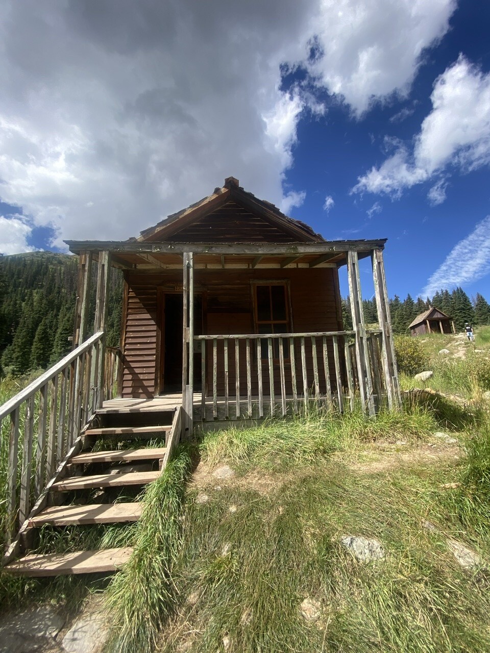
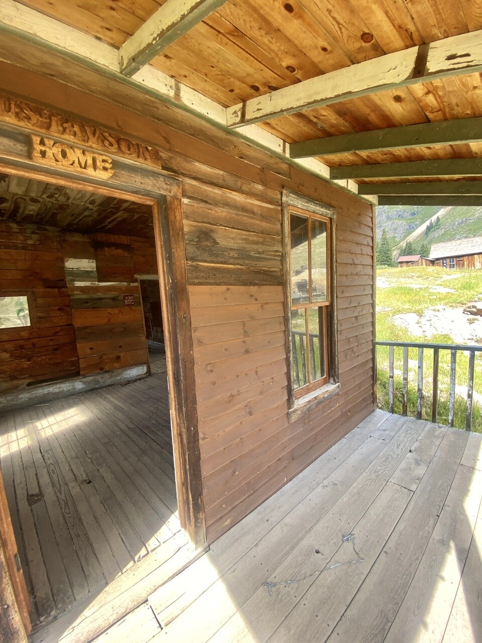
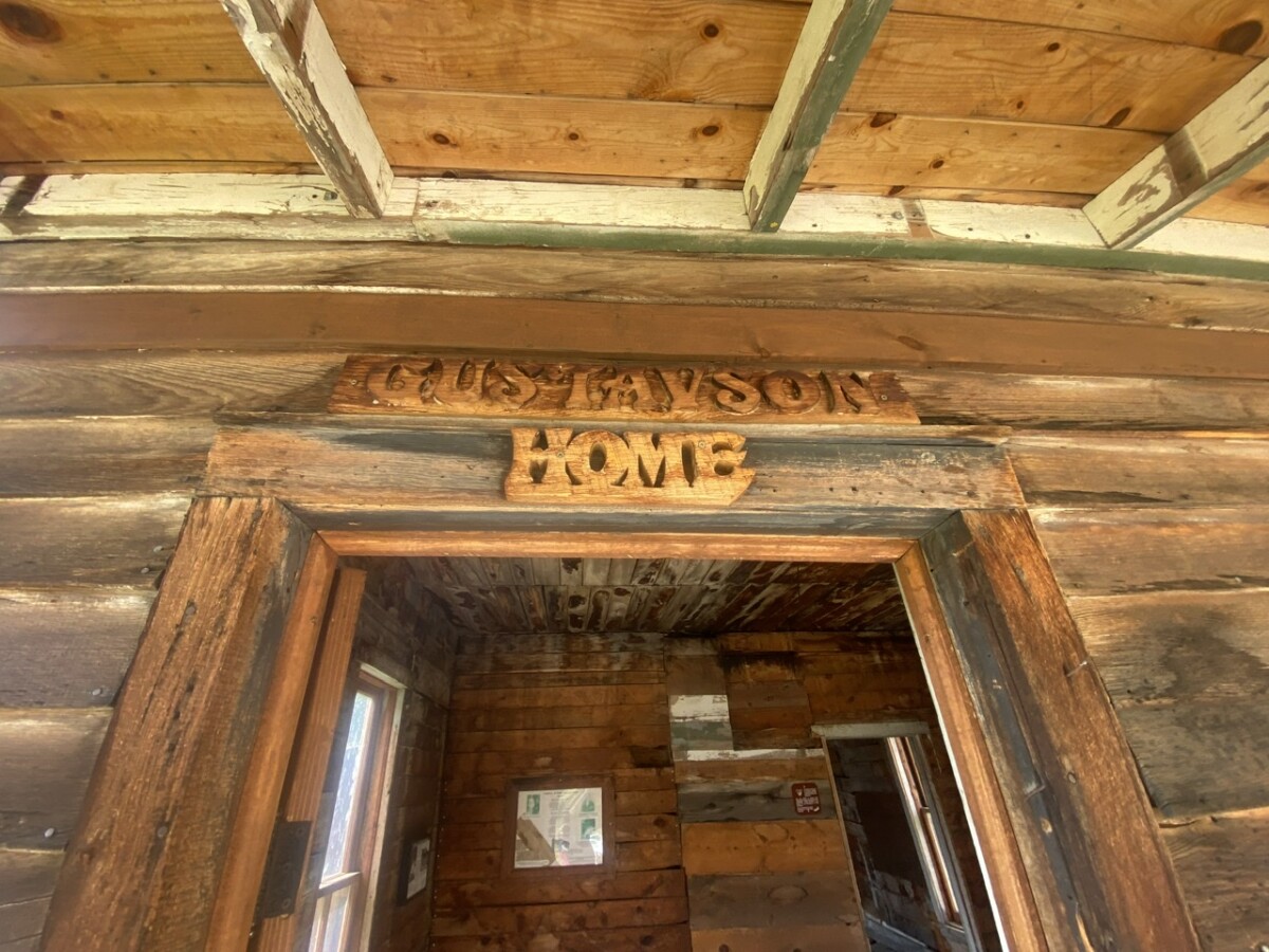
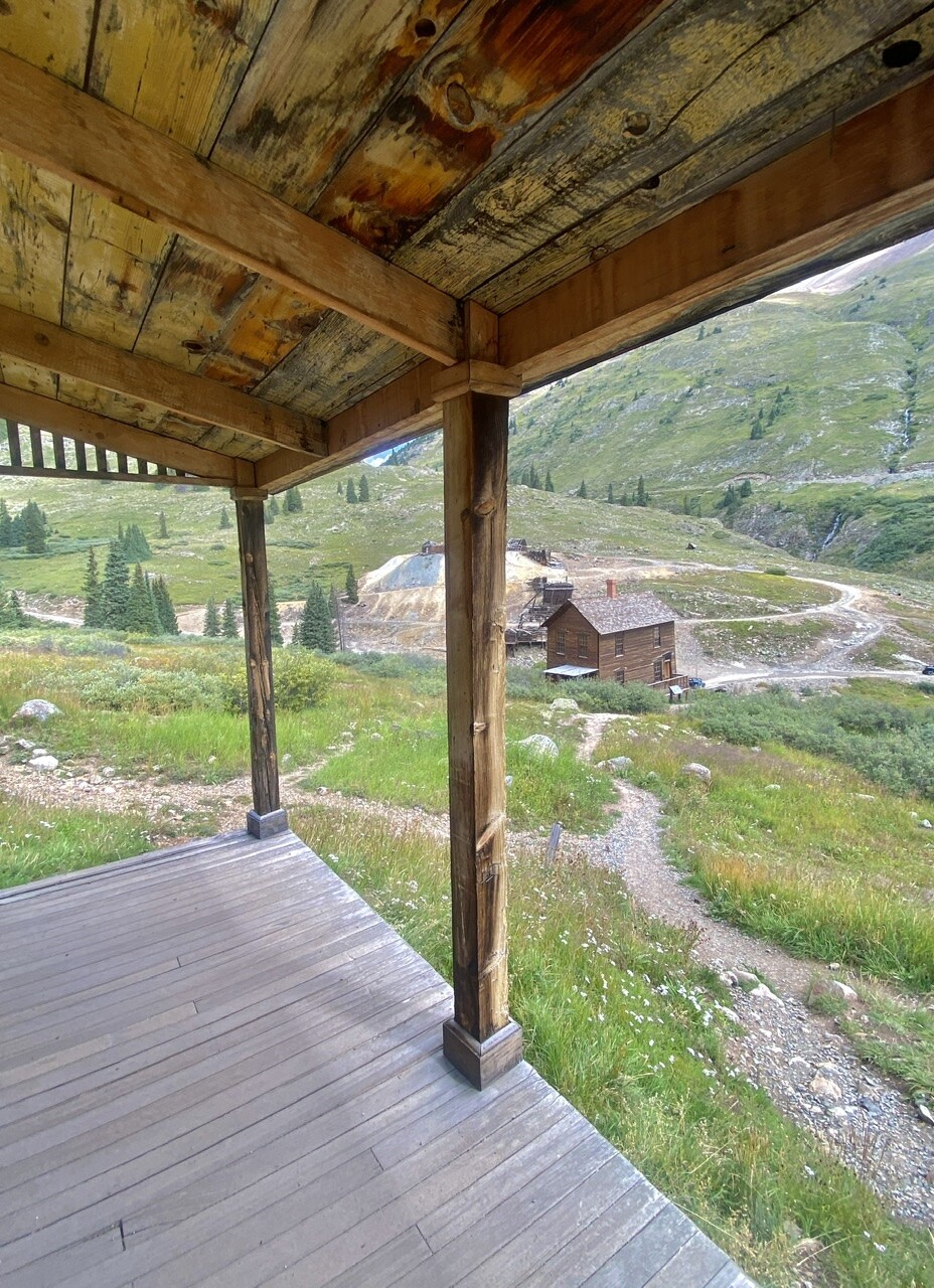
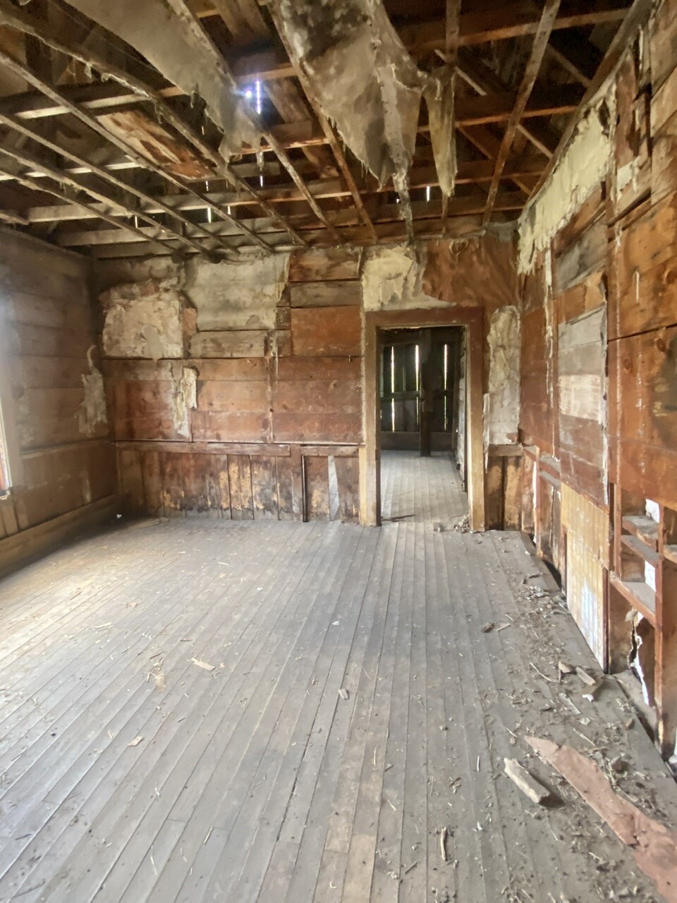

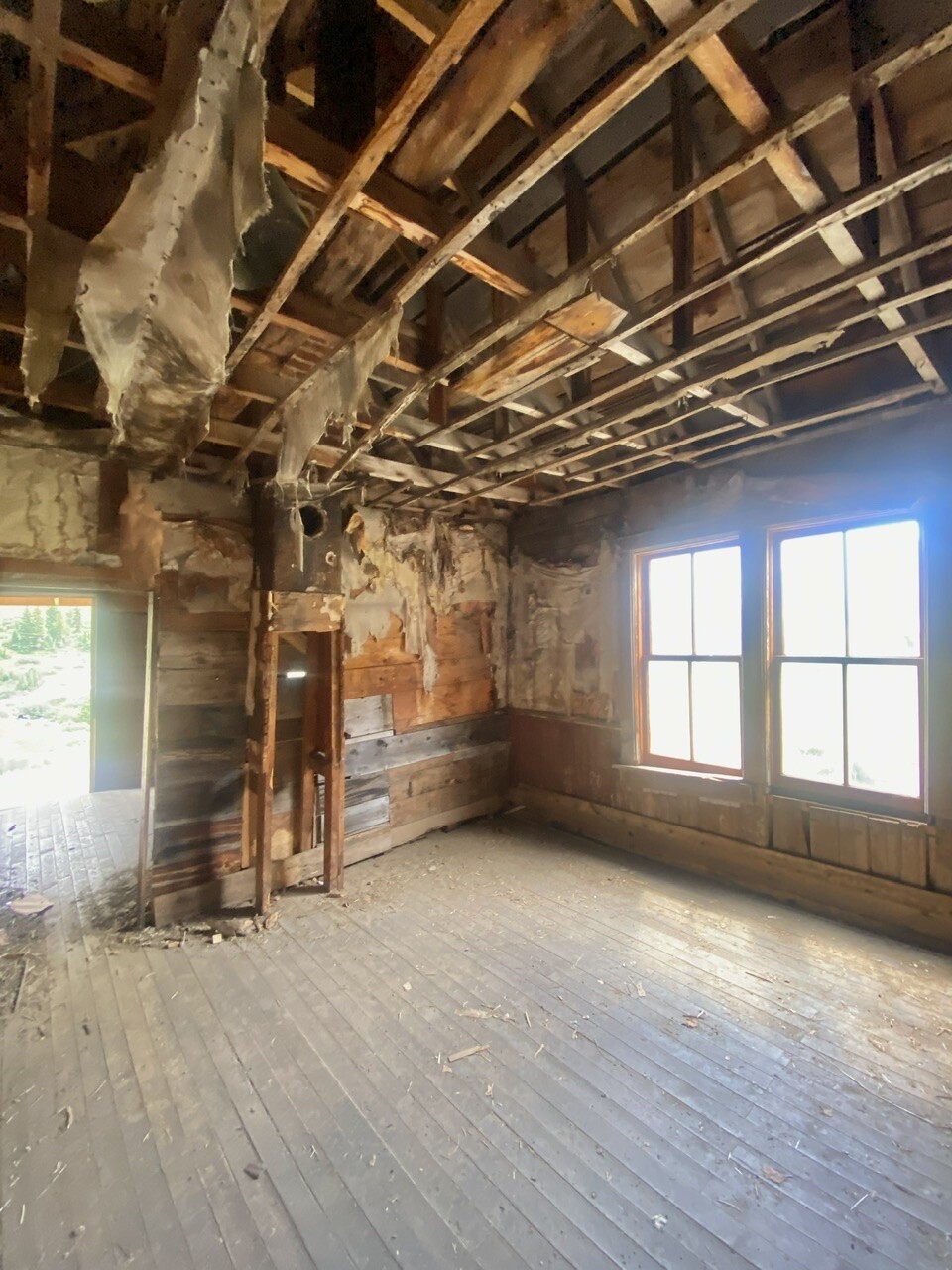
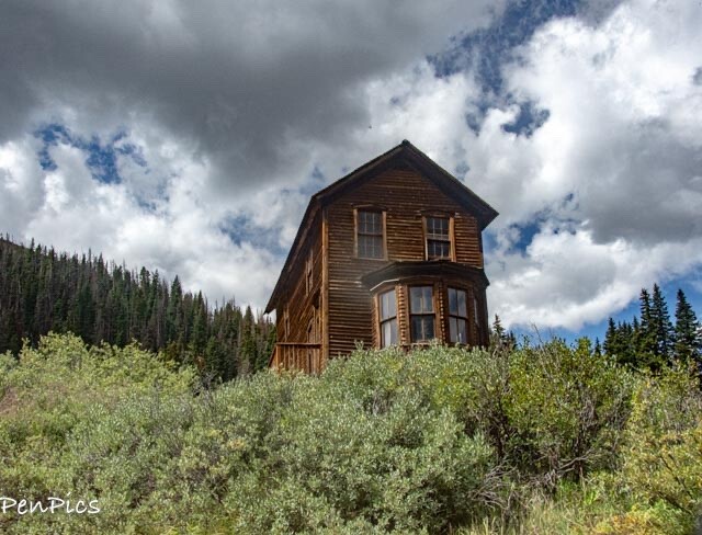
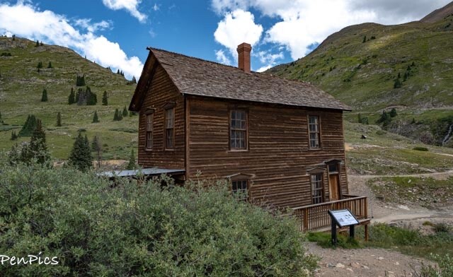
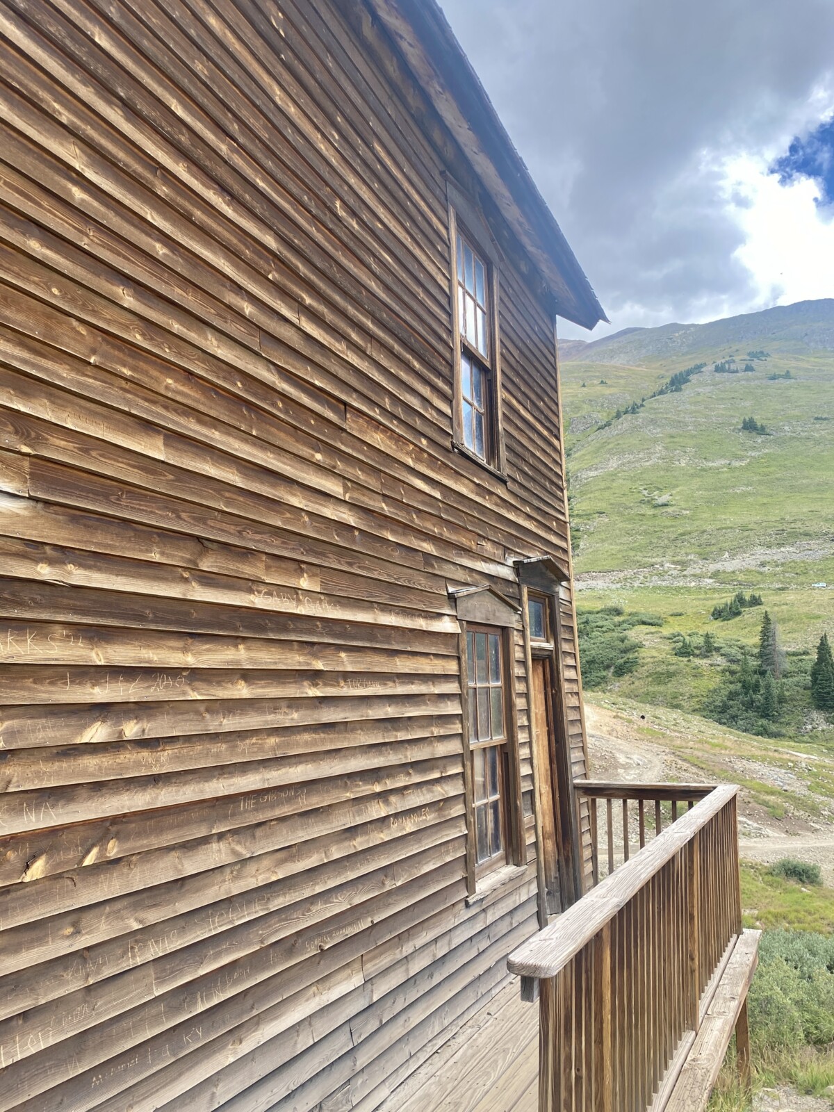
⬆️⬇️ The William Duncan House
If you’ve ever watched the show “Hell on Wheel’s,” ya kind of know which house belonged to the “well to do” banker, or the owner of the mill or mines.
This house was definitely an impressive structure, and even given its age, with some imagination, one just some how knows what it must have been like, in its hey day.
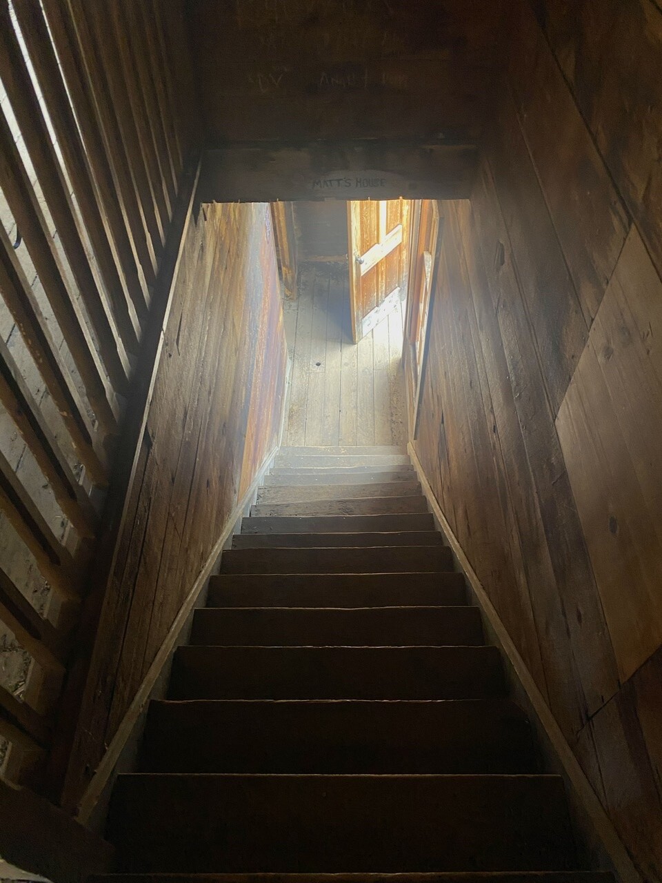
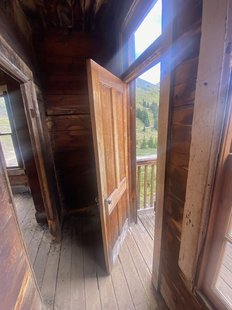
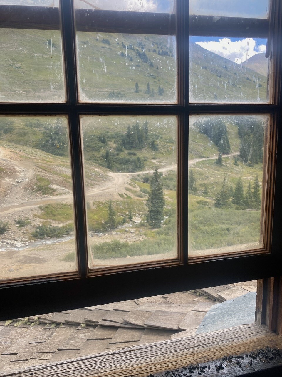
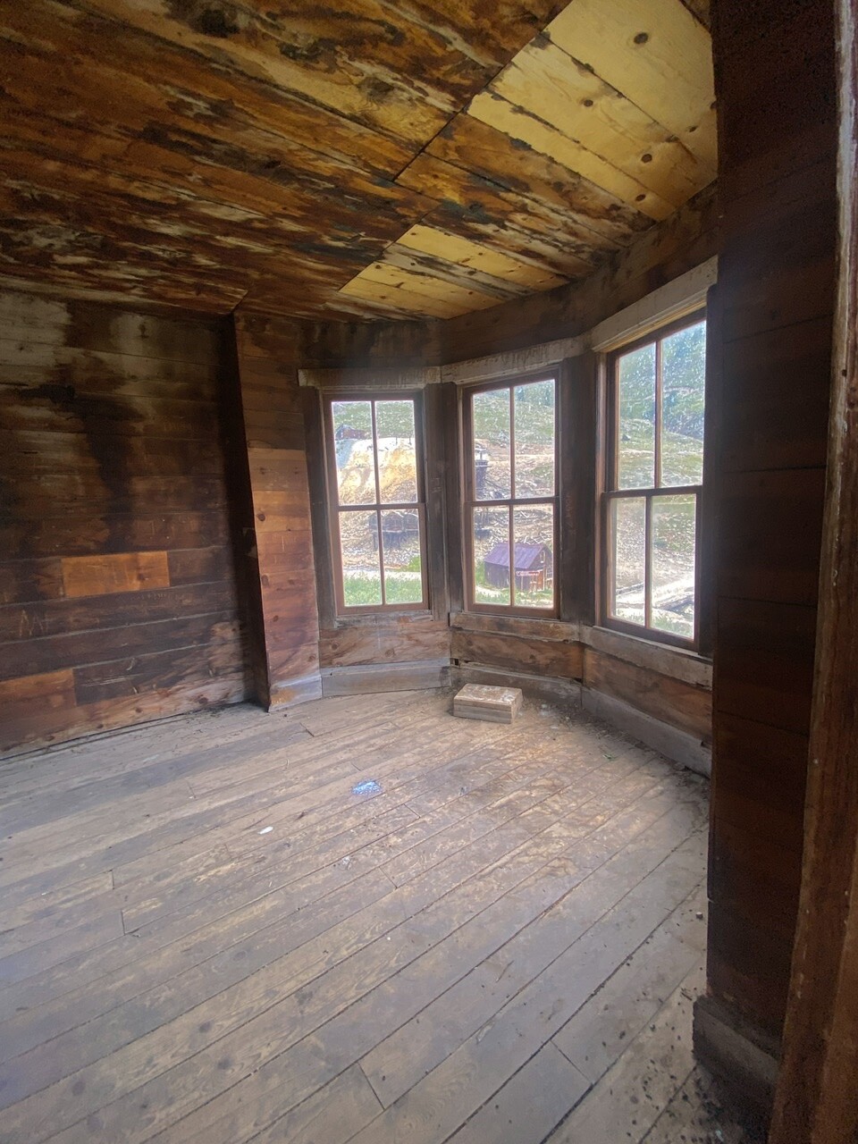
⬆️⬇️ Migrating from the East Coast, the Duncan’s chose to include several architectural elements popular during the Victorian era, such as the finely-detailed picturesque bay, with tall windows, to take advantage of the natural light and breathtaking mountain views. Although these elements are typical of the Victorian era, they were highly unusual for such a remote location at this early date.
The Duncan family departed Animas Forks in 1884, leaving this magnificent and haunting statement of the optimism and confidence that a select few prospectors and their families carried deep into the San Juans.

The Townsite was listed on the National Register of Historic Places in 2011.
Today, the Duncan House retains many of its original historic architectural features, including decorative trim and siding, the cedar shingle roof, and most of the original window and door hoods and casing.
Coinciding with the 25th Anniversary celebration of the designation of the Alpine Loop Backcountry Byway in 2014, a major stabilization and restoration project preserved the intact elements of the Duncan House, and replicated many features that were lost or severely damaged.
Over 250,000 people visit Animas Forks every year. The Duncan House is perhaps the most photographed historic structure on the Alpine Loop.
********
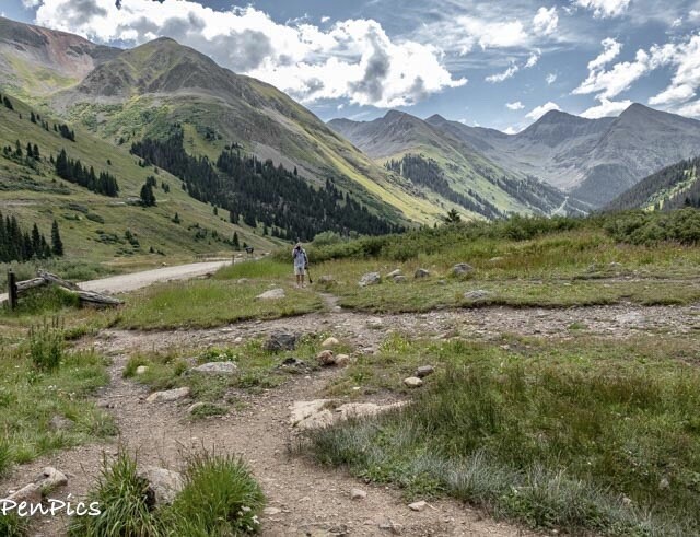
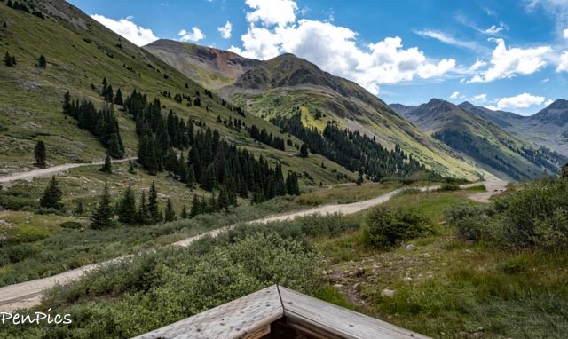
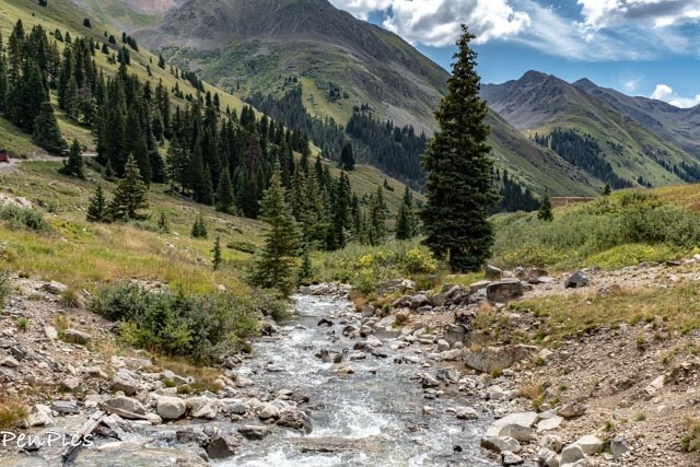
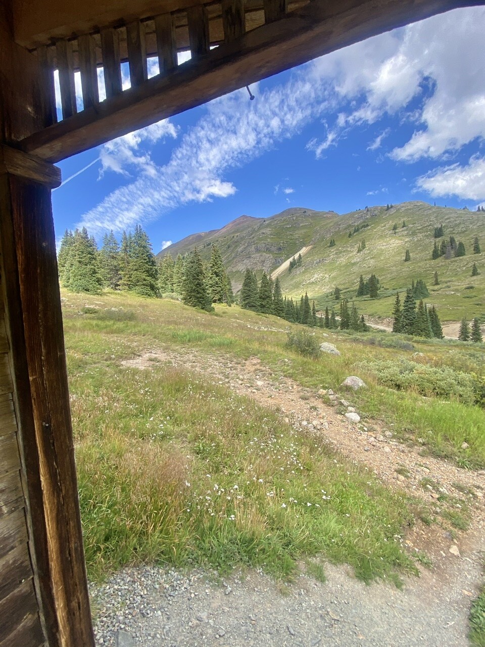
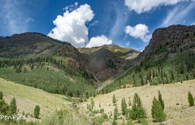
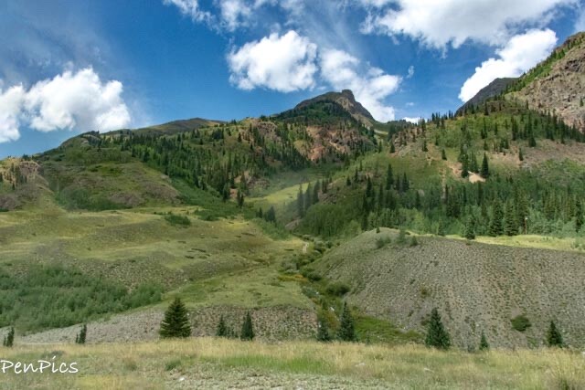
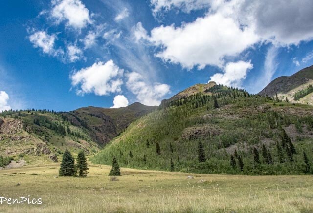
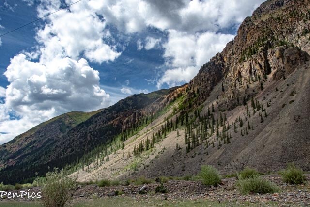
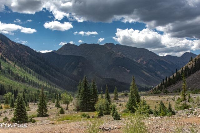
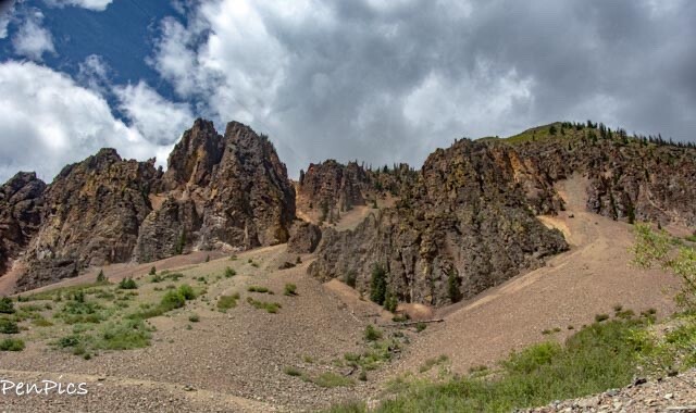
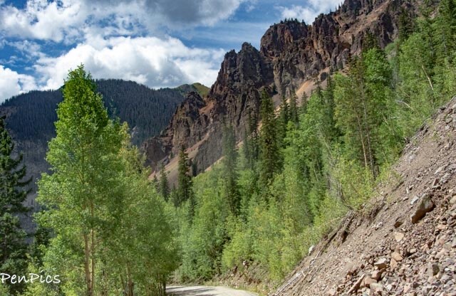
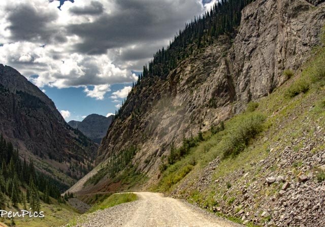
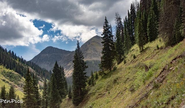
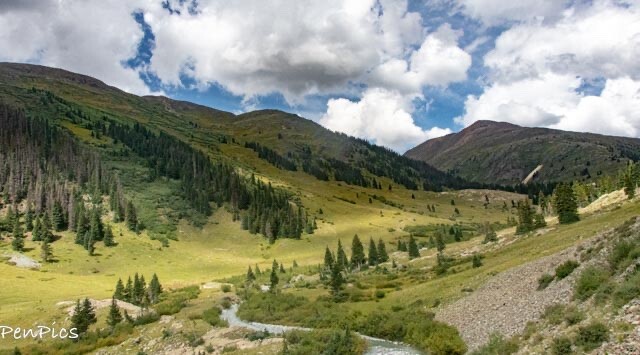
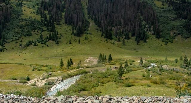
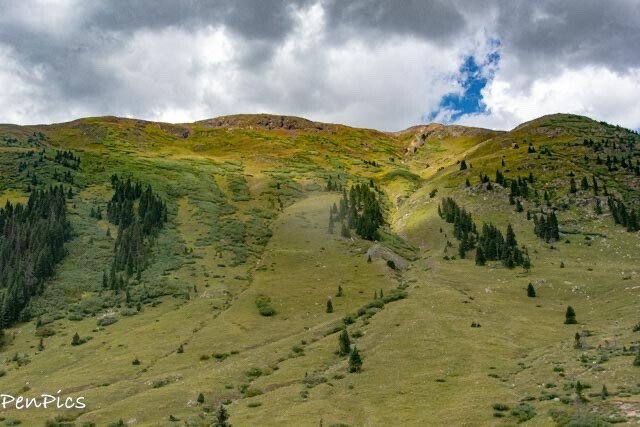
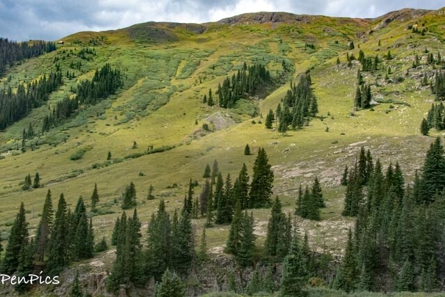
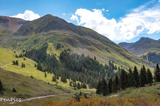
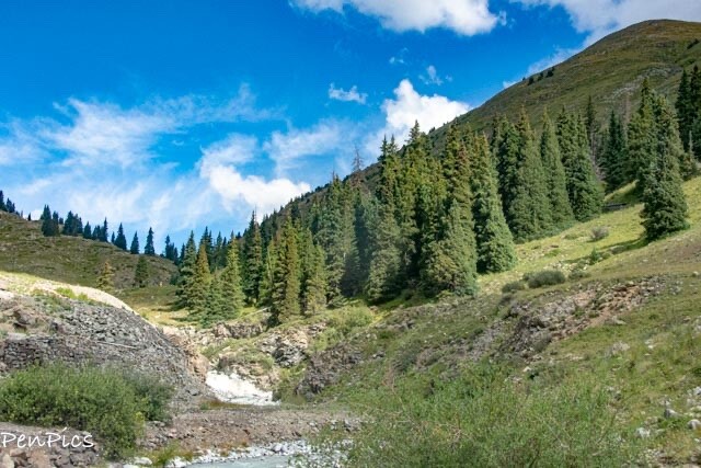
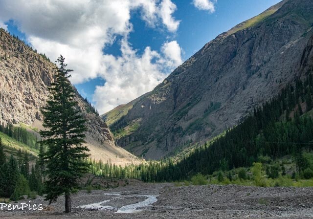
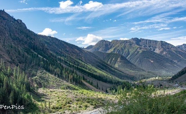
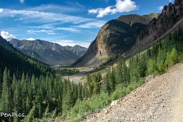
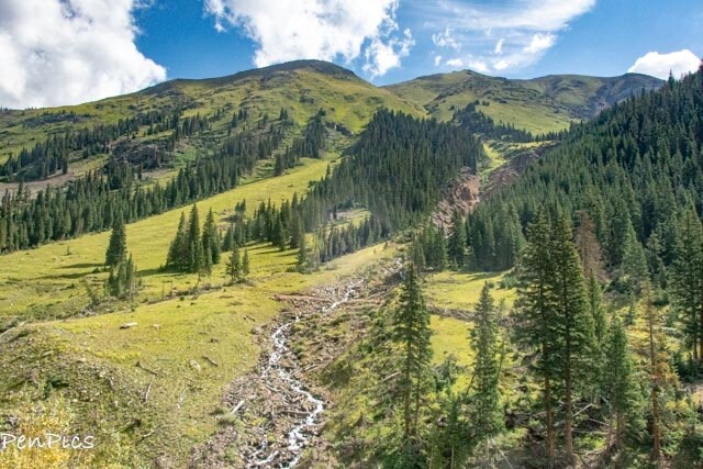
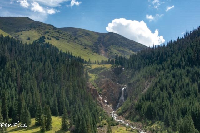
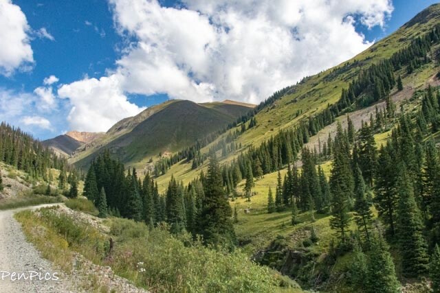
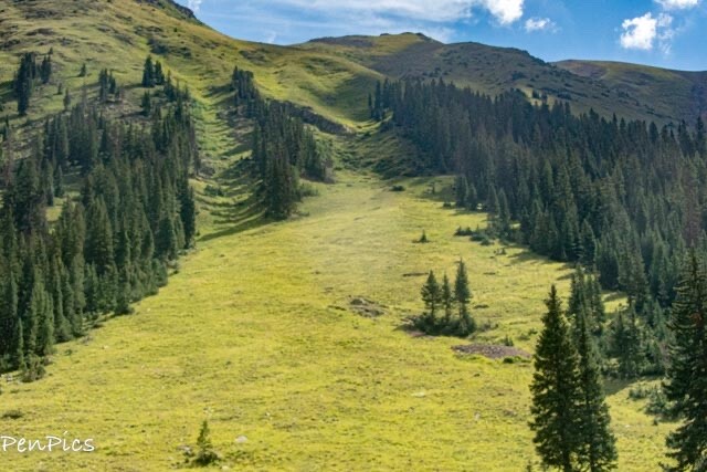
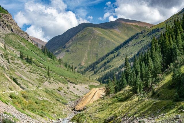
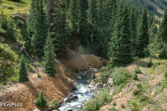
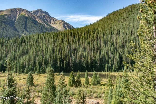
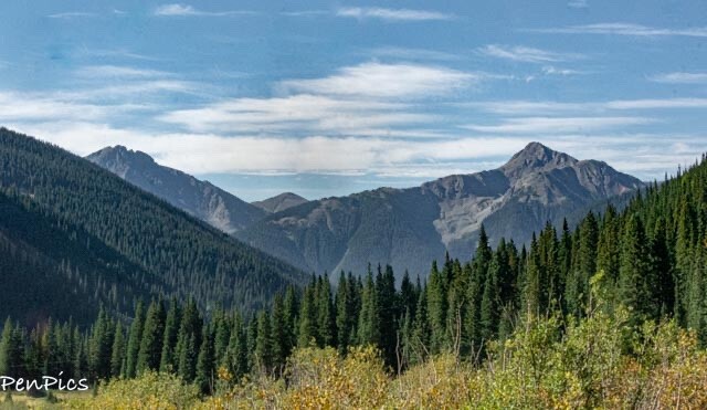
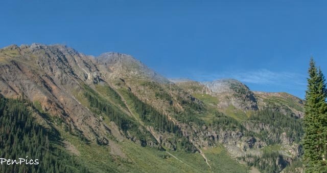
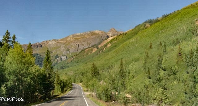
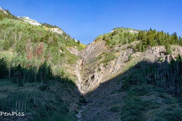
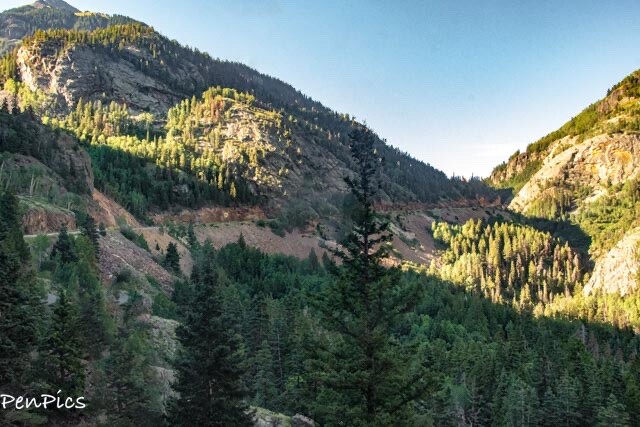
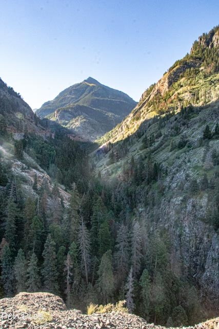
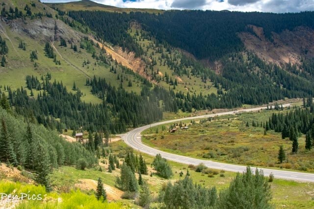
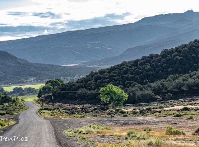
The Scenic Drive in the San Juan Mountains, to get to the Alpine Ghost Town ⬇️
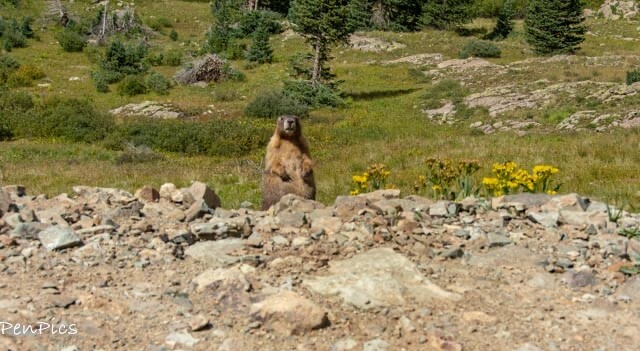
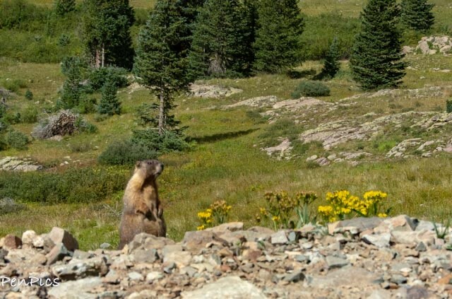
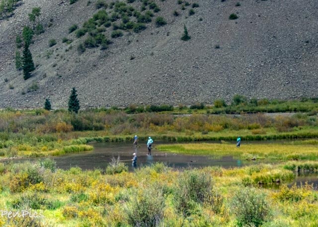
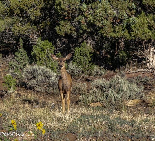
Being on hyper alert, while driving on this terrible road, our ears were listening for any sounds to indicate trouble, when…we both heard a high pitched squeaky sound. Once we figured out our vehicle was okay, we thought bird.. but what kind of bird sounds like that? Then, Daryl spied the huge groundhog… or perhaps Marmot. It was right next to the road and alerting all other Marmots to our presence! 😂
It was too cute! The critter was on Daryls side of the road, so he got the best photos of this cutie. Mine are not as clear. Regardless, this was a big highlight of the day for me.
⬇️ The pictures show clearly, why this area is called the Scenic Alpine Loop. A loop, by the way we choose not to do, only because we wanted to return on the same road we came in on; “tried and true” thinking to be on the safe side. Had we been in a 4×4, we would have done the full loop, but we did not feel the least bit cheated on the views!
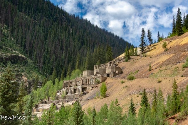
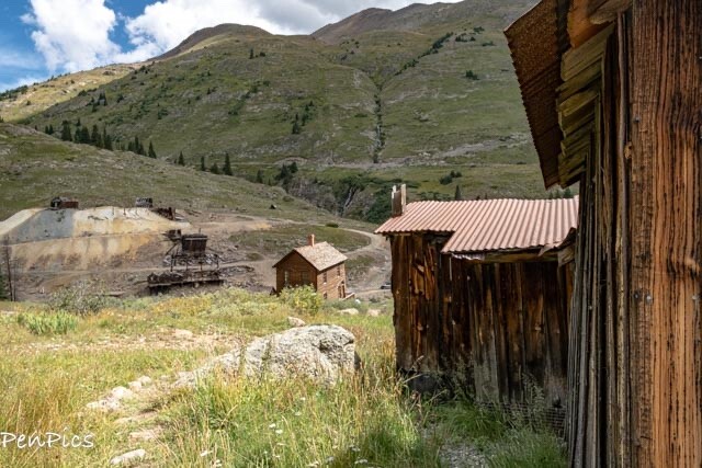
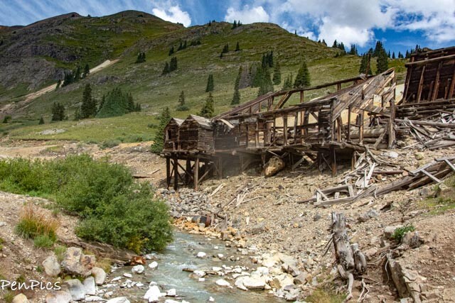
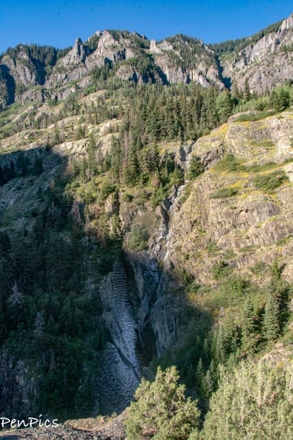
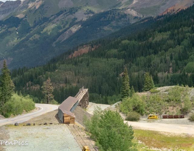
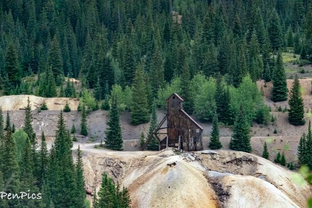
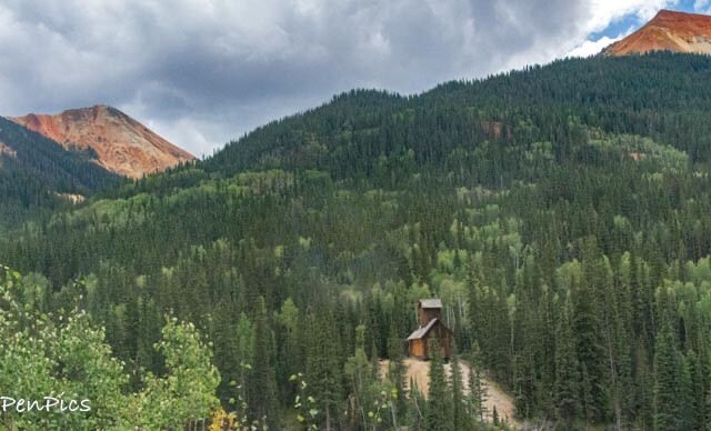
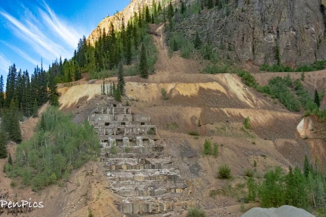 ⬆️ Along the way to Animas Ghost Town, we pass through the remains of Eureka, and the ruins of the Sunnyside Mill are hard to miss.
Back in the day, this mine was finished in 1918. Soon, the town’s permanent population grew to about 250 people and boasted several boarding houses, a barbershop, J.F. Warnock’s Mercantile, McJunkin Station that sold feed and fuel, the Eureka Hotel and restaurant, A.L. Lashbaugh Livery, a doctor named William Carter, C.F. Worden’s billiard hall, as well as several mining companies and assayers.
However, in 1920, a national recession hit, and industrial metals’ price dropped to the point that operations at the Sunnyside Mine were suspended once again. In 1922, the mine reopened, 216 men were working, and 500 tons of ore were processed per day.
During the winter of 1977-78, a fault appeared in the mine shafts under the lake and began to leak, but experts felt that the distance between the lake and mine was safe. They were wrong.
On June 4, 1978, in early evening, the lake broke through into the mine, dumping its entire contents; estimated to have been 500 million gallons of mud and water, into the mine. The violent rush of water blew out of the two-mile-long American and one-mile long Terry Tunnels. At the American Tunnel portal at Gladstone on the other side of the mountain, water flowed from the mine in 8-10 foot waves, filled with mine timbers, equipment, and debris. A 20-ton Plymouth Locomotive parked below the main ore pass was completely flattened. Fortunately, because this accident occurred on a Sunday, the mine was closed, and no one was inside, working.
Had it happened on any other day, as many as 125 men would have been killed in the violent inrush of mud and water.
The mine would never again regain its profitable status, and it was closed in January of 1985.
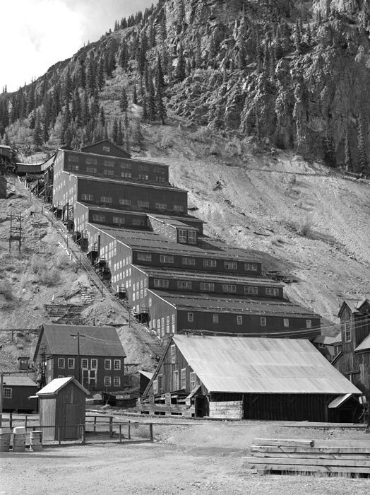 ⬆️ Historic photo of Sunnyside Mine


**********
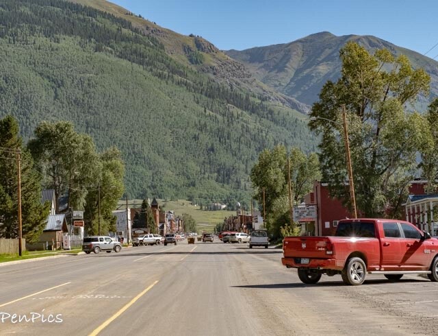
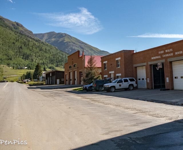
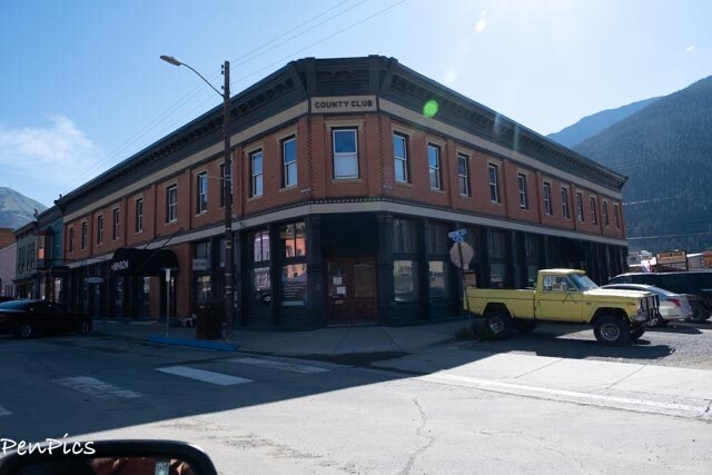
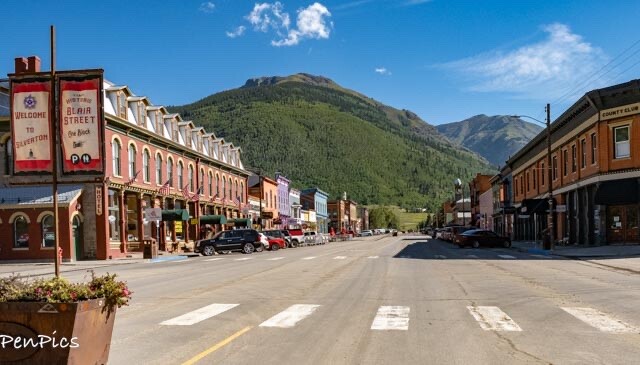
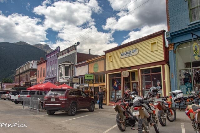
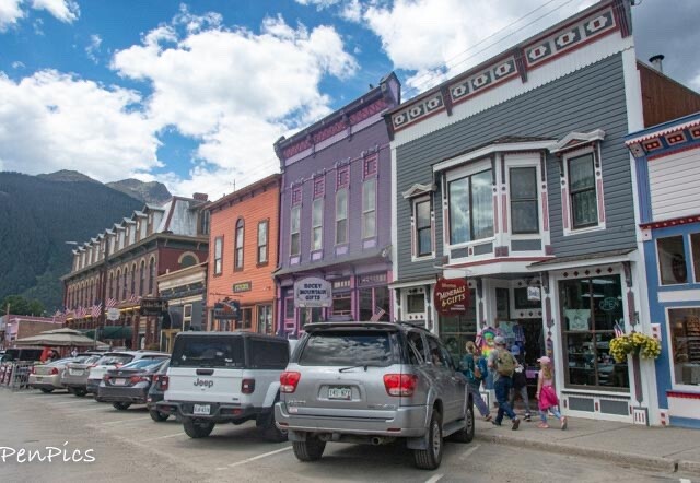
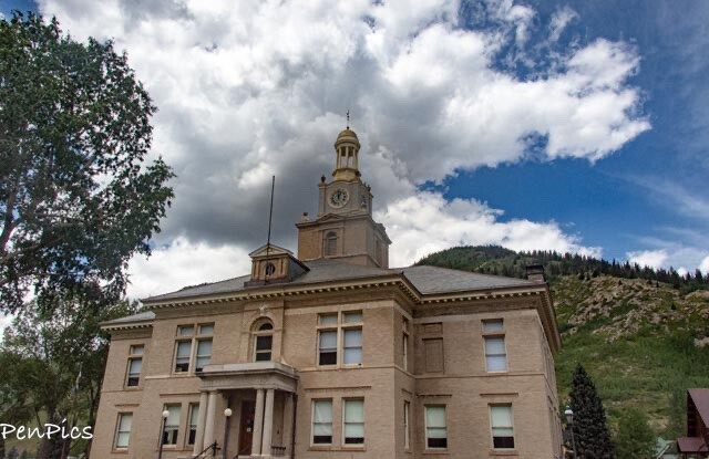
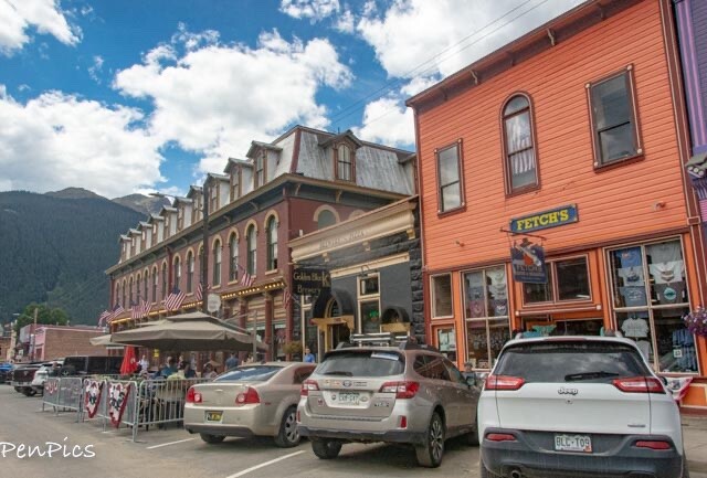
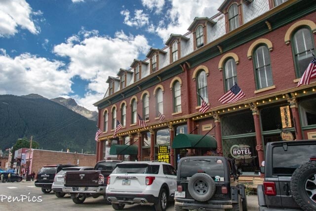
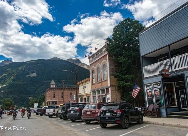
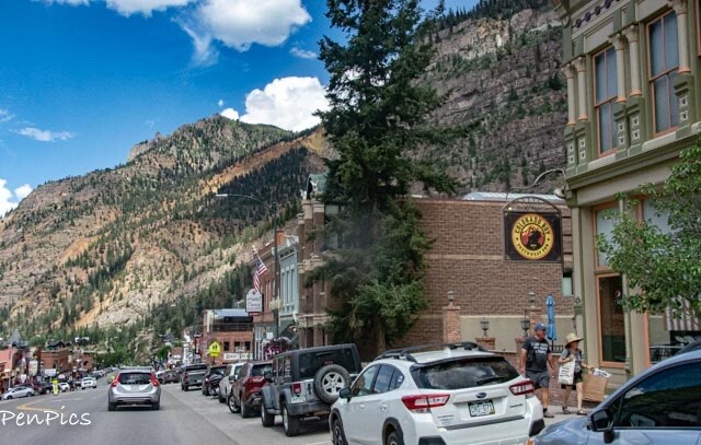
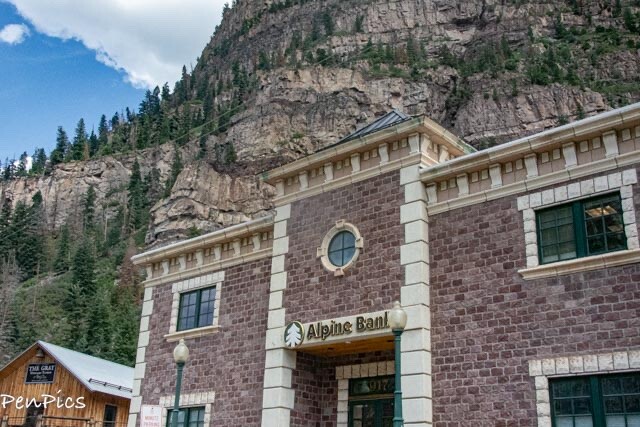
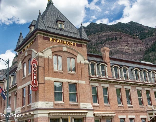
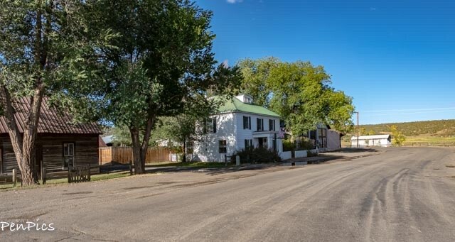
Silverton ⬇️
is also an old mining town, and still lived in with the Main Street kept alive and relevant; though no longer with a working mine.
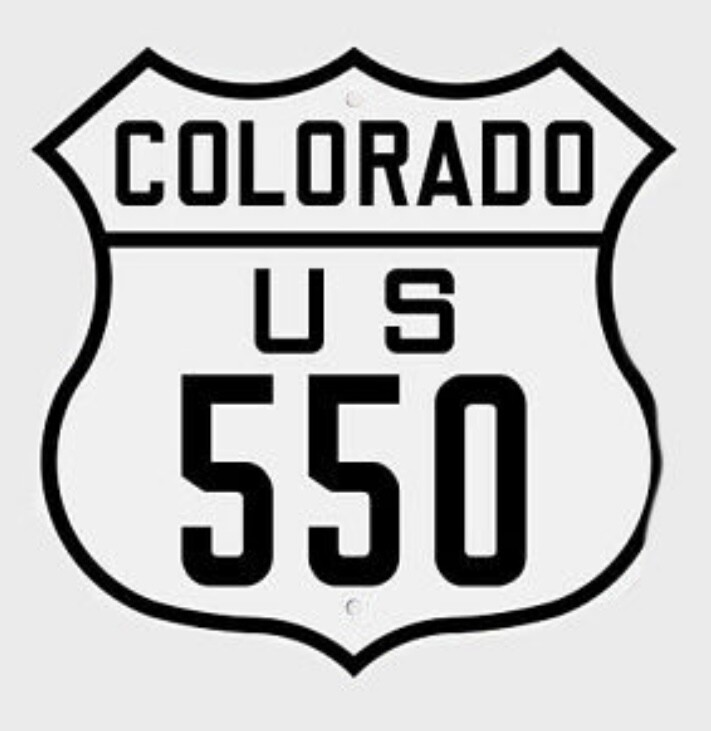
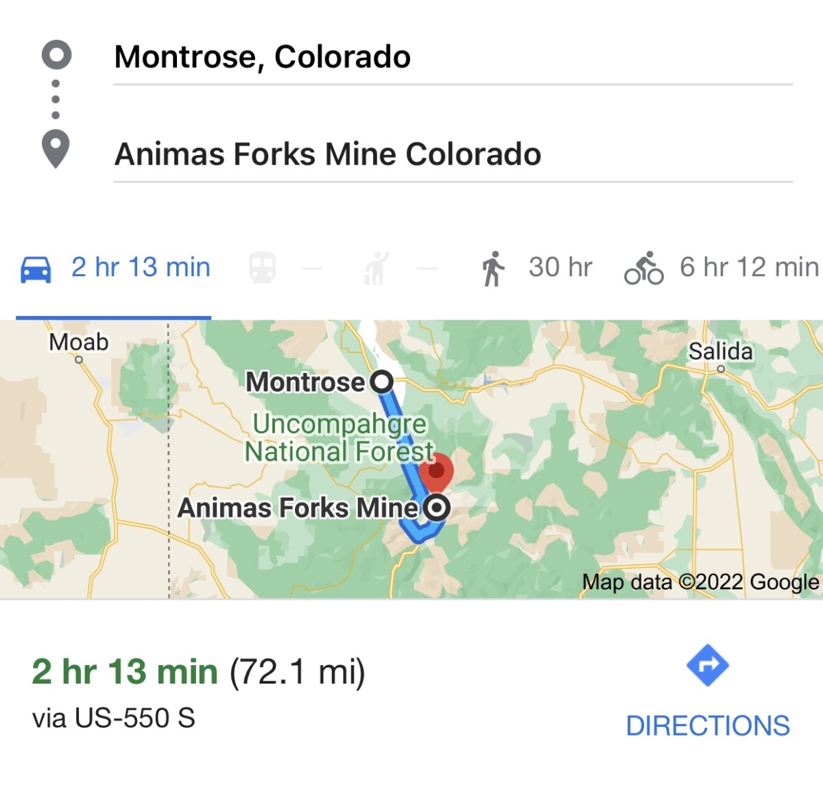
Traveling on Hwy 550, beginning just outside of Montrose, and pushing on through Ouray, the Highway has an intersection, where one can turn left to go through the Main Street and on to the dirt road, or by taking a right, US Hwy 550 continues, all the way to Durango.

**********
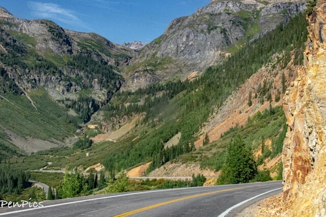
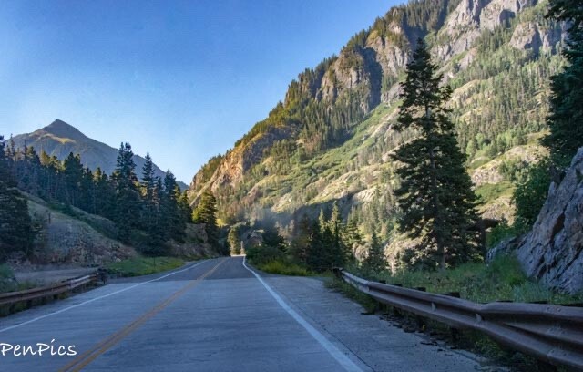
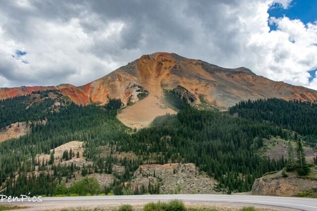
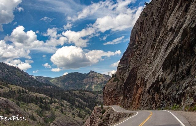
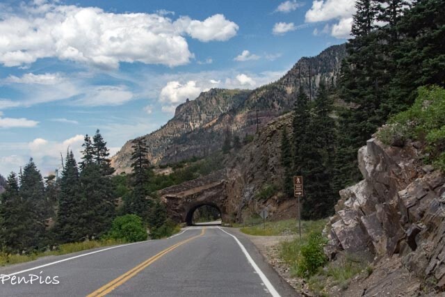
The Million Dollar Highway ⬇️
Passing through Ouray again, on our way to Silverton, we continued on Hwy 550 and on over Mountain Passes, on the section known as “The Million Dollar Highway.”
WOWZA! BEAUTIFUL!
 In the state of Colorado, in the United States of America, there is a special highway that was built in the late 1880’s: the Million Dollar Highway, part of the San Juan Skyway. You’ll be on the “outside” for a while with a hell of a view to your right. Forget standard driving safety measures like guardrails and shoulders, there aren’t any on this stretch, so swerving off the road is not advised!
From Durango, through Silverton and Ouray, to Ridgway, the drive delivers jaw-dropping vista after vista. This Highway was cut from the side of the mountain and became know as the “Million Dollar Highway,” and it stretches for about 25 miles, and follows the route of U.S 550, between Silverton and Ouray. Between Durango and Silverton the US 550 Skyway, loosely parallels the Durango and Silverton Narrow Gauge Railroad.
This majestic highway climbs up to three very high mountain passes:
Coal Pass at 10,640 feet, Molas Pass at 10,970 feet and Red Mountain Pass at 1,018 feet
……and what about winter time on this highway? ⬇️
The most perilous road in America gets 300 inches of snow a year, features 70 named avalanche paths, and remember, there are almost no guardrails!

**********
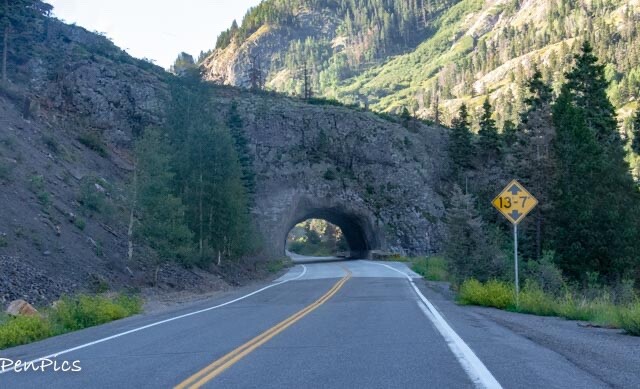
The stretch between Silverton and Ouray, the part we went on during this day, is 25 miles in length, and took us (in our vehicle), about 42 minutes.
NOTE: Large RVs travel in both directions, often, but know there is a tunnel with a clearance of 13 feet and 7 inches. Our three axle Motorhome clears, at 13’ 1”…. When we drive to our next stay in Durango, we will be driving “The Whale” this way.
 Idarado Mine opened and continued to operate until 1978. It was the site of a historic silver boom from 1882 until 1893.
The nearby towns of Silverton and Ouray, fought to become known as the “entry point” into the district, with each touting that it was the only way into the area and warning of the dangers faced by those who came from the other direction.
The two towns were almost an equal distance from the new discoveries and better transportation was badly needed to bring the rich ore out to market.
In 1880, a road began to built from Ouray across the steep “impassable” cliffs to Red Mountain Pass by the Ouray and San Juan Wagon Road Company. Though progress was made in the first two years, the company was running out of money by 1882. After several attempts to reorganize, and refinance, Otto Mears offered to purchase a 54% interest in the toll road company. After putting a larger and more experienced construction crew to work, Mears completed the road in 1883. This road would eventually become known as the famous Million Dollar Highway.
 ⬆️ Ouray Toll Road, pre-1883 by Detroit Photographic Co., the road before The Million Dollar Highway was built

 ⬆️ Yankee Girl Gold Mine
After the mining district’s heyday with Silver, there was some gold discovered at the Joker and Meldrum tunnels, but the ore lost value the deeper the miners went and these ventures also eventually closed.
Mining revived during the first and second world wars, and in the 1930’s the Idarado Mine opened and it continued to operate until 1978.
It is estimated that upwards of 30 million dollars in silver, lead, zinc, copper, and gold were taken from the Red Mountain Mining District in a few short decades. At today’s prices that production would be well over a quarter of a billion dollars, today.
 ⬆️ Looking down over Idarado Mine, we passed by, earlier
 Ironton is a ghost town in the process of restoration in the Red Mountain Mining district

Over the years, many of the structures of the mining district fell into disrepair or were salvaged.
In 1998, the Red Mountain Project was launched in an effort to preserve threatened historic landscapes and structures along the San Juan Skyway and in and around Red Mountain Pass. After years of effort, the Red Mountain Task Force partnered with several organizations and private citizens to purchase over 8500 acres of historic landscapes. The project protects and stabilizes the district, installed interpretive signs, and constructed miles of hiking trails to provide public access to this once endangered site.
Little remains of the towns that once prospered in the district but, about 50 structures still stand in the area. The outline of the railroad grade is only faintly visible. Some of the district is privately owned and not open to the public, partly due to dangerous structures and open shafts, and also due to ongoing environmental clean-up.
**********
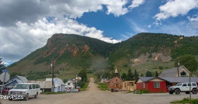
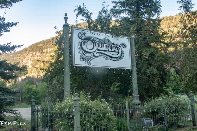
Ouray ⬇️
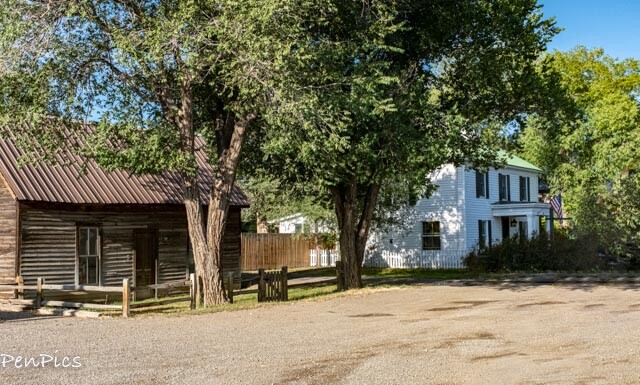
 Heading back to home base, by early afternoon as the clouds moved in on us, with pending storms, (which has been the norm for our Colorado summer stay), we came back through Ouray, and as we got closer to Montrose, we stopped at an easy access, Living Ghost Town called Colona, right off of Hwy 550.
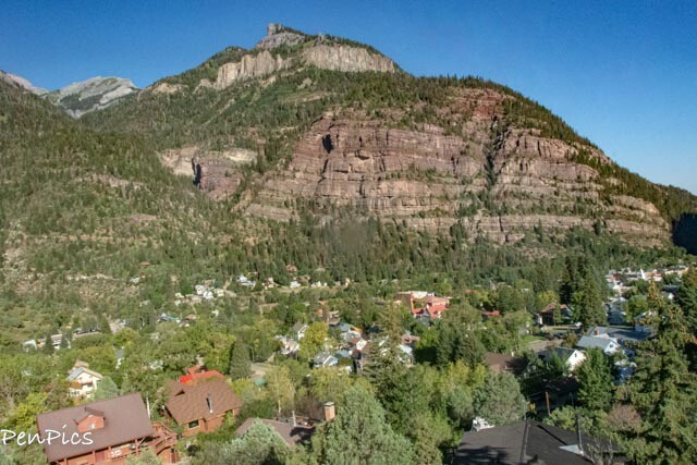
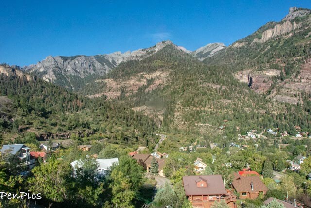
⬆️ Coming down off the Million Dollar Highway, overlooking Ouray
************
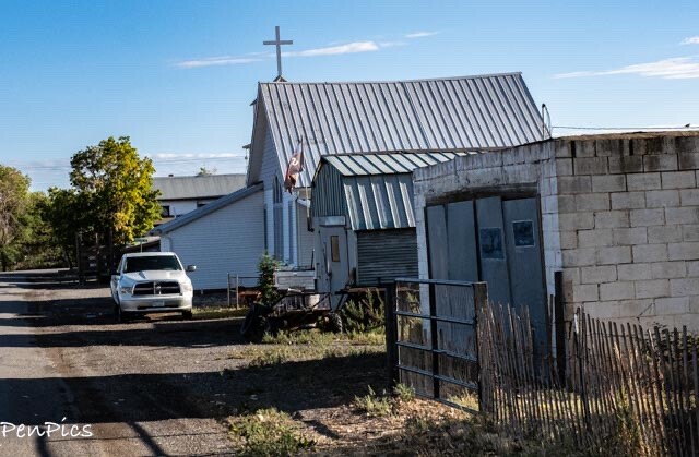
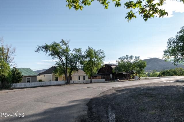
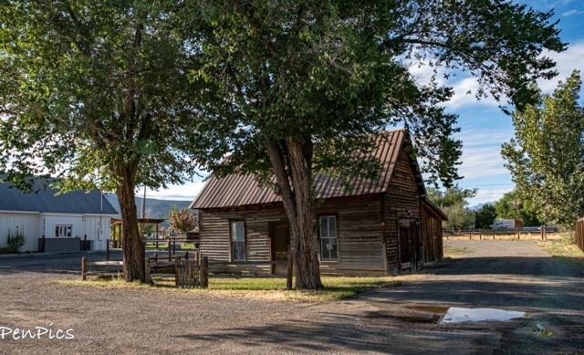
Colona ⬇️

Colona; Population 23 is ten minutes south of Montrose with its amenities such as shopping, a hospital and a commercial airport, serving the entire region.
At an elevation of 6340 feet, temperatures are typically several degrees cooler than Montrose, at elevation of 5900 feet, about 5-7 degrees warmer than Ouray, at 7792 feet, and Telluride, at about 8750 feet.
The surrounding area was settled and homesteaded in the 1880’s. Colona was established after the The Los Pinos Agency was set up near the junction of the Navajo Trail (County Road 1) and the Uncompahgre Valley Trail (Highway 550).
This is a country setting, surrounded by farms, ridges, mountains and the Uncompahgre River.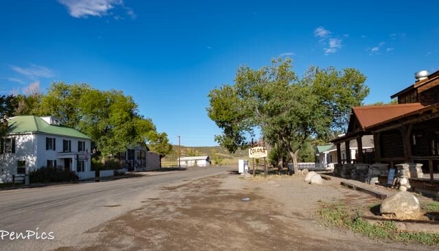
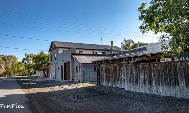
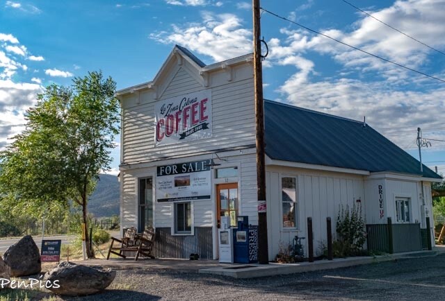
So cute! I’m thinkin if all 23 people in this town would have drank more coffee this place could have made it!

About Us

About Us
Hello and Welcome to our Travel Blog Website, We enjoy writing about our experiences and taking photos of our adventuring along the way. Our names are: Daryl and Pen, but Daryl calls me “Bunny.” We met, quite randomly, whilst both traveling in Thailand with friends. We happened to be in the same travel group, and […]
WOW!!! JUST WOW! The views are breathtaking. Your photography is amazing! And your accounts of the history of these high elevation towns is a walk back in time. Im so intrigued with ghost towns.
Thank you, Lynne! We so enjoy western history as well! Ghost Towns are awesome!