


“Utah USA 🇺🇸 and Arizona USA 🇺🇸 ~Second Stop of Five In Page, Arizona: Lake Powell’s Antelope Point, then to Horseshoe Bend, Monument Valley, and Navaho National Monument”

I had to re-create this blog post, since the original has disappeared (somehow). This has never happened, before… so weird.
We spent the month of June; 2022 traveling the Utah Grand Circle, visiting all the National Parks and Monuments on and near this loop. It was amazing!
We deviated from the loop, some, to include Arizona, to see other worthy sites, too.
Re-creation
Second Stop of Five:
Page, Arizona for Three Monument Visits ✅

Note: As you can see from the blue “X” this is approximately where Page, Arizona is, so it was easy to include, Arizona and get back to Utah.
We arrived in Page, Arizona from Kanab, Utah. We based ourselves out of this one campground at Antelope Point RV, next to Lake Powell, and spent two days driving long distances in the tow vehicle, to see everything we wanted to see, before going back to Utah.

Antelope Point RV


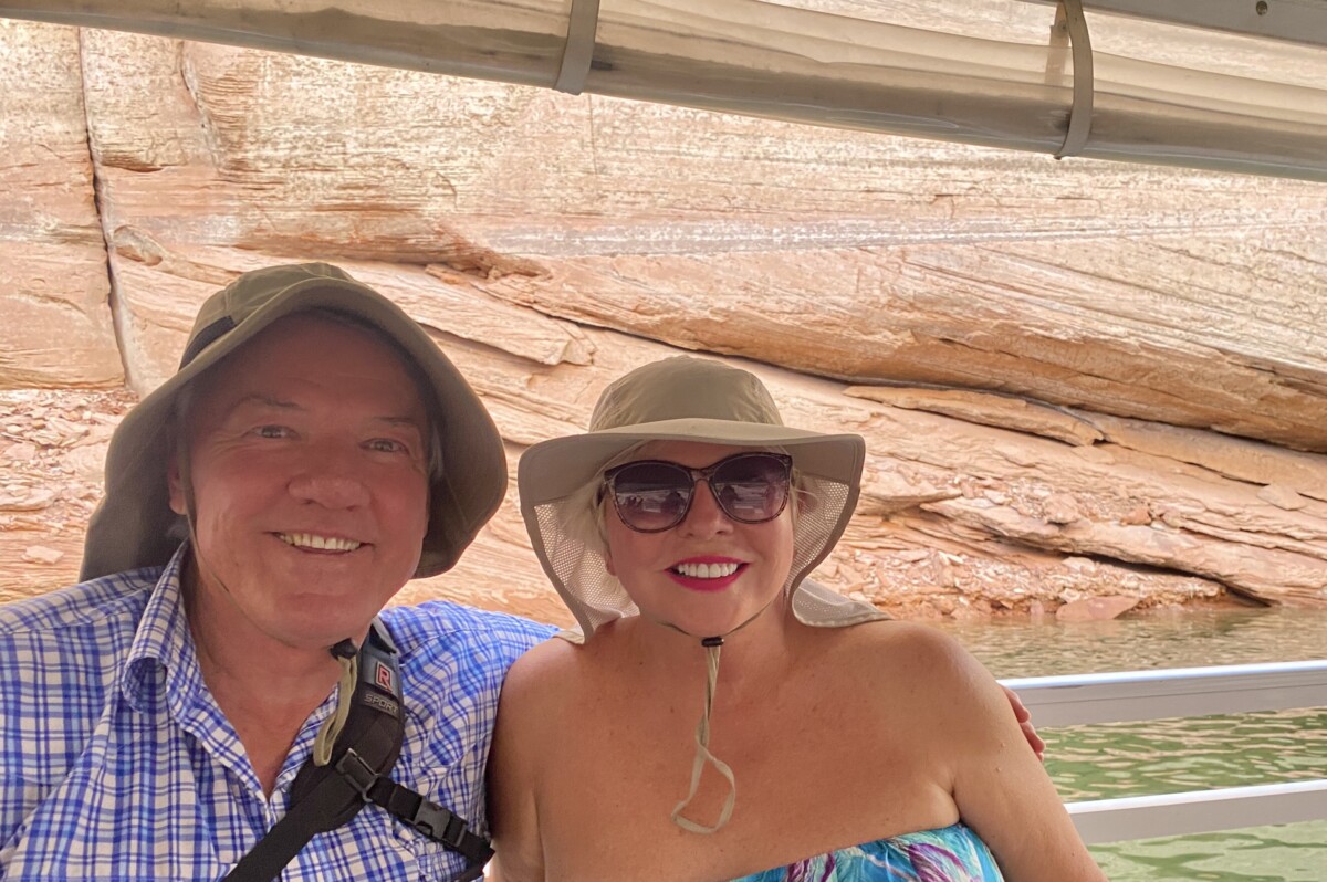
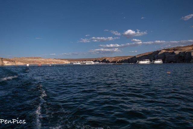
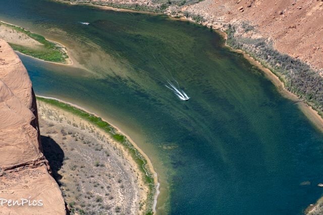
Lake Powell Boat Ride

From our campsite, we walked down to the marina and got on golf carts to be driven to the marina with the boat tour. The water was extremely low and all around was in drought conditions. This is a very sad thing for tourism.
Once we got out of the marina and low water, we enjoyed the boating through the peaceful canyon around sunset.


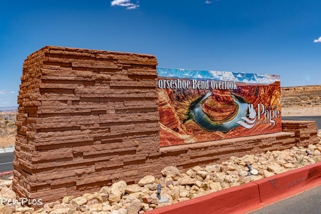
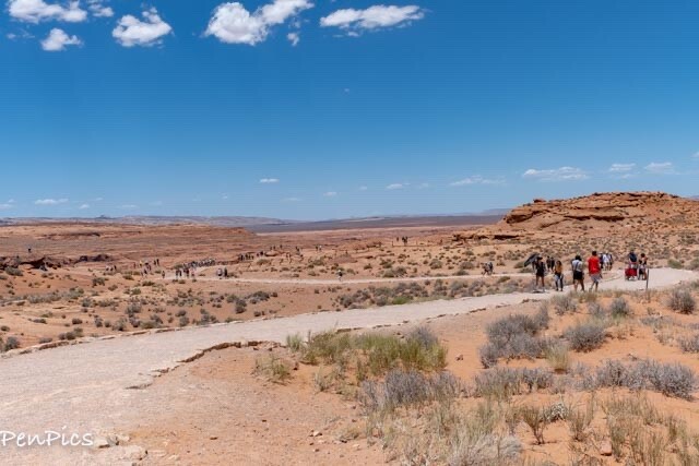
The next day, we made our way to a very cool scenic overlook. This place is not to be missed! I had only seen pictures of this place and I looked forward to going, one day!

Horseshoe Bend Overlook
Formation


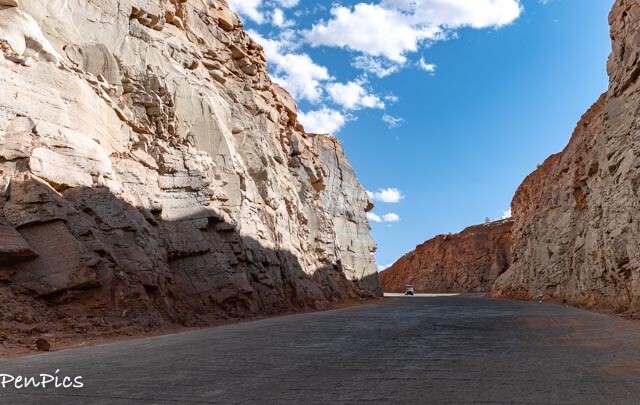
The next day, we got up very early to visit two more monuments. It required a lot of driving.

Navajo National Monument

This was a long drive day, but on the way to our main point of interest; visiting Monuments Valley. It was a nice break, but we felt pressed for time, and didn’t stay as long as what we would have otherwise done. The hike to see the monument would have taken way too long, and even the overlook which can be done without a guide, was an hike. Had we done more, we would not have gotten to Monument Valley.
The good news is, I had seen many Cliff Dwellings, and Daryl would eventually see them, too, just not here.


The Navaho Nation covers more than 27,000 square miles of desert landscape around the Four Corners region, Navajo Nation has many treasures to explore. We have now been to all the monuments within this Nation, by stopping at this site, so we would not have missed it.
At Navajo National Monument in the far northern reaches of Arizona, ancient homes were notched into the sides of cliffs. The dwellings here date back to 1300, when many Ancestral Puebloan people dispersed to different areas of the region. Navajo, Hopi, Paiute and Zuni once lived in this area and likely in these structures before moving onto more permanent villages. These pueblos are remarkably well-preserved, along with the stories of nomadic hunter-gatherers who lived in this region for centuries.
Explore the Dwellings
These remote ties to the past are difficult to get to, but worth the effort. The monument protects the remains of three massive pueblos. Visitors can walk along a short self-guided trail from the visitor center to reach a viewpoint of the Betatakin ruins in the distance.
To get up close, join group tours, led by park rangers that require a strenuous 3- or 5-mile hike to the cliff dwelling.
The other big draw, Keet Seel, requires a backcountry permit to take a 17-mile roundtrip hike across streams and up steep switchbacks to reach the site. A third site, Inscription House, has been closed to visitors due to its remote location and fragility.
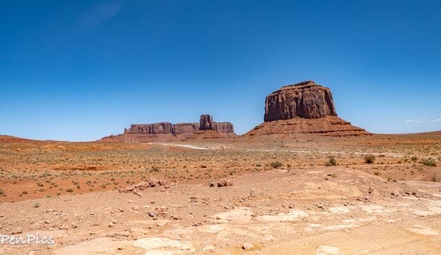
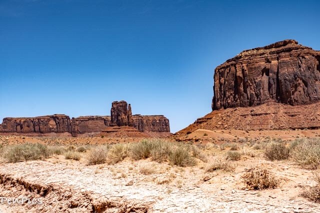
We drove the rest of the way to Monument Valley and the long drive day was super worth it! This place is a bit off-the-beaten-path, but it’s a really remarkable place!

Monument Valley

Navajo Name: Tse’Bii’Ndzisgaii – Monument Valley
First up, we drove the 17-mile loop drive, for a view of the scenic beauty and magnificent formations. It was not monsoon season, so we had no concerns of flash flooding.
BTW, Motorcycles/RV’s are Prohibited on the loop drive, due to the rough terrain and deep sand dunes.
Though we visited during peak season, there were no crowds, so we enjoyed that. We were instructed to please be cognizant of our surroundings and please obey all signs, stay on designated routes; stay hydrated and stay safe. Also, wear appropriate attire as the weather is unpredictable and can change at any time. Wearing a hat, t-shirt, long sleeves and tennis shoes will keep you comfortable and avoid the elements. …I wore my flip flops, and sun dress, but we stayed hydrated and wore hats.
The Navajo Nation’s Monument Valley Navajo Tribal Park is one of the most majestic, and most photographed points on earth. This great valley boasts sandstone masterpieces that tower at heights of 400 to 1,000 feet, framed by scenic clouds casting shadows that graciously roam the desert floor. The angle of the sun accents these graceful formations, providing scenery that is simply spellbinding.
The landscape overwhelms, not just by its beauty but also by its size. The fragile pinnacles of rock are surrounded by miles of mesas and buttes, shrubs and trees, and windblown sand, all comprising the magnificent colors of the valley. All of this harmoniously combines to make this visit, very memorable!


We made our way back to The Whale and got rested up.

We would move the next day, to get all the way up north, back into Green River, Utah and back on the loop.


For Part Three of this Five Part Blog Series, here is the link:
About Us

About Us
Hello and Welcome to our Travel Blog Website, We enjoy writing about our experiences and taking photos of our adventuring along the way. Our names are: Daryl and Pen, but Daryl calls me “Bunny.” We met, quite randomly, whilst both traveling in Thailand with friends. We happened to be in the same travel group, and […]