


“Montenegro 🇲🇪 ~Scenic Canyon Loop on Panoramic Roads D1, 1, and 1E”
It would be a seven hour drive on this day, to only go a short ways from our starting point this morning. It was not the plan, but we were in complete awe, throughout our day spent; in the record holding, deepest Canyon of Europe!
When we started out, our intention was to make our way to the cliff side Monastery, (the one we’ve wanted to get to for three days, so far) but by way of one of the renowned Panoramic Roads.
What we could not see on the maps was, it being a gigantic loop, so when we exited one Panoramic Road (1) and entered (D1) we were suspicious of the fact, (by midday) we may be driving right by the hotel we left this morning; six hours later! Sure enough, things started looking familiar, right down to the raspberry stand we bought from, not far from our recent hotel in Mojkovac; at our starting point, so many hours earlier.
Panoramic Road 1 is the roadway we hit up after we came over the border to get to central Montenegro. Yes, they are longer routes, but they also live up to their namesake! We had a great laugh over the whole thing, because I couldn’t figure out how we could start out and be three hours to our destination, yet, every time I checked the maps it would say we were further from the cliff side Monastery, not closer.
The scenic drive was spectacular, so it mattered little that we didn’t make our planned destination, and even if we truly understood (D1) was just a loop, from (1), which would lead us to (E1), we would have done it, anyway.
Incidentally, there are a total of four designated Panoramic Roads in Montenegro. The only one we have not traveled on is (4). Perhaps we will end up in it at one point. Ha!
Moving on, we had a wonderful day, and one of our road trip rules of keeping the vehicle full of fuel. (fill at half tank) really paid off off, today. We were ill prepared for this enormous loop we traversed, because an electronic map only gives timeframes, not the number of mountains we would scale, not to mention the many side roads we took to see some extra sites. We still had a third of a tank, when we came back off the canyon loops, but when in foreign lands, we just like to be careful.
By the end of our day, with both of us driving, we were completely (happily) exhausted, we ended up in a city called Podgorica, and found a hotel with a restaurant. The rest of our evening I figured out what to do with the 100 plus photos I took 😳.
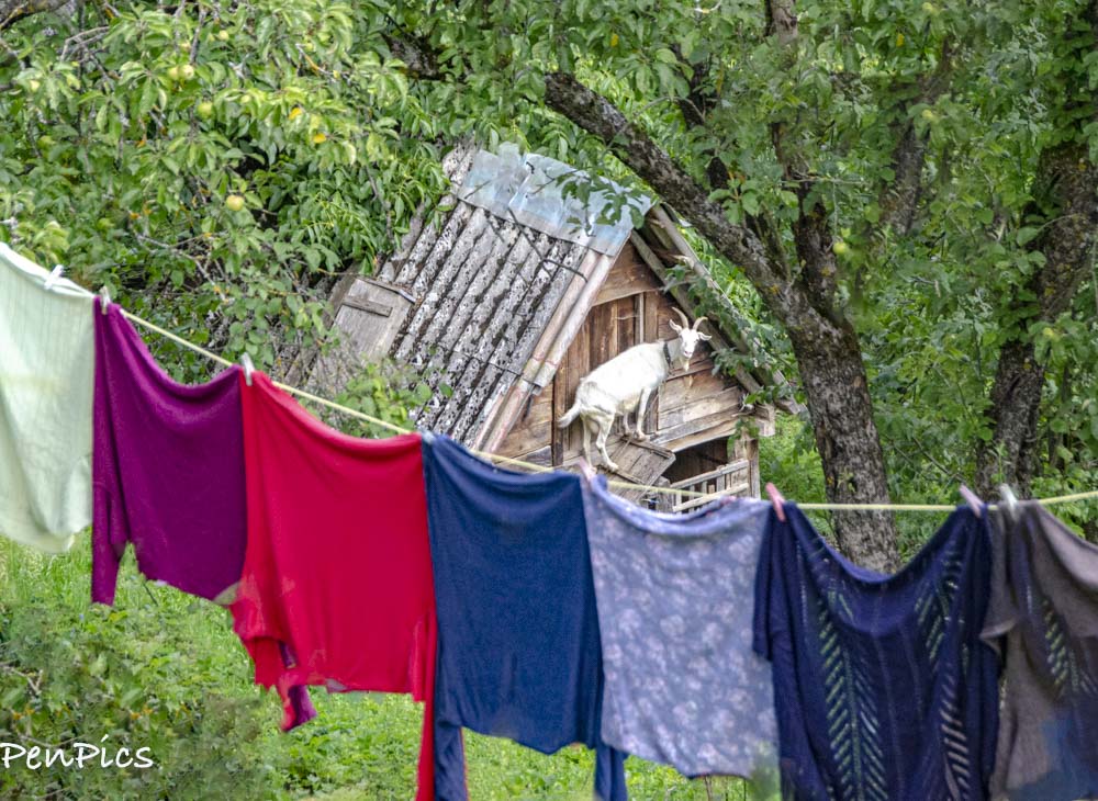
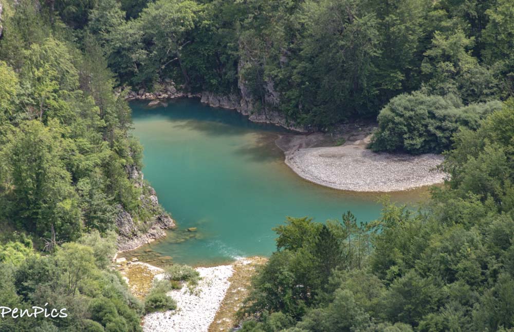
Im still laughing about this site. I had gotten out of the car in hopes of taking photo of a scenic view, but this was below, where I was standing.
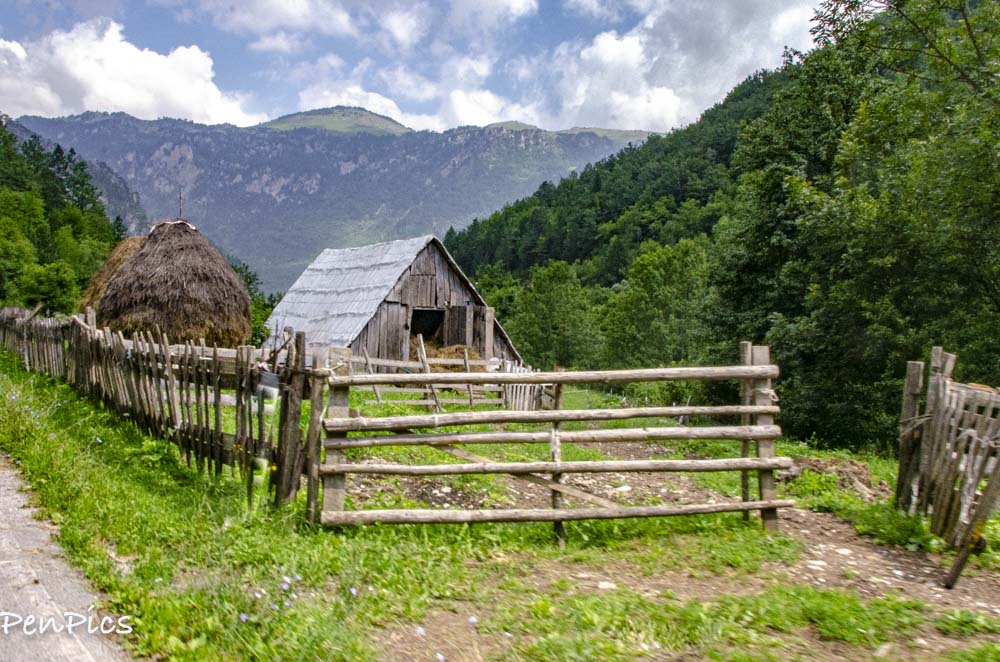
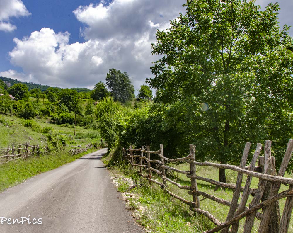
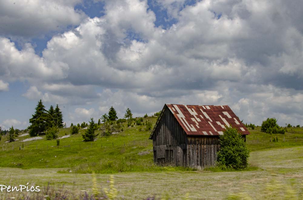
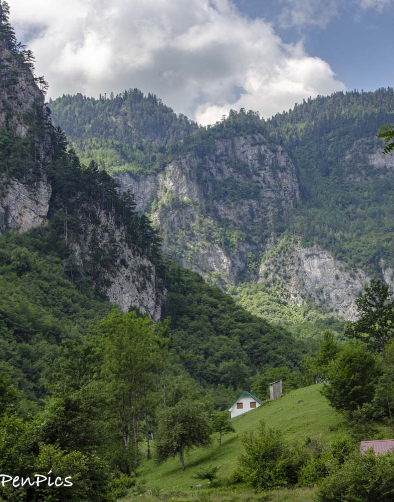
The old farms and lands go on and on. Such an interesting way of life, here in the Alps
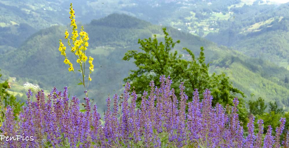
We noticed the sides of the roads are not cut back, and this could be for many reasons, but since there are so many bee-keepers in this region, which produce wonderful honey, the wildflowers are allowed to thrive, making the bees and photographers happy
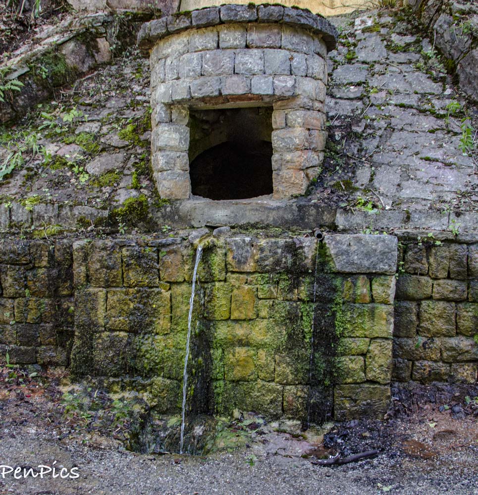
Another rule road tripping fir us is to have planty of water in the vehicle. In the case of being in the Alps, there are always roadside natural springs, we could always drink in a pinch. The locals say we can drink this spring water, but we only get some collected to make our coffee with, because it is really great tasting water. It’s probably safe to drink, directly, but we don’t have time to deal with any affects, if the water would not agree with us.

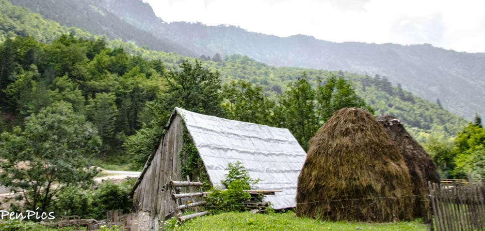
Traditional-style roofs in rural Montenegro
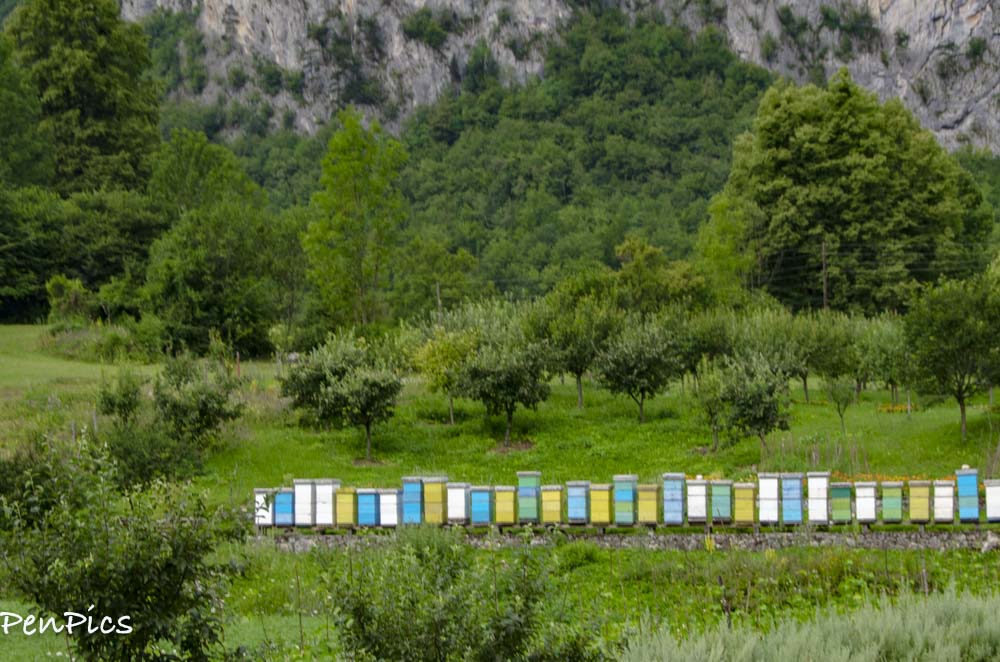
Bee Hives
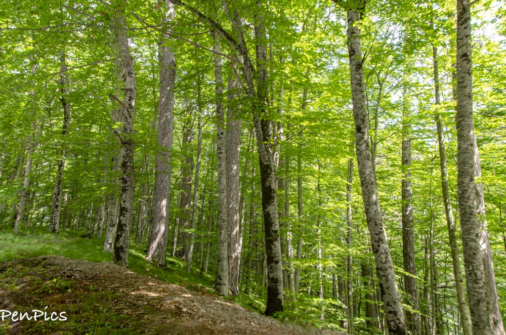
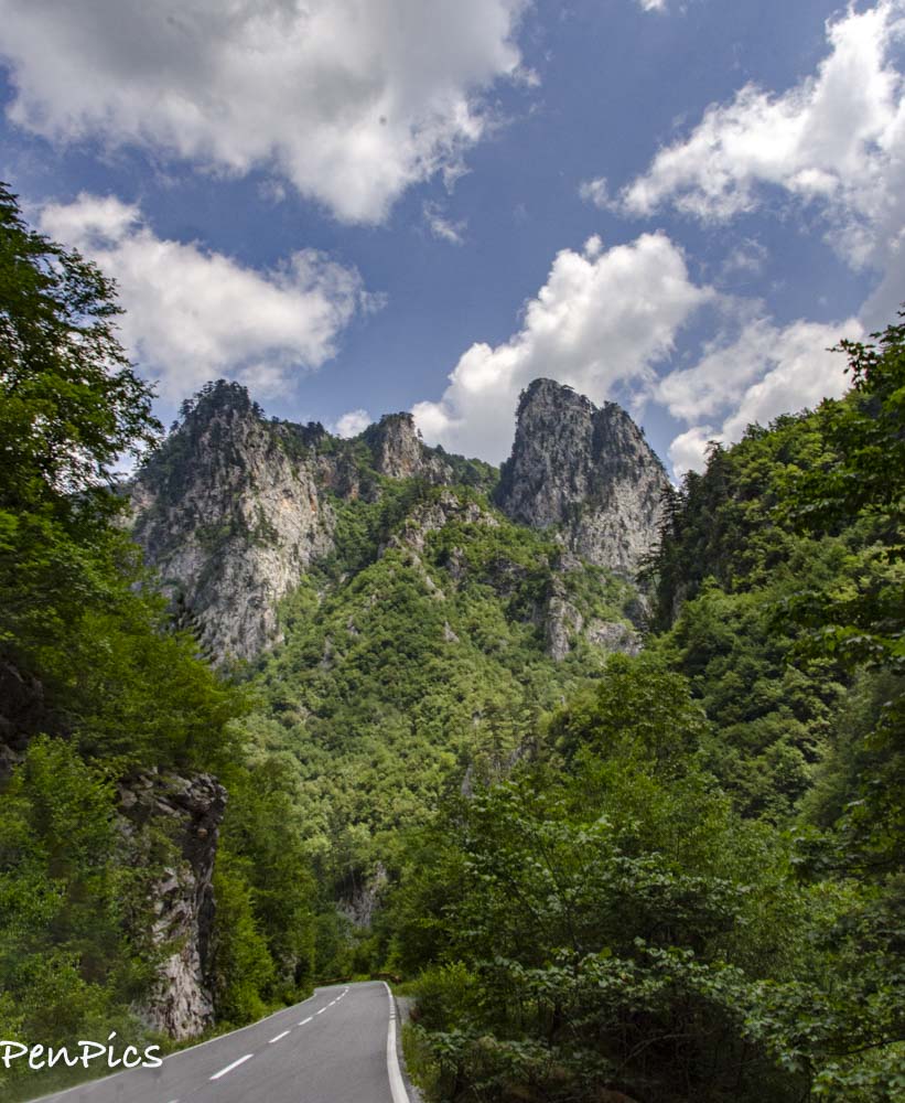
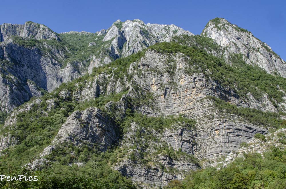
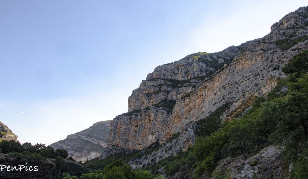
Ancient forests are stunning, throughout the canyon loop
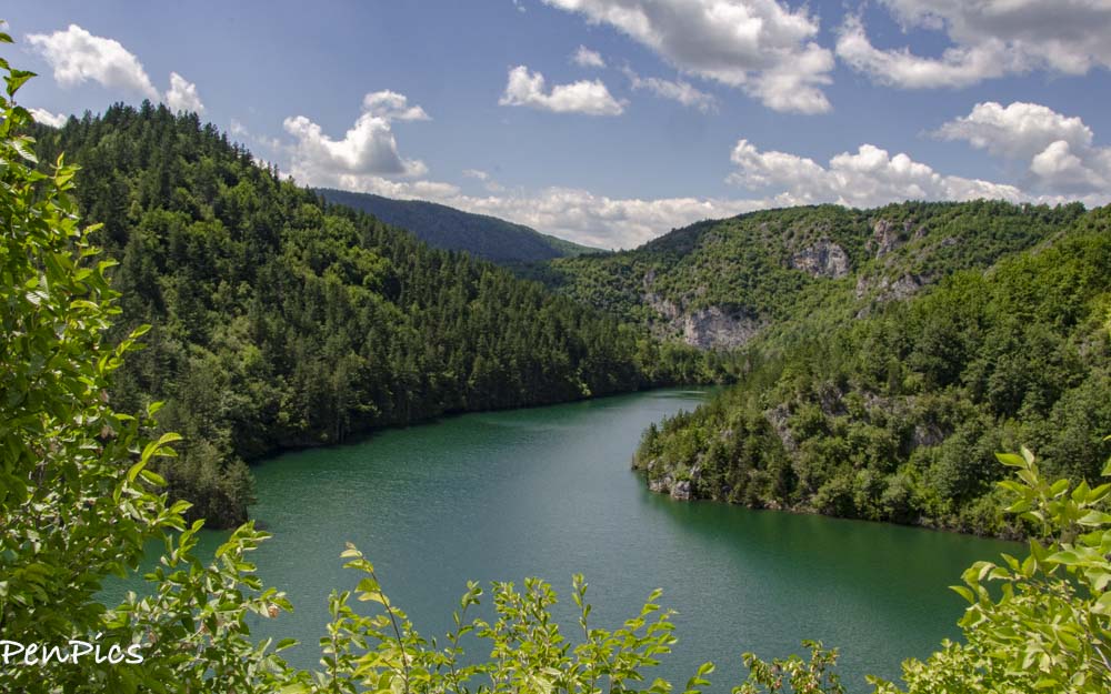
Durmitor National Park
Formed by glaciers, the UNESCO World Heritage site of Durmitor National Park owes much of its beauty to the glimmering glacial lakes that nestle at the foot of craggy mountains. The most well-known is Crno Lake (Black Lake); surrounded by deep pine forest,
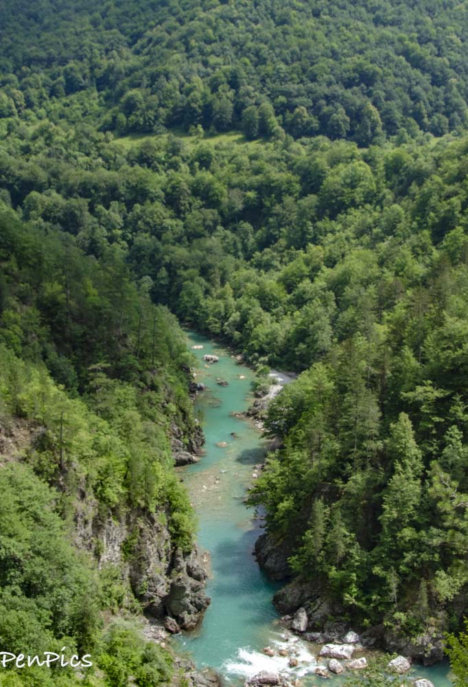
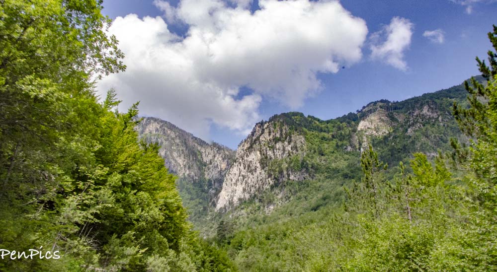
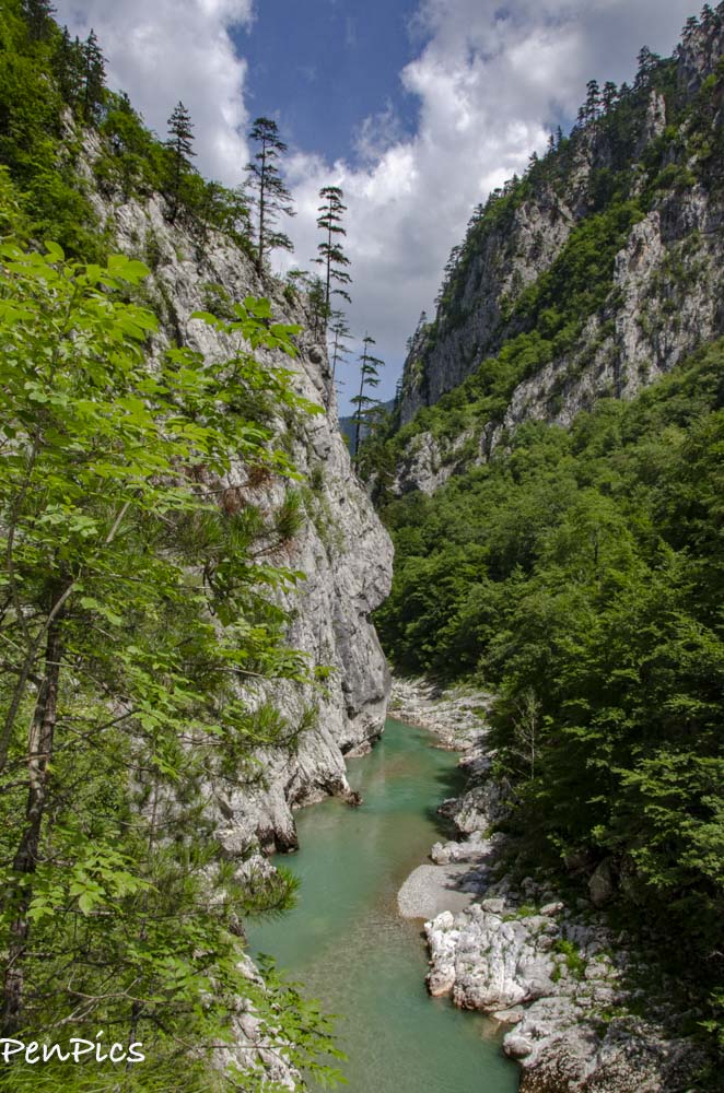
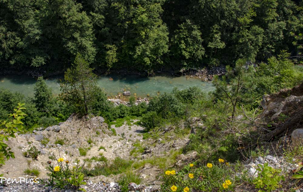
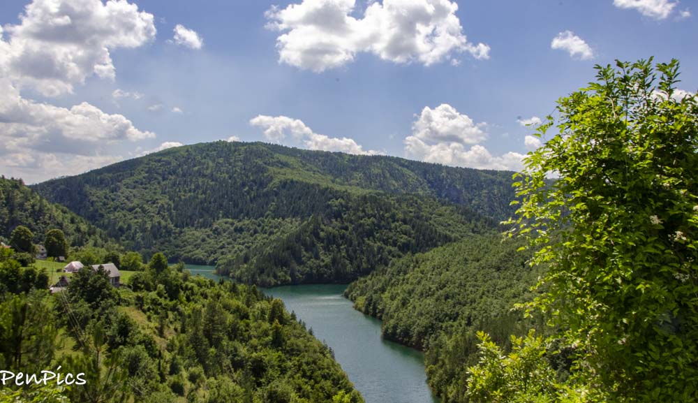
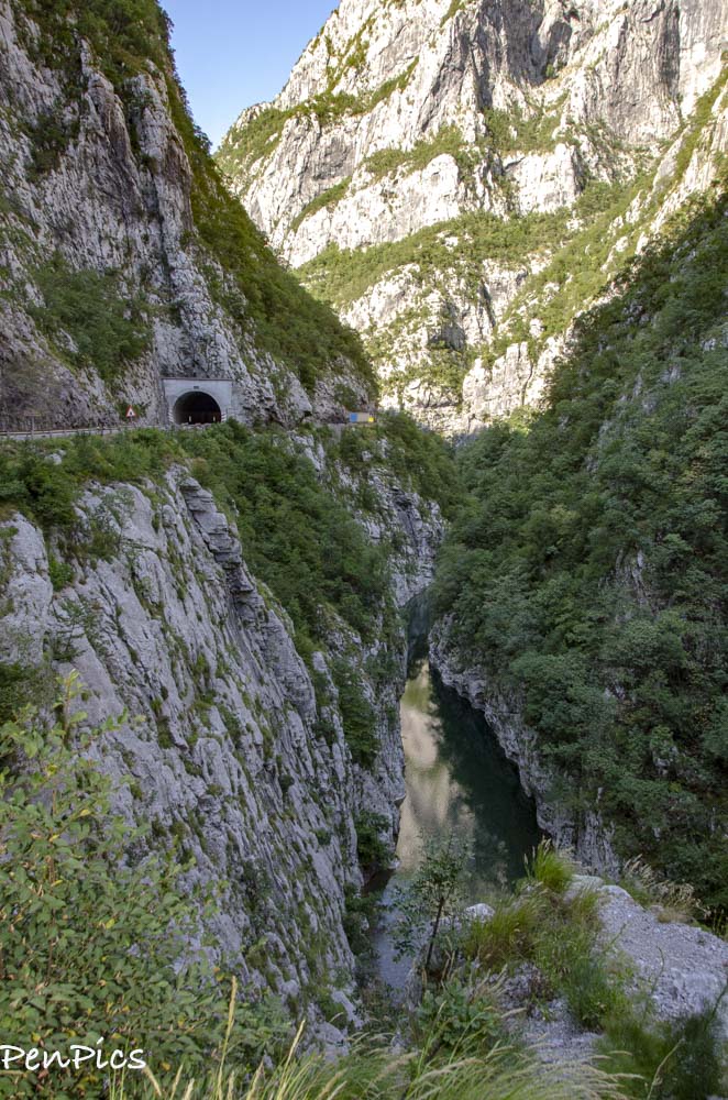
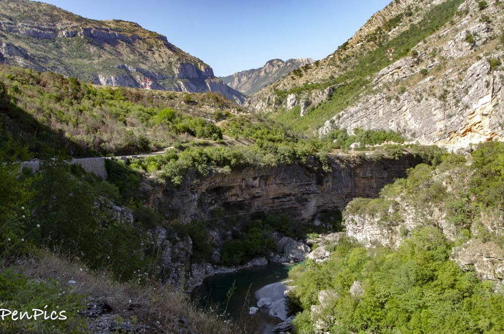
Second only to the Grand Canyon in terms of how deep it is, here we have Tara River Canyon
The dense “Black Forest,” harbour 400-year-old European Black Pines which can reach a height of over 154 feet
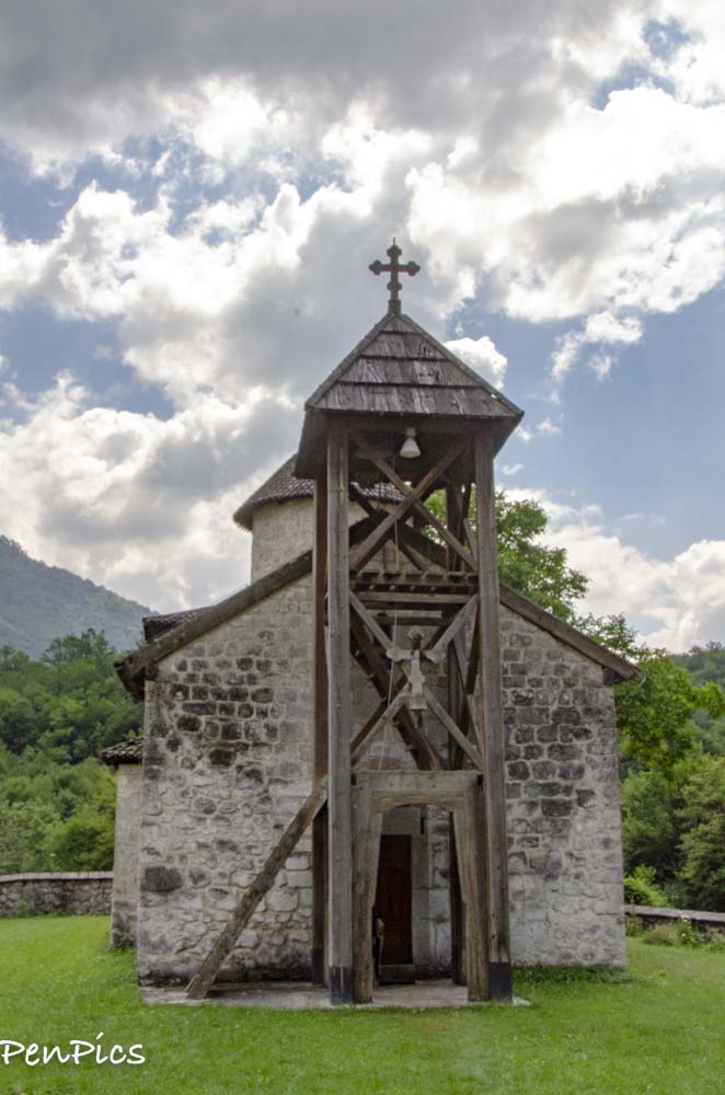
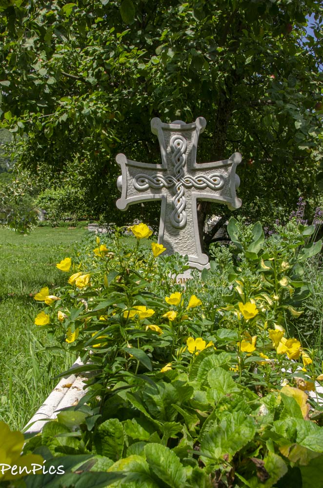
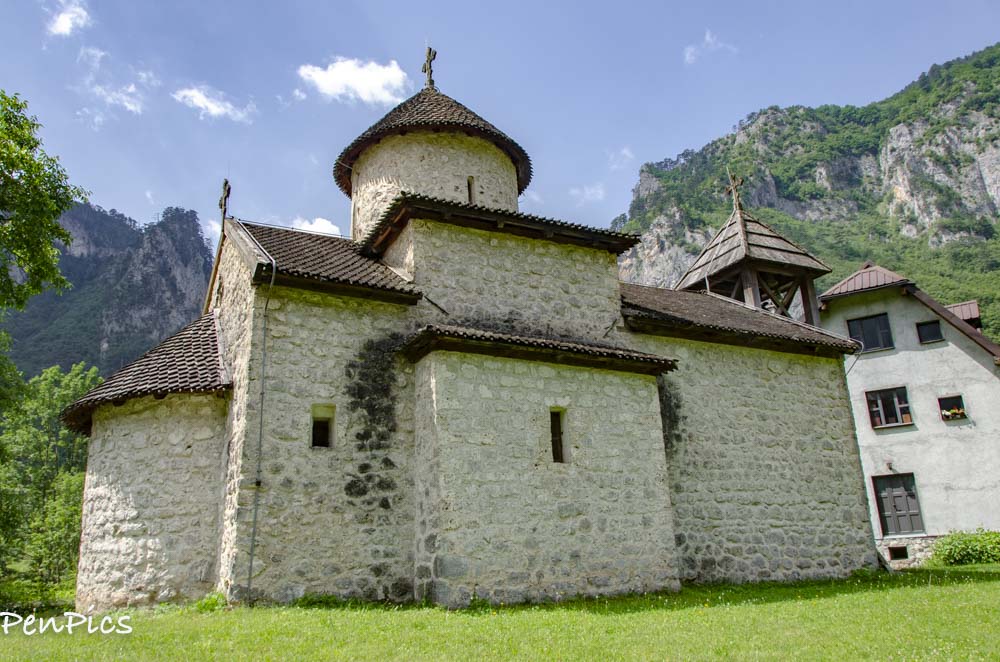
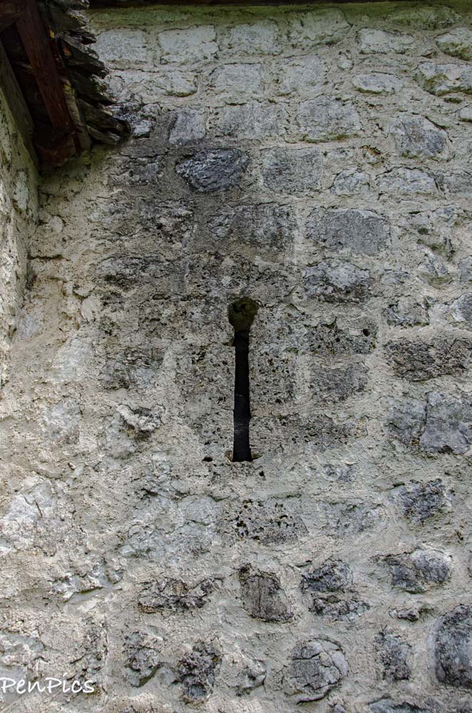
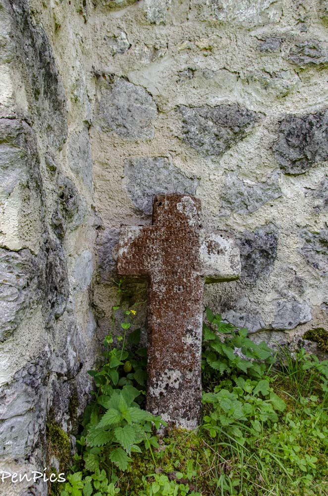
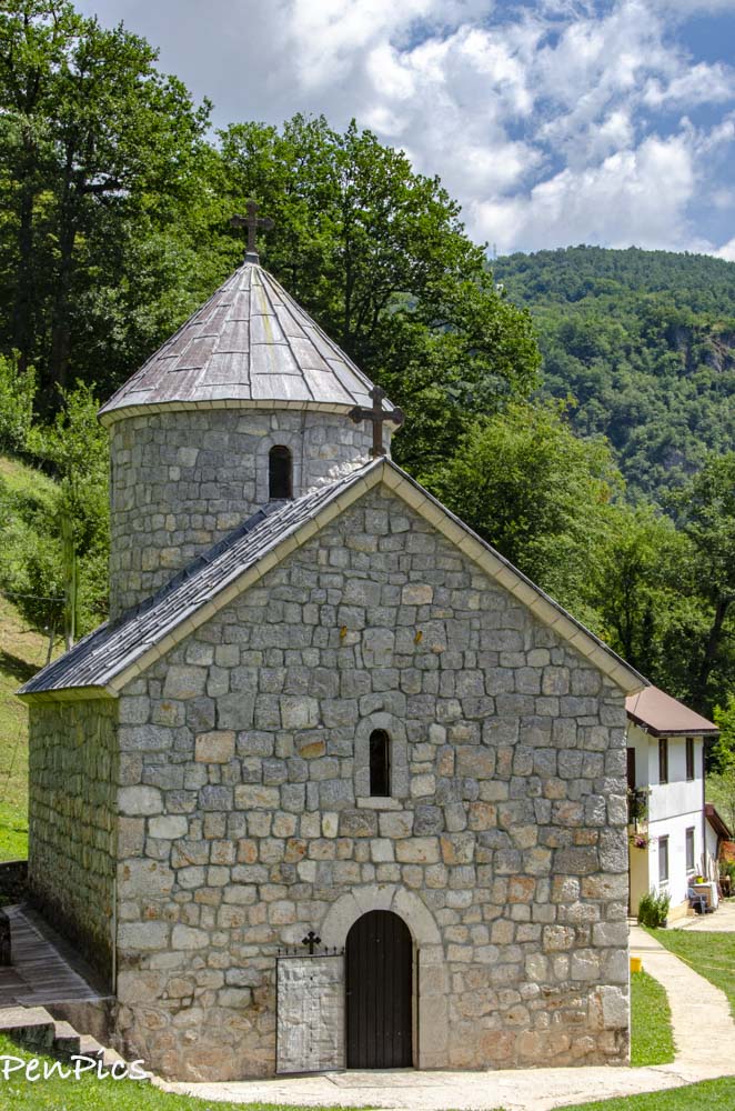
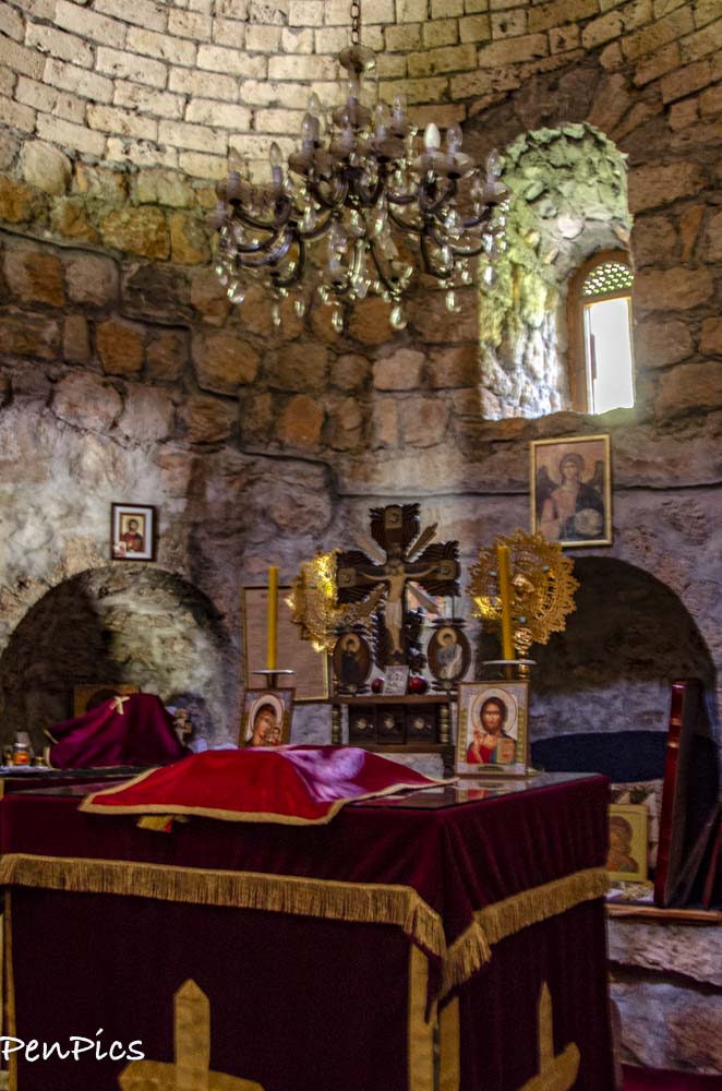
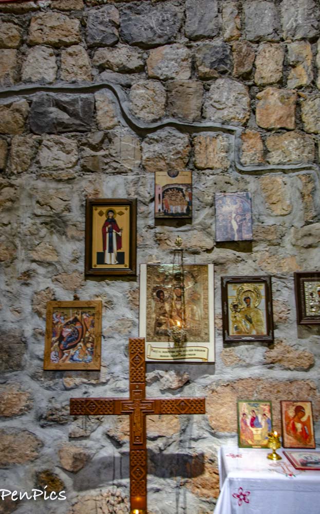
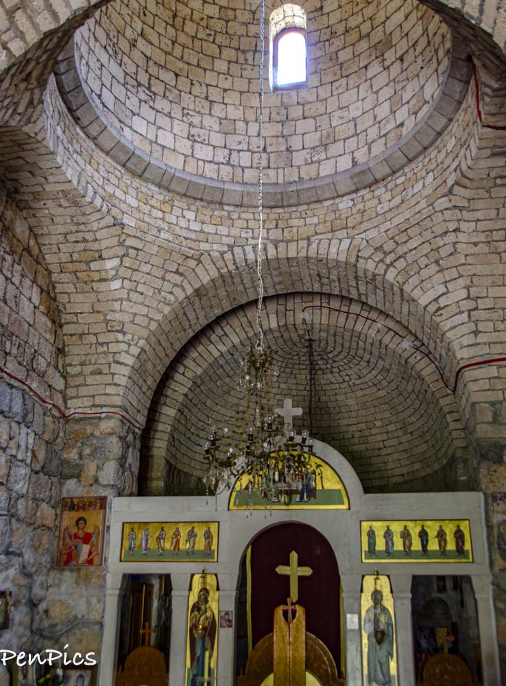
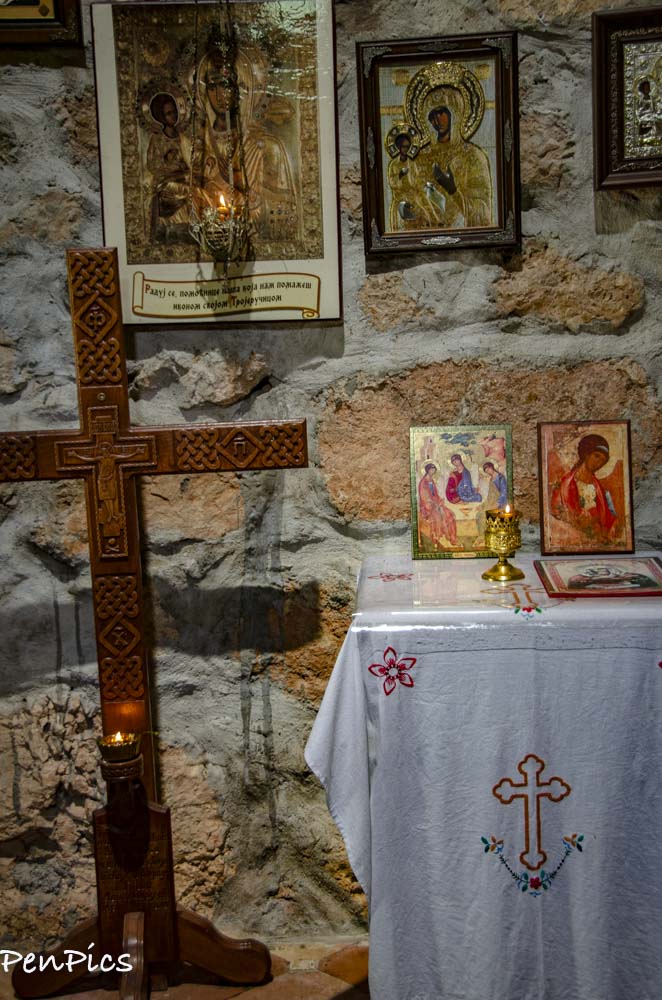
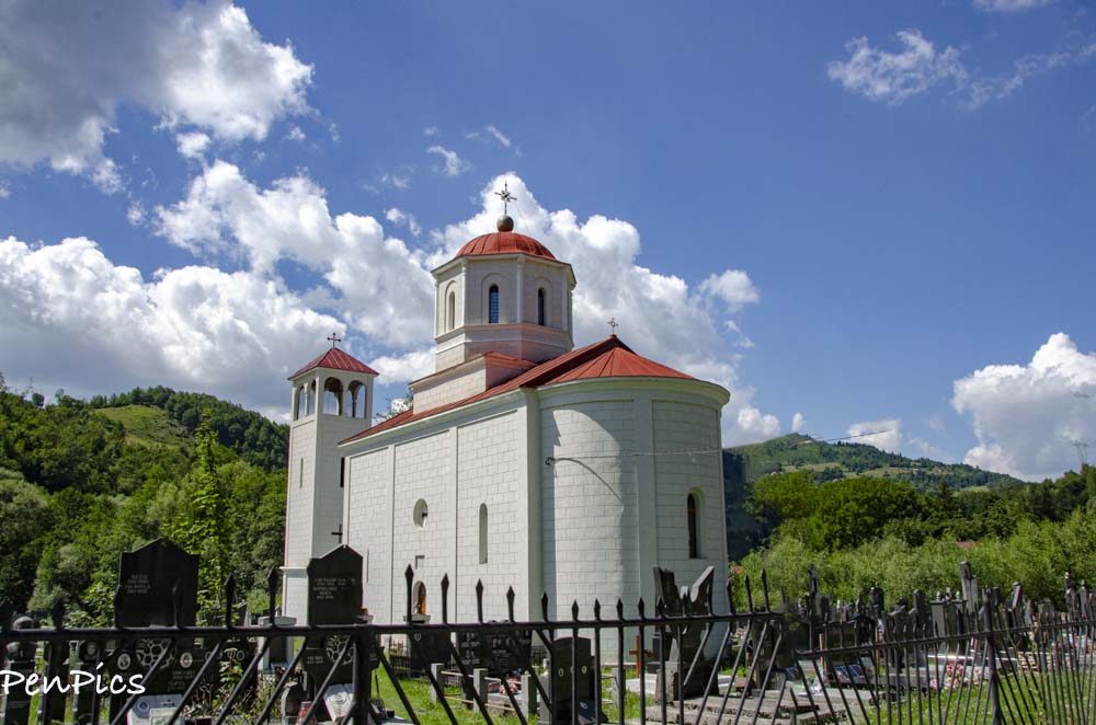
The Monastery of Saint George in Dobrilovina
Situated in the picturesque area of the Tara Canyon, among the rocky cliffs, on the gentle plateau of the village of Gornja Dobrilovina, is one of the most significant cultural and historic monuments of this region, the Monastery of St George in Dobrilovina. However, do not let this idyllic surroundings trick you because peace and quiet of this place are in total contrast with the tumultuous history of the monastery.
About the founding of the monastery, little is known. It is certain that it existed before 1592 when the Turkish government issued permission for the repair of the ruined church in Dobrilovina. Among the locals it is better known as Mala Morača (Little Morača), because its appearance resembles Morača Monastery, and it is thought to be a legacy of the Nemanjić Dynasty, just like Morača Monastery.
It is said that the monastery in Dobrilovina, like the other monasteries in the surroundings, had its own milk pipeline; a specially constructed channel made of yew or other wood by which fresh milk was transported from the pastures of Mt Sinjajevina.
At the beginning of the 18th century the bones of Archbishop Arsenije were transferred from Dovolja Monastery to Dobrilovina. Legend says that Dovolja Monastery, once an important spiritual centre of Potarje, was so named, because of the fact that there was a sufficient amount of everything there.
In the middle of the 18th century the church in Dobrilovina, and the monastery were reconstructed, but as soon as 1802 the monastery was abandoned. Then, 28 years later, it was restored to active service, only for the Turks in Kolašin to attacked it in 1833 and forced the monks to leave.
The monastery church was reconstructed in 1867 by Archimandrite Mihailo Dožić Medenica, and soon after that, in 1870 he also founded the first school in Potarje there. Difficult times and frequent attacks by the Turks forced the teachers and pupils to hold and attend classes in a nearby cave, instead of the monastery, using the stone boards for writing. It is said that the pupils themselves guarded the cave, taking turns at the entrance of the cave with their rifles on their shoulders.
Today, this place is one of the favourite picnic spots for inhabitants of Mojkovac, and visitors can take a break and sit on the school desks set there in memory of the first pupils. In 1609, during the time of Abbot Joakim, the church was frescopainted. Due to the frequent destructions, frescoes have been only partially preserved, and plaster ornaments of vine leaves and rosettes, made in a very shallow relief, can also be seen. The monastery is recognisable by its wooden bell tower set by the facade of the church.
I have never been more disappointed to not be able to go inside a historic relic. It was locked up and nobody was around, but an old dog and a mama with four kittens. Given its remote location, I get that leaving it unlocked is not a good idea, but timing is everything and we just happen to come along when nobody was there. There are many, many monasteries and churches all over, but many are new, following the fall of Communism. There are few, like this one that was not destroyed during the communistic era. Obviously the remote location did help in the long run to preserve it through its many years of war it faced.
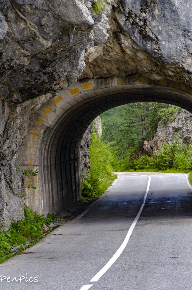
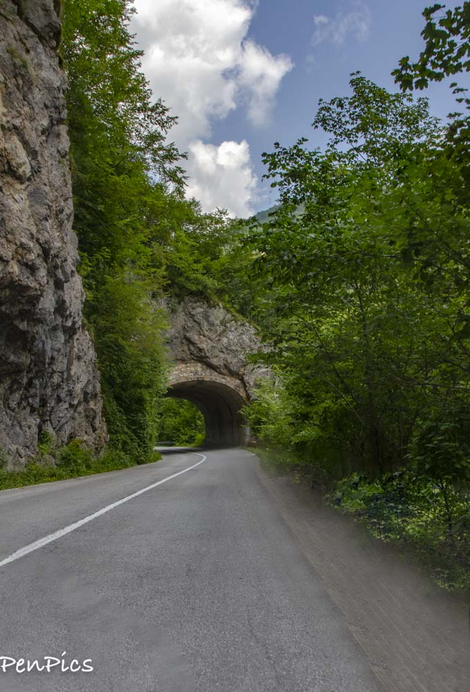
With countless bends, and many hand-hewed tunnels throughout the canyon, this scenic loop will leave an impression. It is fabulous! the tunnels can be a little tricky, as they are narrow and VERY dark. Adjusting from the bright sunlight in to a black tunnel was challenging, every time. The trick is to significallnty reduce ones speed, which angers those behind, but we are not as familiar with these circumstances as the locals are (who drive way to fast to begin with) This tactic came in quite handy, when a very bad driver, actually passed a vehicle and was heading right for me in my lane; oncoming. That was a narrow miss, and if I had not been going super slow, I shudder to think what could have happened!
Like this particular tunnel. many are very long and if not for the reflectors and having headlights on, it would be impossible to navigate.

Apart from seeing the views of the Tara river in the bottom of the canyon, it is worth veiling old villages of Montenegro, in which there are still old houses preserved, the so-called “savadake” houses and watermills and katuns scattered next to Durmitor’s brooks.
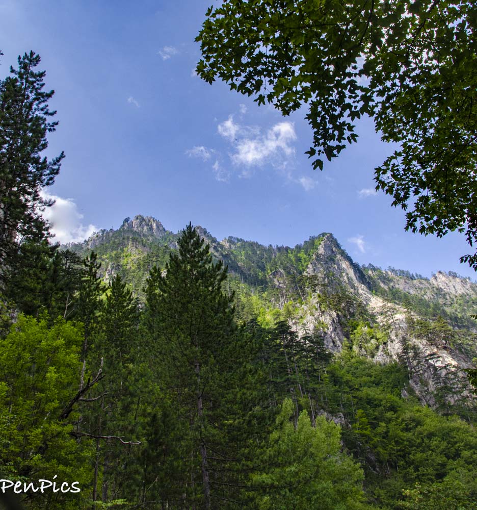
Tara Canyon cuts through four mountain areas, with Durmitor being the one with the most admirable features. Durmitor his National Park has over 48 peaks higher than 6,562 feet high! Durmitor is the home of the highest peak in Montenegro, as well. There are up to 20 glacial lakes in this area, one of them being Black Lake in the bottom of Medvedja mountain. It is interesting that some lakes appear only when the snow melts and then vanish after the summer period.
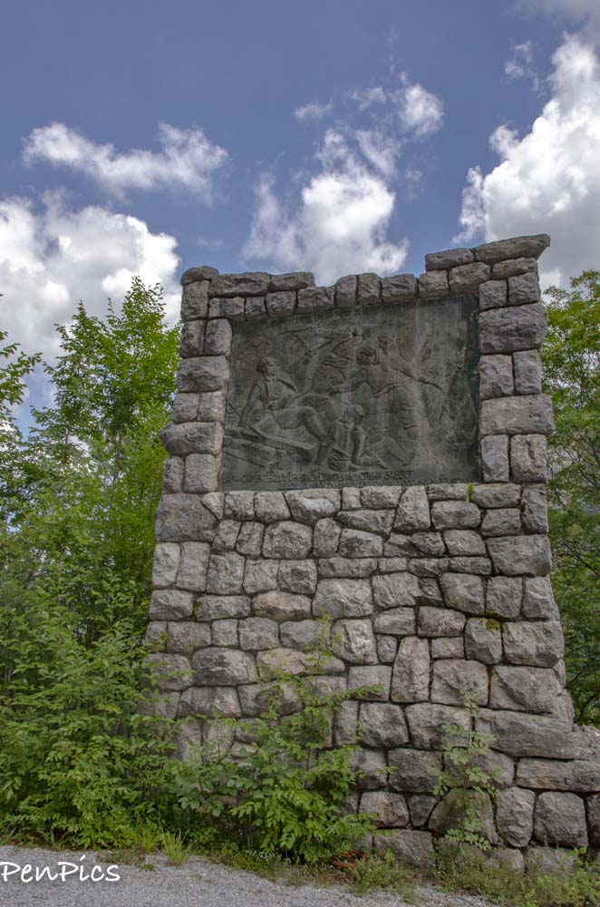
No info in English, but it may have to do with the circumstances of the of the bridge durign the war
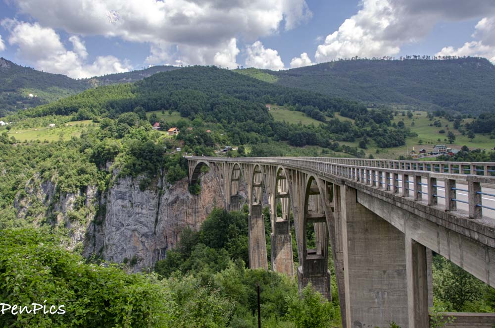
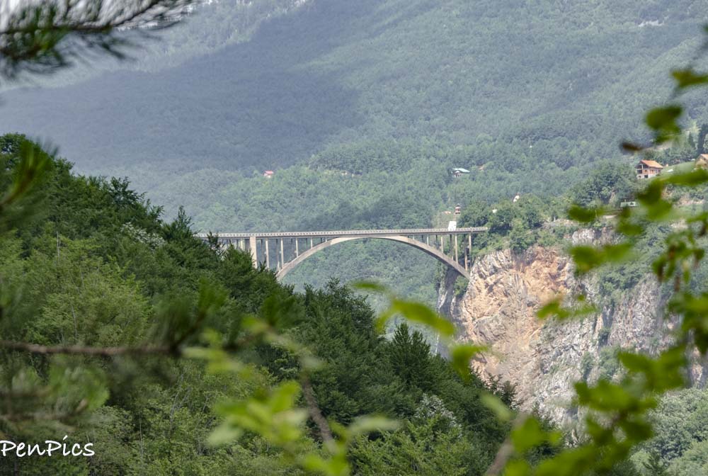
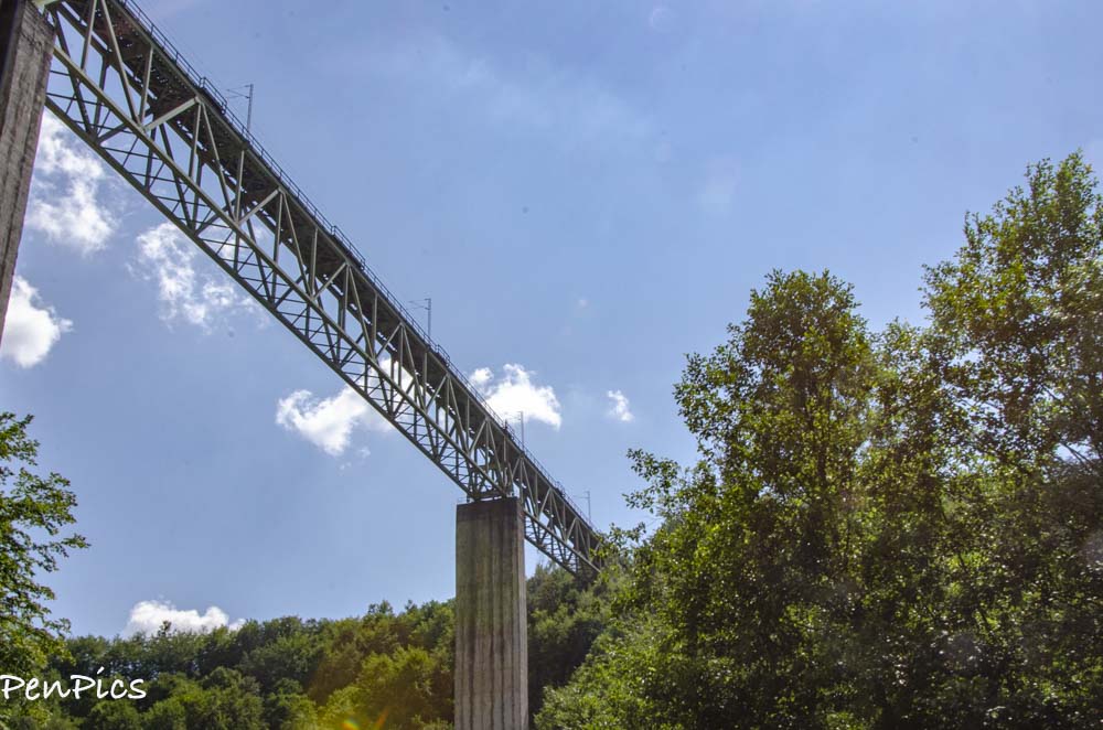
The Tara River Bridge – Djurdjevica
World records were broken by Djurdjevica Tara, and one is still held to this very day. The first record is that never before has a bridge had an arch almost 380 feet long, making it the leading pioneer in that time and the second world record, which will most likely not be beaten, due to the advancement in technology; is that the wooden scaffoldings, which were necessary in order to build the bridge, cost forty percent of the total budget for the construction.
The bright green nature around the bridge puts this bridge on the “Must-visit in Montenegro” list!
Historical fact: Did you know that the bridge was blown up during the war, just two years after it was finished? In the beginning of 1942, the Italians and the Chethnics were moving their forces towards Durmitor, where the partisans were based. In order to stop them from penetrating the area, it was ordered by commander Tito (who later became the president of Yugoslavia) to blow up the bridge, but in such manner that it can be easily restored after the war.
One of the engineers during the build; Lazar Jauković, was chosen for that task, and on the 6th of May, 1942 he blew up the smallest arch on the left river bank with explosives. The same engineer was caught by the chethnics three months later and shot at the bridge. Once the war was over, the bridge was restored from 1945 to 1946, back to its previous state and a monument dedicated to Lazar Jauković was built near the bridge, in memory of the brave engineer.
It is interesting that there is still a veil of mystery involving these events after some rumors started circling in the post-war era. Legend has it that because he was assigned to blow up the bridge, the real creator of the Djurdjevica Tara bridge was Jauković instead of Mijat Trojanović, and allegedly Trojanović, out of respect towards Jauković, never claimed that it wasn’t true. This is how engineer; Lazar Jauković is known as the “creator who was forced to destroy his most precious masterpiece.”
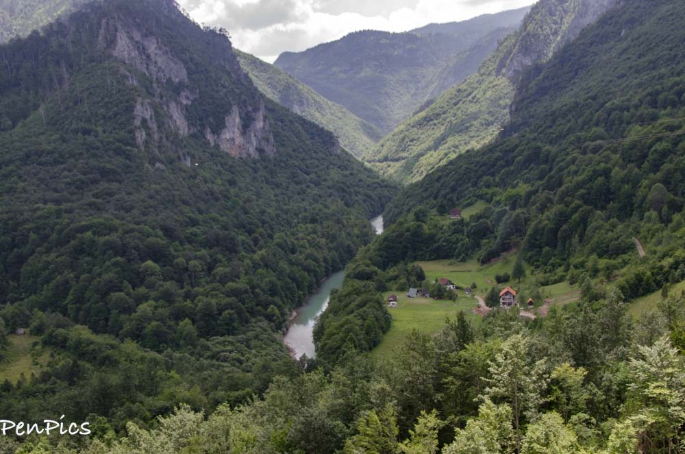
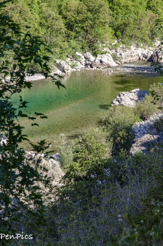
Flowing through Montenegro and a part in Bosnia and Herzegovina, Tara River is a creation of two rivers in the Komovi mountains in Montenegro; Opasanica and Veruša. In some parts, the walls of the Tara Canyon are 4,373 feet deep, making it the second deepest canyon in the world, after the Grand Canyon on the River Colorado.
This canyon in regards to its beauty, is known as the “Tear of Europe.” Tara River is almost 100 miles long, has 14 different rivers flowing into it; seven from each side, and it has 69 rapids on that path. Another interesting feature are the cascades. Since we are here in the heat of the summer months, most of them are not flowing, or even noisy, but I have no doubt with the snow runoff of spring, the loud noise of the cascades can be heard even in the upper parts of the canyon.
There are over 40 cascades on the Tara river, the most important being Crna Vrela, Bijela Vrela, Djavolje Lazi, Sokolovina and Bijeli Kamen. The most important spring that flows into the Tara river is Bajlovica Sige waterfall, which crashes into Tara with almost 30 gallons of water per second, falling from the Bucevica cave which is over 98 feet high!
Tara river takes pride in being on the UNESCO’s list of protected areas in the “Man and Biosphere” program from 1977, because of its diverse flora and fauna. A lot of animals call Tara canyon their home, such as Trout, Huchens, Graylings and other types of fish. There are birds like Hawks, Eagles, Capercaillies, Griffon vultures, and then there are The European Brown Bears, Wolves, Foxes, Chamois, and the rarest of them all, in these areas are the playful Otters that swim in the Tara river.
In the valleys of the Tara Canyon, there are certain herbs and trees that date all the way back to the ice age. Forests are rich with oak, ash, birch, beeches, and black pine trees. Most of the year the water level is a class three to four or less; only in the spring when the snow melts, and when there are heavy storms in a short period of time, the river is a class-five. The average temperature of the water is around 46 degrees, and it is drinkable throughout the whole stream.
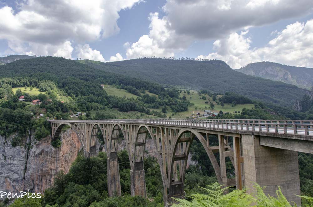
Tara Canyon Bridge – Djurdjevica
About 30 min of driving from Žabljak, the Djurdjevica Tara bridge stands gloriously 562 feet above the Tara river. Built from 1938 to 1940 and designed by professor. Mijat Trojanović, this picture perfect bridge connects two sides of the Tara Canyon with a 1198 feet of road, between the villages Budečevica and Trešnica in the northern part of Montenegro.
It becomes obvious that Djurdjevica Tara was built some 80 years ago, once you start crossing from one side to the other. The road is not too wide, but it is the most important connection in that area. In that time, the Djurdjevica Tara bridge was considered the most beautiful bridge in the Balkans; so beautiful that, according to one of the legends, it is believed the fairies helped build the bridge.
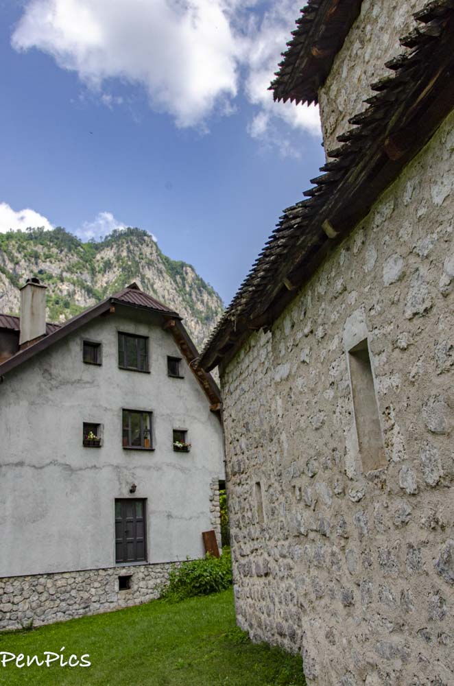
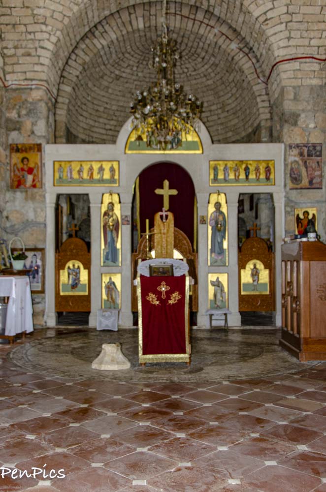
This church was off the main road, and we had signs directing us, but the signs and the name of this one was not English, so my keyboard can’t even type the same letters. No matter, as a woman came out of the home and offered to open the little church up, for us to see. How nice was that! With some English, she was able to explain the top part of the church was destroyed during the communists, but later rebuilt, as soon as they were allowed to, after the fall of communism. Don’t know the date it was originally built, but it looks to us like it was in the 1600’s.
Platije Canyon
There are some parts of the canyon where rocks are sharpened like diamonds and are so polished that only lichens and mosses can live on them. The sun illuminates rocks of the canyon in so many ways that every time you pass it, you can see different colors and shadows.
Morača is one of the longest rivers in the central part of Montenegro. Its canyon and water are the habitat of many endemic species.
In its lower course, the river is known for deep whirls, especially near the Vizier’s Bridge (Vezirov most) in Podgorica. Even though it runs through the capital of Montenegro it is still wild and untamed. On its way to Lake Skadar it collects numerous tributaries and brings water to the largest lake on the Balkan Peninsula.
After merging with its largest tributary, Zeta, just north of Podgorica, the Morača enters the Seta Plain.It flows through this flat area of Montenegro, until it empties into Skadarsko Jezero. The Moraca River is the biggest tributary of Skadarsko. Its source is at the height of almost 3,200 feet above sea level. Apart from the Morača’s platije canyon, its right-hand tributary, the Mrtvica also flows; for the most part of its length, a lesser known high canyon of breathtaking beauty.
The region in the basin of the Moraca River is featured by the steep slope of the terrain. It is intersected by deep gorges and canyons.The upper part of this river valley stretches to the entrance in the Platije canyon, which consists of Gornja Morača.
The Platija canyon is 328 feet deep on average and the mountainous Morača’s tributaries also flow through the canyons with the banks often as high as up to 3,280 feet. This River basin is oriented to the Adriatic Sea while the Tara River basin pertains to the drainage system flowing into the Black Sea.
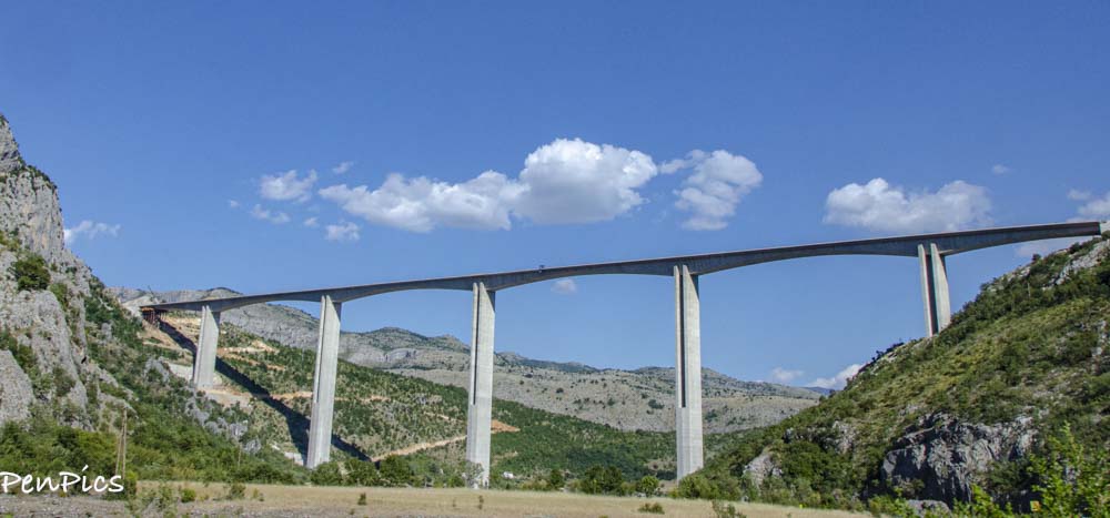
Moracica Bridge is the king of Montenegro’s almost 26 mile Bar-Bolijare highway, between Podgorica and Kolasin. It was set to open in 2019, but it does not look like it made this mark, as of this writing.
At 3,149 foot long, Moračica Bridge and highway will reduce drive time between Podgorica and Kolasin from 90 minutes to just 25 minutes. The Moracica Bridge is being constructed by its investor the China Road and Bridge Corporation.
As soon as we saw this massive structure, I told Daryl, it looked like China is involved again; this time in Montenegro. We have seen China’s work like this in many countries in the world. They also build ports and prisons, which we have seen in our world travels

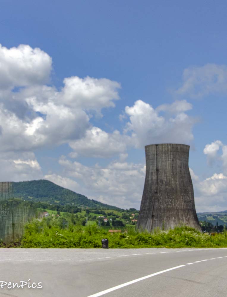
We did not expect to see a nuclear plant on our drive
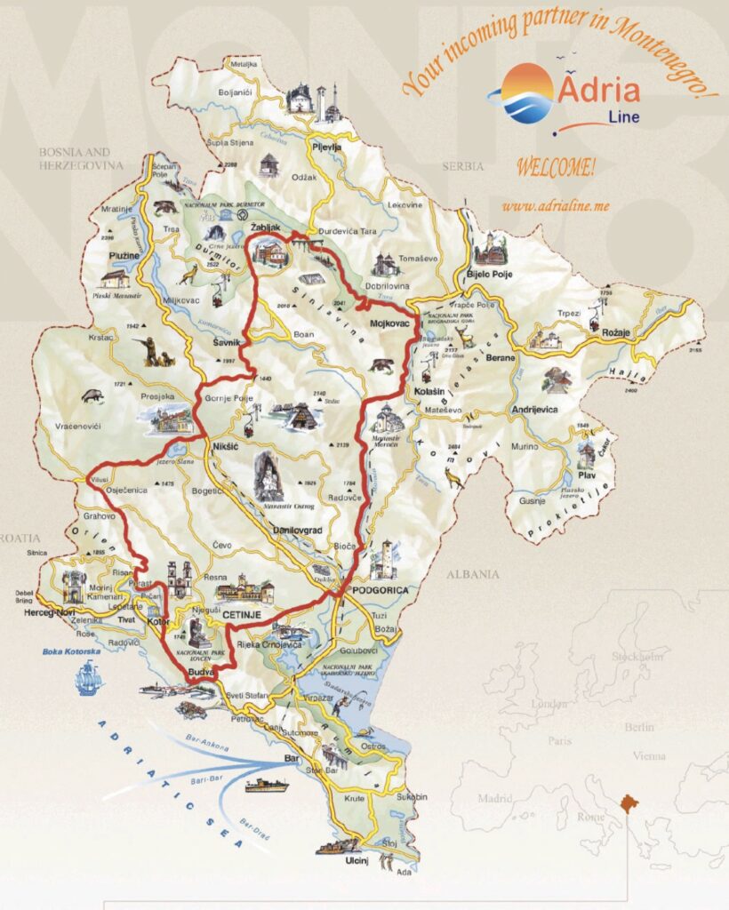
This is the scenic loop, though we started at the top and ended at the bottom right; city of Podgorica. (The capital city).
From there, if you cut across on the straight yellow road, that is closer to what we drove, since we have not been below Podgorica on this trip. (we did get to see Kotor Bay and surroundings three years ago, below where we are today). We will return to see more of this area of Kotor, because there is so much more to see than what we saw then!
We are still learning about all the “Panoramic Roads” available. Here is more information, if interested
https://www.montenegro.travel/files/multimedija/18652622.pdf

Leave a Reply to Judith Helen Twist Cancel reply
Archive Blog Posts of Our Country Visits
About Us

About Us
Hello and Welcome to our Travel Blog Website, We enjoy writing about our experiences and taking photos of our adventuring along the way. Our names are: Daryl and Pen, but Daryl calls me “Bunny.” We met, quite randomly, whilst both… Read More
Beautiful country side
Its been amazing. This is one of the reasons we came back to Montenegro!