


“USA Alaska 🇺🇸 ~Yukon 🇨🇦 ~Haines, Alaska to Skagway, Alaska by Ferry and The White Pass Historic Railroad into Canada ~FANTASTIC!!”

With our last campground stop in Alaska, after over two months of all things Alaska and recently, the Yukon, again, for the third time; before we head back south, to the lower 48, we planned a fast ferry trip to Skagway for a few nights. It would be the only stop in the inside passage we would get to, as RVers, on this trip.
This will not be our last trip to Alaska. I’m already plotting another trip, but it will not be with Jonah and The Whale, however, that’s another story.
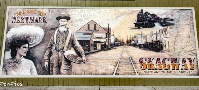
I just love Skagway, but have never taken the historic White Pass Railroad trip. Daryl has never been to Skagway at all, so he was game. We love train trips and seek them out, wherever we go, and have enjoyed many, all over the world!
The 45-Minute Fast Ferry ~Haines to Skagway ⬇️

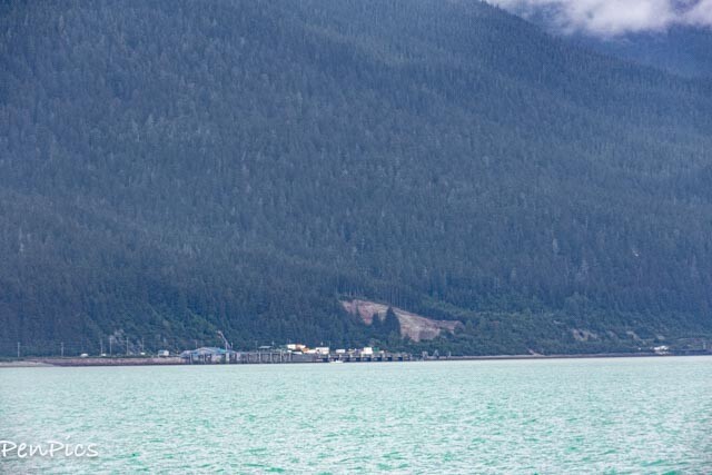
The ferry left out of the Haines harbor, which was only about an eight-minute drive from our camp spot. The ferry itself, takes 45 minutes, each way, and we left at 3PM. It was a pretty ride and we enjoyed the views.


We had dry weather and even some sun peeking out a little bit on this day. We had enjoyed a few days of sunshine, after arriving in Haines, but this summer, sun has been very fleeting in Alaska.

⬆️⬇️ Looking back at Haines, as we left for Skagway


⬆️ In 2021, there was a tragic landslide on this hill. People died. I’ve heard that little red-roofed building is condemned, though it survived.


A note about this World Renowned Fjord:
Skagway is located at the terminus of the Lynn Canal; it is the deepest and longest fjord in North America. It is 90 miles in length and over 2,000 feet deep.
It was improperly identified as a canal, by Joseph Whidbey in 1794 and named by George Vancouver after his birthplace; King’s Lynn in Norfolk, England. But, it was later, properly identified as a Fjord, but the canal name still is used.


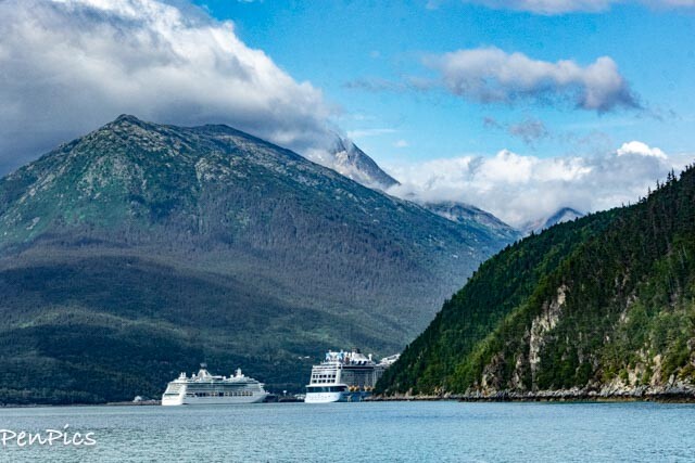

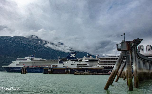
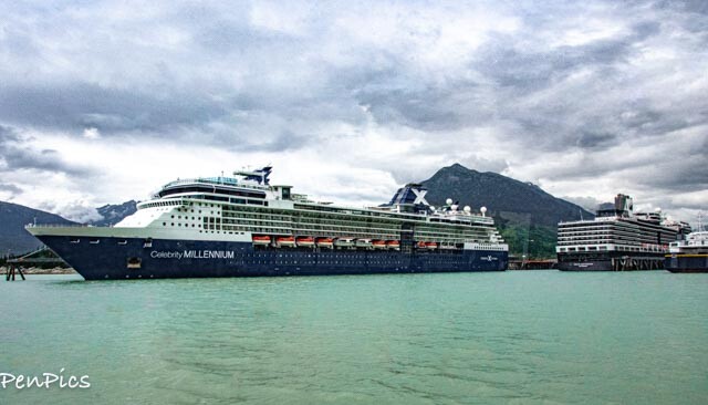
⬆️ Skagway Harbor
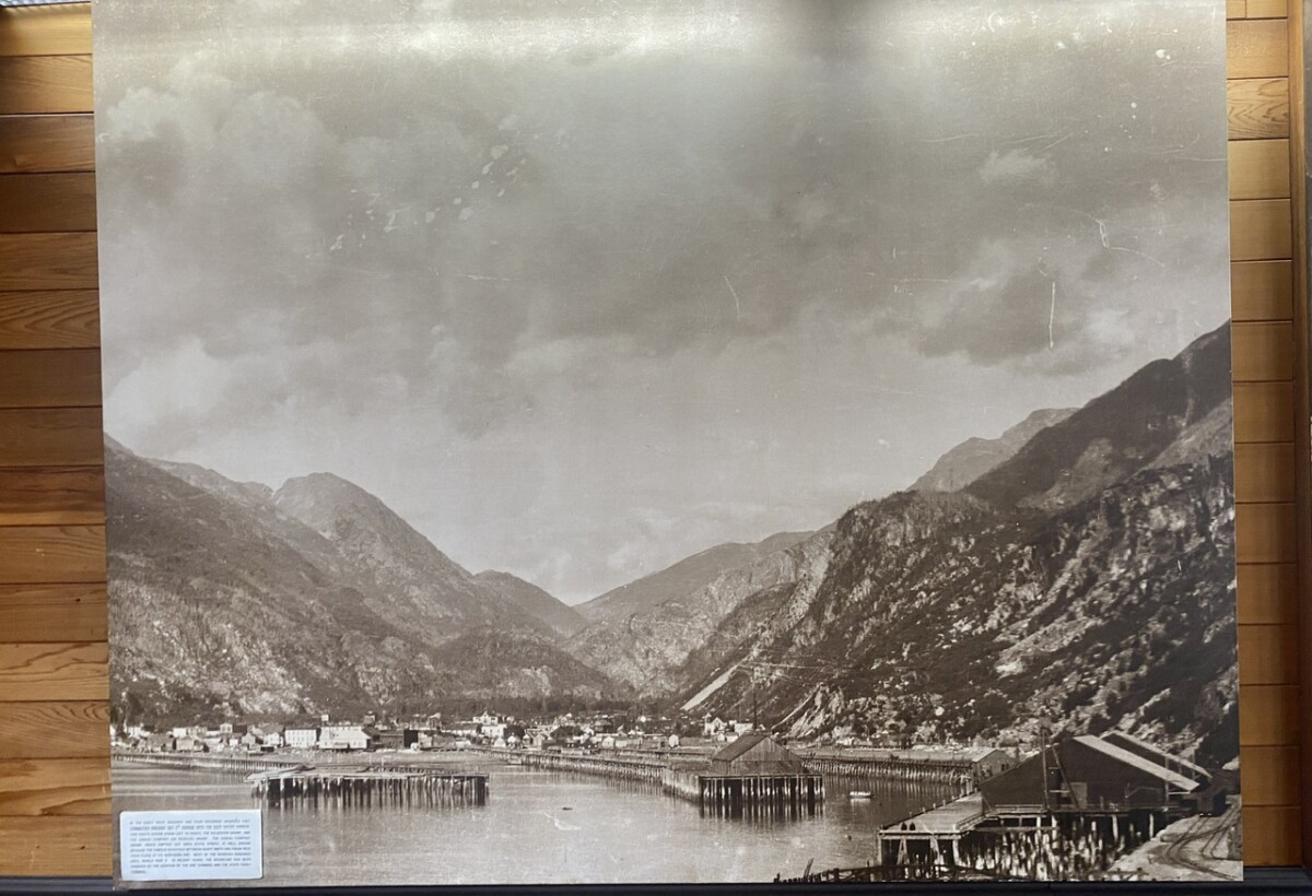
⬆️ Skagway Harbor in the 1800’s


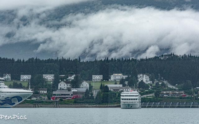
Upon arrival, the Westmark Inn picked us up at the harbor, in their shuttle and we got checked-in.
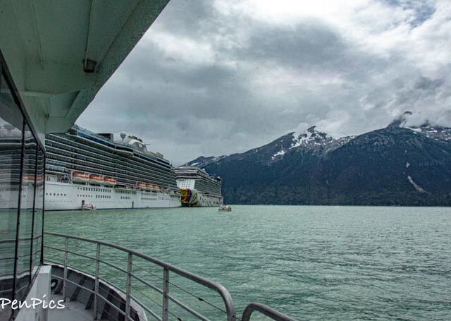
Also, upon arrival, as you can see in the photos, there were three cruise ships in port. That’s a lot of people; and most of the people on our ferry from Haines were coming back from a day-trip, there, and going back to their ships. There was also a very long line of people already at the Skagway harbor, going back to their ships.m; either by tendering or by dock.
By 5 or 6PM, all ships had disembarked.


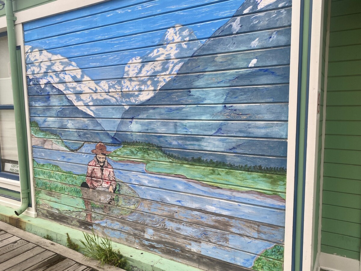
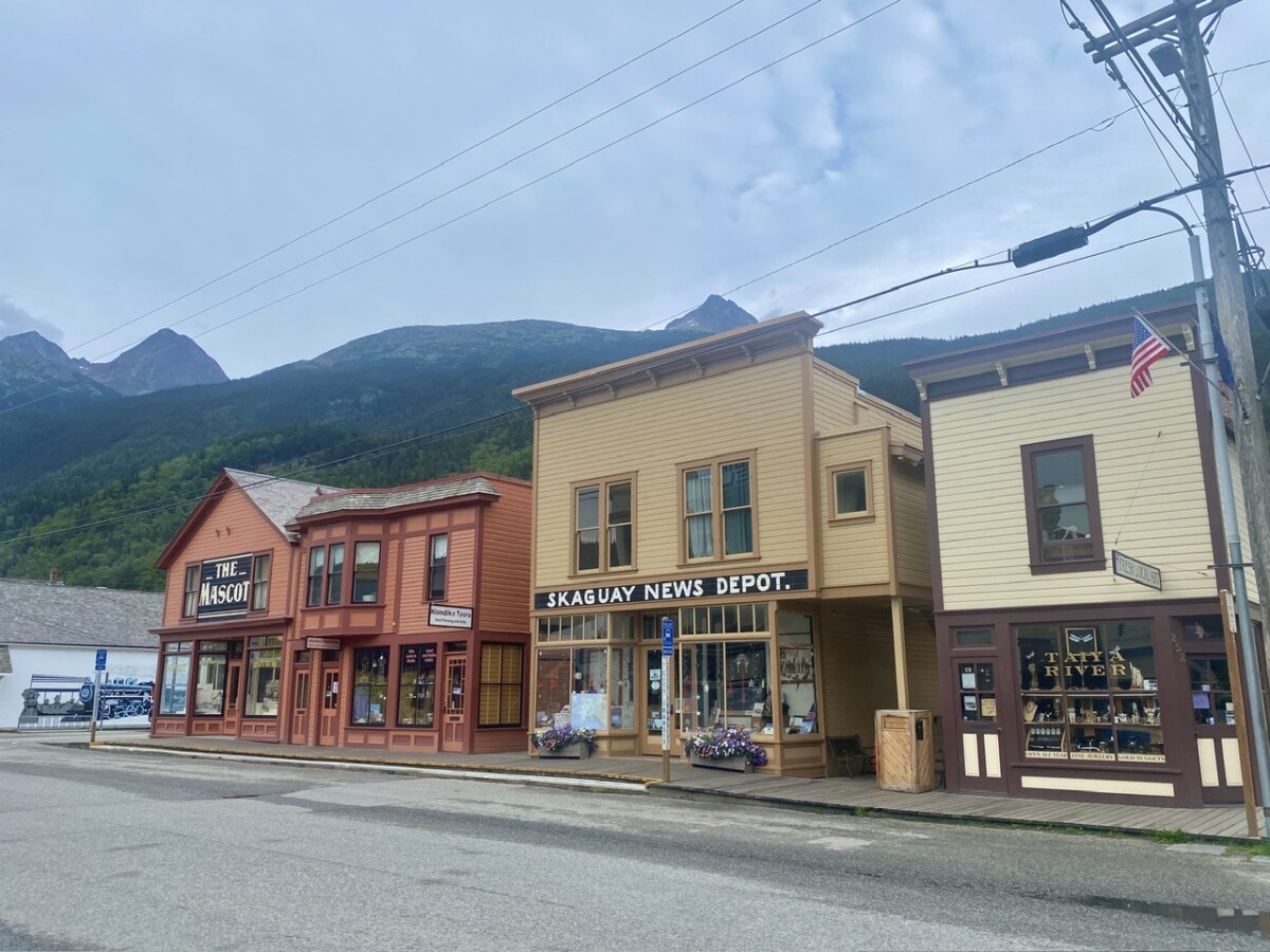
While we waited for the restaurant to open for dinner, we took a walkabout, around old town Skagway. ⬇️


⬆️ Seafood Fettuccine
As good as I’ve had in Italy!

After dinner, we went for ice cream and wandered from street to street. Everything was closing up, because it was after 6PM. Ha! There were no cruise ships in port, just a few of us tourists, not connected to cruising. It was so quiet and peaceful, sans the occasional train whistle in the distance or the fog horn from the harbor.
I knew rain was coming, so I took some pictures with the empty streets.
A Note About the Cruise Ships:
A town like Skagway, survives, primarily because of the cruise ship industry. (all ports that are part of the inside passage do) Yes, this adds a lot of people at once, in many inside passage towns, during the heart of summer, but those on cruise ships want to see these ports of Alaska, just like RV-ers and those who commercially fly in to Anchorage and rent vehicles. I’ve done all of the ways in, to visit Alaska, myself, and I support anybody who does the same.
I say this, because I’ve heard complaints from tourists who are not on the ships, complain about the cruise ships and “all the people.” I say get over it, because you are missing out on a beautiful part of Alaska, if ya don’t visit, because of said people. It’s not that bad, and because of that industry, college kids have summer jobs and businesses can thrive, during the short summer season.
The port towns would not “be” for anybody to see, if not for promoted ship tourism. For those who still are not sure, there used to be a website I used, when living and traveling overseas for so many years. It’s a website that shows the cruise ship schedule for EVERY cruise ship company. It’s basically a comprehensive calendar of dates for port-of-calls, if you want to pick a travel date of an area when cruise ship numbers are down, or not at all.
*rant over*
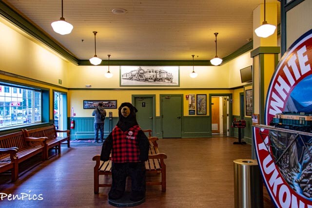
The next morning, we were up and out the door, to get to the train station; one block away. As I suspected, it started pouring rain in the night and though it was suppose to stop by morning, it did not. Drats!
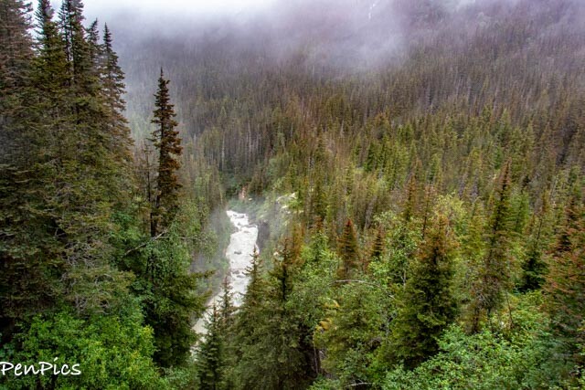
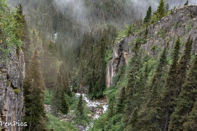
Regardless, the train ride and the narrated history was fabulous. We did not get to see all the lovely views, with the low lying clouds and fog (our primary summer pattern, unfortunately for EVERY Excursion we paid gobs of extra money for) but we saw many historic landmarks along the way, and because some of the history of this area of White Pass is very sad, the photos with their ominous vibe, was very haunting and fitting, in a lot of ways.
For us, we felt the additional, historic significance on this train ride, having just come from Dawson City in the Yukon, where we had immersed ourselves in the Bonanza Gold Strike history there, and then drove down the Klondike Highway to Haines, and now, over to Skagway, via the marine highway: by water. It’s ALL connected, historically, and we were up-to-date on the big stampede to the Klondike gold fields, back in the 1800’s and those coming up from the south, to get to the Klondike.
Those stampeding to the Yukon, had to climb over this treacherous White Pass, or Chilkoot Pass; and into Yukon, before the narrow gauge railroad was built.
More on this incredible history, later.


After our three-hour train ride, for which was a giant loop, we unloaded at the same historic railroad depot, in Skagway and since it was still raining, we headed back to our hotel.
There is no internet in the rooms, but the lobby has a big area, to use their internet, but not the kind to allow streaming and the like. For our entire visit in Alaska and Canada, this has been the norm..Except for the Valdez KOA campground. They had it all in the world of internet. That was a treat!
Anywho, it stopped raining, so we went back out to walk the streets again. By this time, a few cruise ships had arrived in port, again. The streets were alive with people; shops open and the smell of kettle corn was in the air. We also found an Indian Fry Bread shop. We got ours to go!


Before we new it, it was time for dinner. Because we opted to not get our room cleaned, during our two-night stay, we got a $5 coupon per day, to use at the restaurant! Sweet!
We settled in for the evening, and I always have photos to process (offline) from all our fun activities. The Westmark Inn is very nice, and of course when we “double book” places, leaving The Whale behind, and in this case, Jonah, too, a bathtub in the room is THE bonus!!
Skagway ⬇️

Skagway, Alaska is the kind of place that you just know has some interesting facts about it. This amazing little town would normally be off-the-beaten-path, but almost all the cruise companies visit it for its historic significance, colorful buildings, and unique Alaskan charm. You know why else Skagwsy is a very popular stop for cruise ship? Because, it has the deepest waters of all inside passage port of calls.
There are loads of fascinating Skagway facts you’ll learn when you visit and or take a tour.
Here are a few:
*Skagway’s original name, Skagua, or sometimes spelled Skaguay means “Home of the North Wind,” in Tlingit. The Tlingit people still live in southwest Alaska
*Skagway was Alaska’s first incorporated city. It was incorporated on June 28, 1900, one day before Juneau was.
*During the Gold Rush, Skagway had a population of around 10,000 people. By June 1898, Skagway was the largest city in Alaska, but today only around 900 people call Skagway home year-round.
*Skagway is one of only three cities in Southeast Alaska accessible by road, but the only road into Skagway comes from the Yukon Territory, Canada.
Skagway IS accessible by a driving road and this can be a little confusing, when Haines is “right next door,” yet almost 400 miles away,” at the same time. Here is a map to help:
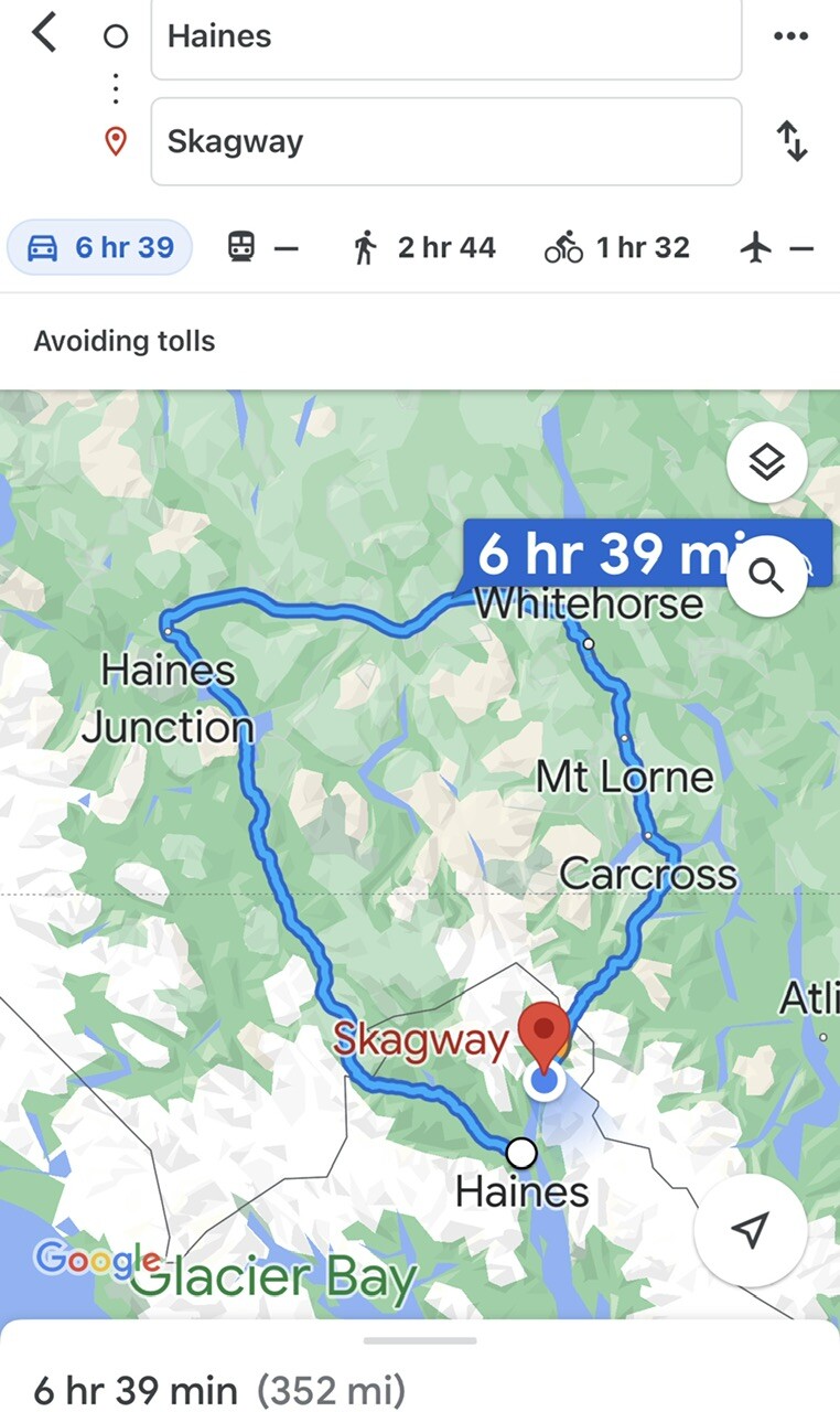
We wanted to “Glamp” in Haines, Alaska, but wanted to visit Skagway. The walk-on ferry was a no-brainer for us, with an easy 45 minute ride, vs a 352 mile drive. This way, we could leave our outfit safely parked, back in Haines; change things up and go on “vacation” for a few days.
We sure had fun!!!
*It is only 50 miles from Skagway to the Yukon Territory. The Klondike (where mining prospectors were headed, is 500 miles away: Dawson City area).
*Skagway is a zero-stoplight town: the closest stoplight to Skagway is over 100 miles away in Whitehorse, Canada.
*The cruise industry is a huge part of Skagway’s local economy: nearly one million people visit Skagway, annually, almost all of them on cruise ships. To make this possible, Skagway has some of the most expansive port facilities in Alaska. Skagway can dock up to five cruise ships at a time, and a sixth boat can anchor-out and tender passengers in.


⬆️ Saint Bernard type dogs, pulling a wagon-cart
⬇️ This building is an original, like many of the others are. It’s so unusual. It is now the Visitors Center.
There is a picture in our hotel room, which confirms its authenticity from at least 1899.


There is more to this town, though all walkable, but that would be so many more pics. I’m sure you get the idea.
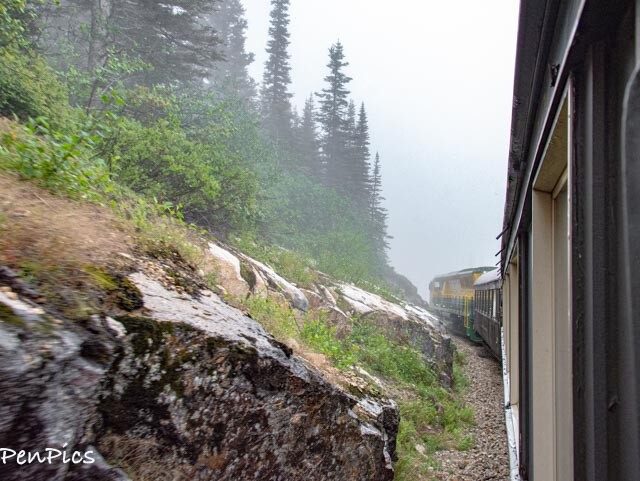
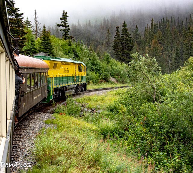
The Historic White Pass Railroad ⬇️
ALL ABOARD!!!!


Tickets can bought online and it’s super easy ⬇️


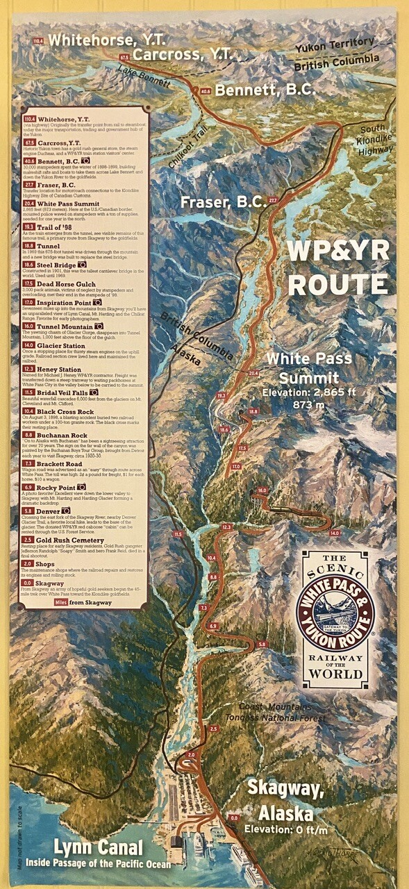
⬇️ You can expand this map. It’s very comprehensive and well done for the route we took. For this train ride, we did not have to show passports, as we crossed in to Canada and back into Alaska, because the North West Mounted Police Station is unnamed at this time. Besides, we were not allowed to get off the train, till the trip was complete.


In The Beginning
For the White Pass & Yukon Route, it was all about the gold, discovered in 1896 by George Carmack and two First Nations companions: Skookum Jim and Dawson Charlie.
The few nuggets they found in Bonanza Creek in the Klondike barely filled the spent cartridge of a Winchester rifle. However, it was enough to trigger an incredible stampede for riches: the Klondike Gold Rush.
A MAN OF VISION and A MAN OF ACTION

The rush for riches was actually predicted by Skagway founder, Captain William Moore. He was hired by a Canadian survey party, headed by William Ogilvie who had been commissioned to map the 141st Meridian, the boundary between the United States and Canada.
Because the known route, Chilkoot Pass, was so rough and rugged, Moore and Skookum Jim decided to head north over uncharted ground and seek an easier route to the Interior. They reached Lake Bennett, near the headwaters of the Yukon River, and named the new potential route, White Pass, for the Canadian Minister of the Interior, Sir Thomas White.

Moore had a 160-acre homestead claim in Skagway. He returned to his home and began to think about the changes he felt would soon come. The search for gold in northwest Canada and Alaska had been underway for the past two decades and Moore believed that it was only a question of time before gold would be discovered. He built a sawmill, a wharf and blazed the trail to the Summit of the White Pass. Moore even suggested to his son that eventually there would be a railroad through to the lakes, and to prepare for the coming gold rush.
1897 ⬇️
The headline of the Seattle Post-Intelligencer on July 17, 1897, broadcast the news of the discovery of gold in the Canadian Klondike. Under the headline “Gold! Gold! Gold!” the newspaper reported that “Sixty Eight Rich Men on the Steamer Portland” arrived in Seattle with “Stacks of Yellow Metal”.
The news spread like wildfire and the country, in the midst of a depression, went gold crazy. Tens of thousands of gold crazed men and women steamed up the Inside Passage waterway and arrived in Dyea and Skagway to begin the overland trek to the Klondike. Six hundred miles over treacherous and dangerous trails and waterways lay before them.
Some prospectors chose the shorter but steeper Chilkoot Trail, which began in Dyea. Each person was required to carry a ton of supplies up the “Golden Stairs” to the Summit of the Chilkoot Pass. Others chose the longer, less steep White Pass Trail, believing that pack animals could be used and would be easier. Both trails led to the interior lake country where stampeders could begin a 550 mile journey through the lake systems to the Yukon River and the gold fields.
Both the Chilkoot Trail and the White Pass Trail were filled with hazards and harrowing experiences.
Men immediately began to think of easier ways to travel to the Klondike. In the fall of 1897, George Brackett, a former construction engineer on the Northern Pacific Railroad, built a twelve mile toll road up the canyon of the White Pass. The toll gates were ignored by travelers and Brackett’s road was a failure.


There were 35 workers who died, during the building of the White Pass Railroad. This grave marker is for two men who died when a blasting accident happened and a 500-ton-boulder crushed them.
Though 35 souls were lost, this number is unbelievably low for back in those days. Most of the 35 died from disease, not injury, but we were told the people in charge of safety for the railroad build, were visionaries, WAY before their time, on the safety aspect of the project. In fact, during the years of construction, a hospital (though temporary) was built on-site. In modern day, there is no hospital in Skagway. Anyhow, many injured workers lives were saved, on site, because of the forward thinking of those in charge.

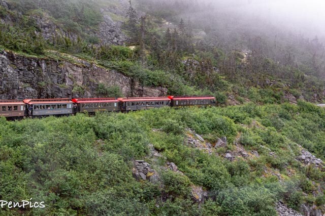
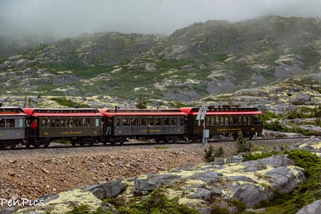
…trains stop, to let other trains pass, on this narrow gauge system

From on the railroad trip, we could see, and pass right by, the Alaska/Canada border crossing, on the ridge. This was the same customs crossing we came through; driving in The Whale, towing Jonah, as we crossed from the Yukon Territory, (after being in Dawson City), to come in to Haines, Alaska.
The writing on the rocks says: “On To Alaska With Buchanan.”
Meaning: The year was 1931, in the depth of the Great Depression. The stock market had crashed, the worldwide economy was in a shambles, and no one was sure where the bottom was. In the midst of this turmoil, Detroiter George Buchanan invited George Hull on an excursion to Alaska. They entered into a business agreement, and expected that each would be good to his word. Both Georges understood that trust was the foundation of this agreement.
The 57-year-old Buchanan had known it for years. Hull, only seven years old, learned it that summer. These were the lessons that Buchanan lived for.
George Buchanan was the founder of an educational program that encouraged young men, and eventually young women, to earn spots on a transcontinental expedition that bore his name. “On to Alaska with Buchanan” became the dream of countless boys across the country, after World War I.
By earning their way, hundreds of young entrepreneurs eventually made the trip from Detroit to Alaska, between 1923 and 1939, and again after the Second World War.
Buchanan’s youth program was out of the ordinary. Participants committed to a tangible investment in money and time. Buchanan’s effort was not franchised like the Boy Scouts or Boys Clubs. He personally interviewed every applicant and led every tour.
With his fortune made in the distribution of coal and coke (a coal by-product), this was his legacy: a first-class trip on a private train for any young man willing to earn his way, as far west and north, as that train would go. Quite inspirational.


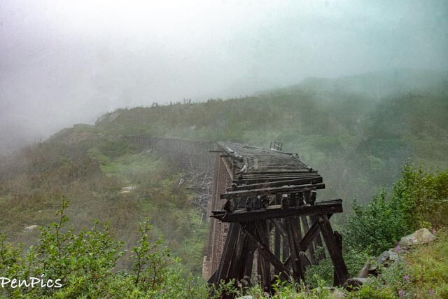
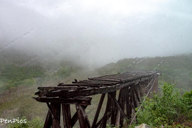
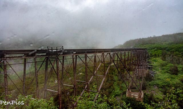
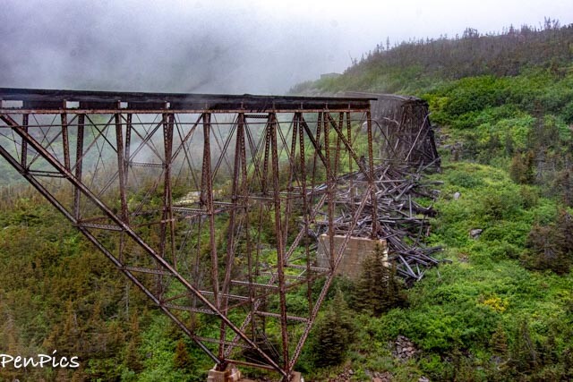
⬆️ Current Day: decommissioned Trestle ⬇️


And, after construction was complete of the trestle in 1900 ⬇️
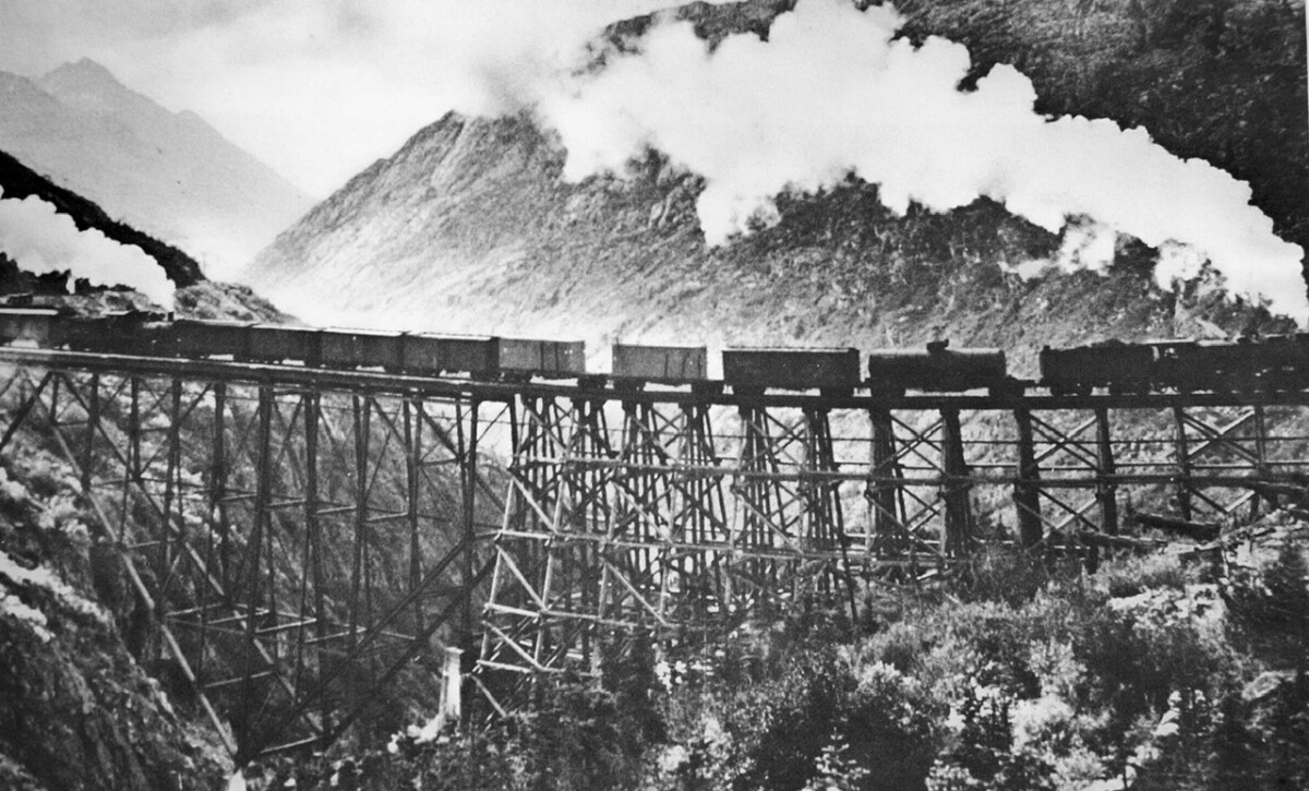

⬆️ This is the newer train trestle, built to replace the decommissioned trestle, from the original build

It is at this point in history, the facts become quite grim, about those who traveled, or I should say; tried to travel the White Pass Trail to reach the gold field so they could “strike it rich,” having made it this far, to get to this point; only to get stuck. Man suffered, but The working horses were indeed one of the tragedies of the Klondike Gold Rush, rarely mentioned. Three thousand horses died on the White Pass Trail, due to the tortures of the trail and the inexperience of the stampeders.
I could barely read the account, let alone wrote it, here, as my love for animals, FAR outweighs my love for the greed, and that of the brutal man.
Most writers using primary sources, estimate at least 3,000 horses died on the White Pass Trail and their bleached bones can still be seen, while hiking in the rock-strewn canyon near the summit. The true story of this tragedy is part of history, so here is the link, if you are interested: https://www.yukon-news.com/letters-opinions/dead-horse-gulch/
This location was later named “Dead Horse Gulch.”


The trail became so narrow, barely one man could continue, let alone, two-way traffic with horse drawn wagons, with their supplies.


⬆️ This is the currently un-manned Canadian Mounty border crossing for the train route
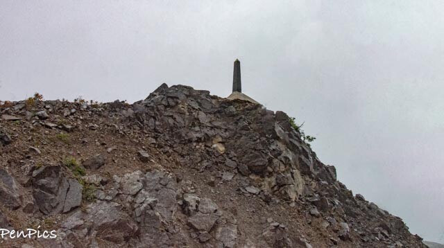
⬆️ The marker showing the border line for Alaska/Canada


|
Original White Pass and Yukon Route |
|
|
Length |
107 miles (Skagway to Whitehorse); 67.5 miles (Skagway to Carcross) |
|
Preserved gauge |
3 ft |
|
Opened |
August 1, 1900 |
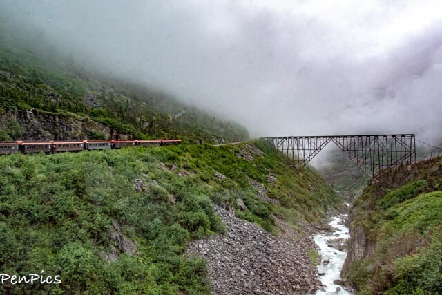
This 2.5 to 2.75 hour, 40 mile round trip climbs from tidewater at Skagway, to the Summit of White Pass; a 2,888 foot elevation.
The fully narrated tour, passes through two tunnels, over sky-high trestles and cascading waterfalls.
The White Pass & Yukon Route climbs to almost 3,000 feet at the summit, in just 20 m-miles and features steep grades of almost 3.9%.
White Pass, also known as the Dead Horse Trail, (elevation 2,864 ft) is a mountain pass through the Boundary Ranges of the Coast Mountains on the border of the U.S. state of Alaska and the province of British Columbia, Canada.
This narrow gauge railroad takes you from Skagway up some 2,888 ft. to White Pass Summit; the official border between the United States and Canada.
The White Pass & Yukon Railway
The White Pass and Yukon Route Railroad is an International Historic Civil Engineering Landmark. Built in 1898 during the Klondike Gold Rush era, the route climbs from sea level, 20 miles, to almost 3,000 feet at the summit of White Pass.
Because of the tight curves of the White Pass, a narrow gauge railroad was used with rails three feet apart on a 10-ft wide roadbed.
Thirty-five thousand men worked on constructing the railroad, building the 110 miles of track – sometimes in the dead of winter and heavy snow.
At the time, a Passport was required as the train took you from the port of Skagway, some 67 miles to Whitehorse, the Capital of Yukon.
However, we were told that Canada’s border remained closed, and the White Pass train would only take us to the U.S. and Canada border, making a loop to take us back down to Skagway.
The White Pass & Yukon Route train ride takes 2.5 – 2.75 hours; round trip. Passengers ride in restored and replica coaches, named after lakes and rivers in Alaska, Yukon, and British Columbia.
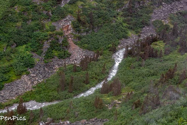
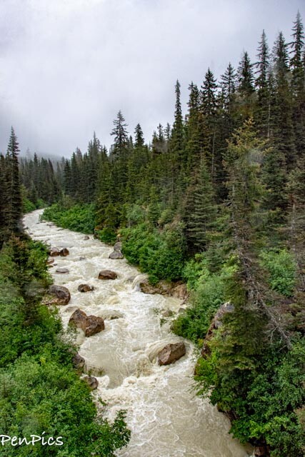
White Pass Scenic Railroad takes you through tunnels, over Dead Horse Gulch, and many photo opportunities of places like Inspiration Point and Bridal Veil Falls, which is a beautiful waterfall cascading 6,000 feet from the glaciers on Mt. Cleveland and Mt. Clifford.
The conductor will walk through the passenger cars to take your train ticket and answer any questions you may have.
The entire trip is narrated so you can learn about the history of building the White Pass & Yukon Route railroad, stories that happened while building it, and they will tell you when the best photo ops are coming up!
Things You Will See Along The White Pass Railroad Route:
- Skagway
- White Pass Railway Maintenance Shops
- Gold Rush Cemetery – Resting place of Gold Rush gangster; Soapy Smith and hero; Frank Reid.
- Denver Glacier Trail – A favorite local hike leading to the base of Denver Glacier.
- Rocky Point – PHOTO OP! Pretty view with Mt. Harding and Harding Glacier as a backdrop.
- Brackett Road – A wagon road advertised as an “easy” through route across White Pass.
- Buchanan Rock – The words “On To Alaska With Buchanan” was painted on the far wall of the canyon. The Buchanan Boys Tour Group brought visitors to Skagway each year from Detroit.
- Black Cross Rock – The resting place of two railroad workers who were buried under 500-ton of granite rock during a blasting accident.
- Bridal Veil Falls – Waterfall cascading 6,000 feet from the glaciers of Mt. Cleveland and Mt. Clifford.
- Heney Station – Freight was transferred down a steep tramway to packhorses at White Pass City to be carried to the summit. Named after Michael J. Heney, a contractor.
- Glacier Station – A stopping place for steam engines on the uphill grade.
- Tunnel Mountain – Where the chasm of Glacier Gorge disappears into Tunnel Mountain.
- Inspiration Point – Beautiful views of Lynn Canal, Mt. Harding, and the Chilkat Range.
- Dead Horse Gulch – Where 3,000 pack animals met their end in the stampede of 1898.
- Steel Bridge – The tallest cantilever bridge in the world.
- Tunnel – In 1989, a 675-foot tunnel was made through the mountain and a new bridge was built to replace the Steel Bridge.
- Trail of ’98 – The famous trail that was the primary route from Skagway to the goldfields.
- White Pass Summit – 2,888 ft. You’ve reached the U.S. and Canadian Border and are at the top of White Pass Summit. Where mounted police waved on stampeders with supplies needed for one year in the north.
When the train returned to Skagway, the conductor announced we could get off the train in the town, or we could ride the train back to the cruise dock.
Founded in 1890, as the gateway to the Yukon and Klondike goldfields, Skagway at one time had a population of 10,000 people. Once the gold rush ended in 1900, the population dropped to 3,110.
The town might not have survived if it weren’t for the construction of the White Pass & Yukon Route Railroad; the first major railroad in Alaska, bringing freight, fuel, and transportation to White house as well as several mines in the Yukon.


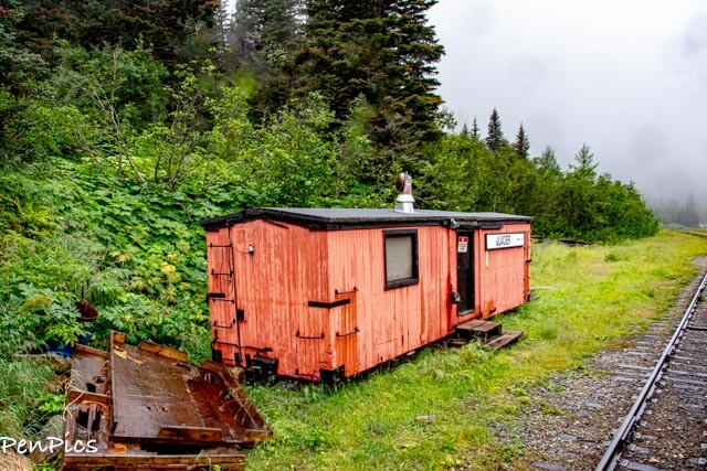


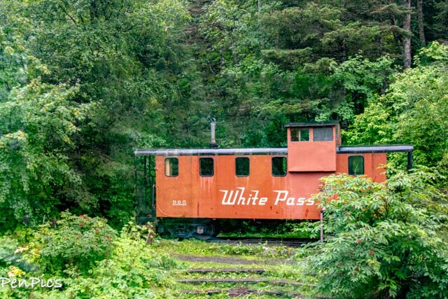
This is cool. I told Daryl we must come back to Skagway and spend the night. The narrator said, “it sleeps six, uncomfortably” 🤣
This unique “cabin” is a refurbished 1960s railroad caboose that is retired from the White Pass and Yukon Railroad. It is an ideal base for outdoor enthusiasts who want to hike to the Denver Glacier.
Access to Denver Caboose Cabin is via the White Pass and Yukon Railroad from May 1 to September 30. The cabin is closed to reservations in the off-season, since the surrounding area is owned by the railroad.
Visitors are responsible for their own travel arrangements and safety and must bring several of their own amenities.

The 4.5-mile trail to Denver Glacier starts at this (Caboose) cabin site. The trail follows a river and has many scenic overlooks.
The nearby terrain is rugged and brushy. Bring Bear Spray

Back in Haines ⬇️
All in all, we had a fabulous few days in Skagway. We made it back to Haines on the ferry, where we saw more Eagles roosting in the trees along the fjord. We also saw some Stellar Seals hanging out on a rock, as we passed by.


It was good to get “home.” Jonah was also parked where we left her at the ferry terminal, and all was well, there, too.


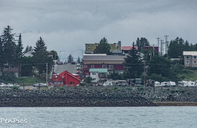
⬆️ As the ferry passed by the Oceanview RV Park, we could spy The Whale. All was fine there.
Though the day was dark, dismal and grey, here are a few photos from our 45-minute ferry ride from Skagway to Haines.
Skagway Harbor ⬇️
Traveling in the Lynn Canal (Fjord)

We saw many Eagles, on both ferry rides. There are about 400 Bald Eagles in the Haines area around September, this increases to about 4,000 in the fall months, when a late run of Chum Salmon in the Chilkat River provides a feast for these majestic birds

⬆️ Stellar Seals on the rock

Here we had a rare sighting of the Davidson Glacier, as we passed by
This is the Haines Ferry where the big ships carry vehicles. It’s the opposite direction from the Fast Ferry dock
⬆️ Haines is coming in to view
Those beautiful homes on the hill, have historical significance, here in Haines. Currently, they are private residences or businesses. They are what is left of Fort Seward.
I had shown a photo of Dr Oakley’s veterinarian clinic, previously; the one with the watch tower. It too, is a historical building. It’s very small in the above photo, so here it is, close-up, as well as few of the other homes ⬇️


Gateway to Alaska Gold
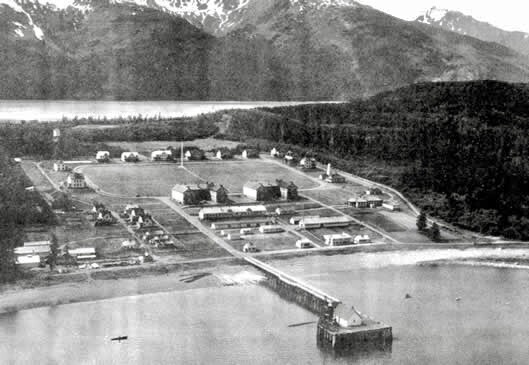
In July 1902, Haines was chosen as the site for a permanent Fort in upper Lynn Canal. Located 17 miles from Skagway, in Haines. The site made it possible to monitor traffic bound inland over the Dalton, Chilkoot, Chilkat, and White Pass trails. In this way, the Army hoped to impose order on the unruly mob of gold seekers heading north, while also providing a military presence in Alaska during boundary dispute with Canada.
Completed in 1904, Fort William H. Seward was the last of twelve Gold Rush-era military posts, built in Alaska.
Some More Pics Coming into Haines Port ⬇️


Almost Forgot to Mention:
Who remembers the movie “White Fang?” 
White Fang gained national recognition as it hit the big screen. This brought jobs to Haines for the production of the movie. Even years after its release, memories of the movie in Haines are still recreated in a local museum. While the movie was filmed in Haines, it was set in the Alaskan wilderness.
************
Like many other RVers who have driven up through Canada to be in Alaska for the summer, slowly, but surely, the time is near, to think about making our exit. For us, this means four days from now. It’s not motivating to stay….so tired of this wet summer!

We are ready, and visiting the Last Frontier has been an unbelievable experience, and we feel nothing but happiness, at this point; ending on such a good note, for our incredible time up North.
We made lots of new travel memories for the books, and more importantly, we made some more new friends.
We look forward to the rest of the year and all the exciting places we have plans to visit, back down in the lower 48, ending at Christmastime with grand kiddos and their parents, on the east coast, as we roll along with Jonah and The Whale.
Till the next blog….Happy Trails! We will be offline and off grid after the 13th of August, unless campgrounds have wifi in Canada. By September 1, we plan to be back on-grid and in Oregon, to visit family and friends.


Archive Blog Posts of Our Country Visits
About Us

About Us
Hello and Welcome to our Travel Blog Website, We enjoy writing about our experiences and taking photos of our adventuring along the way. Our names are: Daryl and Pen, but Daryl calls me “Bunny.” We met, quite randomly, whilst both… Read More
Love this post! What fantastic experience, to go to Skagway! Thanks for sharing all of this.
There is so much more in the inside passage.. we will def be back for another visit Znot in our rv and do up that area. We had a great time in Skagwsy for sure.
I remember a local telling us to buy souvenirs from local craftsmen as the ship sponsored ones left when the cruises were over. hadn’t thought about that…went to Ketchikan from here and same there
That makes total sense… I love the inside passage
I have heard the same and aporevisye the locals. There is much talent up in the North!
Those old miners were tough! Sad for all the poor horses. I never heard that before, but don’t doubt the lengths some did go for greed/Gold.
It’s so awful. Especially since most of the horses were old and cheap to begin with… hardship I wouldn’t have wanted to witness at all!
So heartbreaking, right? That gold fever was a real thing. Sadly very few ever got rich, and the cost was high!!